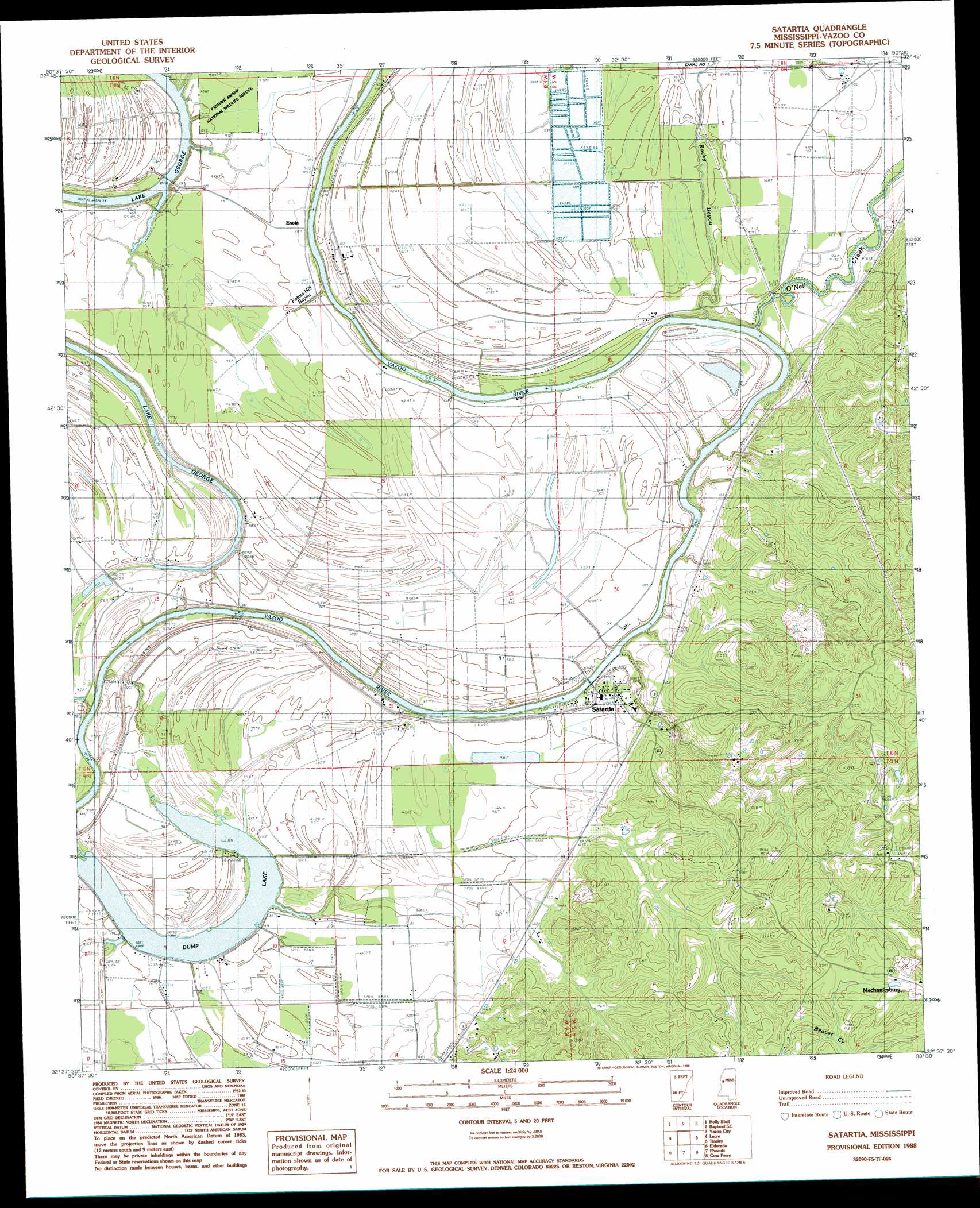
Satartia Topo Map Mississippi
To zoom in, hover over the map of Satartia
USGS Topo Quad 32090f5 - 1:24,000 scale
| Topo Map Name: | Satartia |
| USGS Topo Quad ID: | 32090f5 |
| Print Size: | ca. 21 1/4" wide x 27" high |
| Southeast Coordinates: | 32.625° N latitude / 90.5° W longitude |
| Map Center Coordinates: | 32.6875° N latitude / 90.5625° W longitude |
| U.S. State: | MS |
| Filename: | o32090f5.jpg |
| Download Map JPG Image: | Satartia topo map 1:24,000 scale |
| Map Type: | Topographic |
| Topo Series: | 7.5´ |
| Map Scale: | 1:24,000 |
| Source of Map Images: | United States Geological Survey (USGS) |
| Alternate Map Versions: |
Satartia MS 1988, updated 1988 Download PDF Buy paper map Satartia MS 2012 Download PDF Buy paper map Satartia MS 2015 Download PDF Buy paper map |
1:24,000 Topo Quads surrounding Satartia
Rolling Fork East |
Bayland |
Louise |
Carter |
Eden |
Red Rock |
Holly Bluff |
Bayland Se |
Yazoo City |
Benton |
Valley Park |
Lucre |
Satartia |
Tinsley |
Bentonia |
Floweree |
Eldorado |
Phoenix |
Coxs Ferry |
Flora |
Redwood |
Oak Ridge |
Queens Hill Lake |
Brownsville |
Pocahontas |
> Back to 32090e1 at 1:100,000 scale
> Back to 32090a1 at 1:250,000 scale
> Back to U.S. Topo Maps home
Satartia topo map: Gazetteer
Satartia: Dams
Lake Dick Dam elevation 28m 91′Peaster Catfish Ponds Dam elevation 26m 85′
Satartia: Guts
Potato Hill Bayou elevation 30m 98′Satartia: Lakes
Dump Lake elevation 25m 82′Satartia: Populated Places
Enola elevation 32m 104′Liverpool (historical) elevation 101m 331′
Mechanicsburg elevation 109m 357′
Satartia elevation 33m 108′
Satartia: Streams
O'Neil Creek elevation 26m 85′Rocky Bayou elevation 25m 82′
Satartia digital topo map on disk
Buy this Satartia topo map showing relief, roads, GPS coordinates and other geographical features, as a high-resolution digital map file on DVD: