Vaughan Topo Map Mississippi
To zoom in, hover over the map of Vaughan
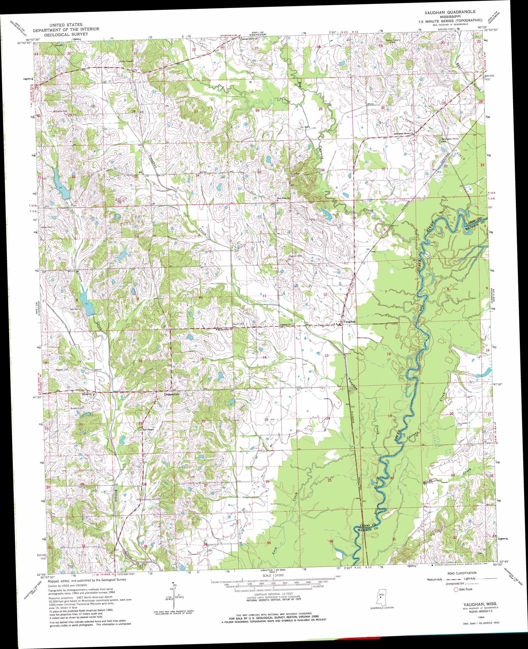
USGS Topo Quad 32090g1 - 1:24,000 scale
| Topo Map Name: | Vaughan |
| USGS Topo Quad ID: | 32090g1 |
| Print Size: | ca. 21 1/4" wide x 27" high |
| Southeast Coordinates: | 32.75° N latitude / 90° W longitude |
| Map Center Coordinates: | 32.8125° N latitude / 90.0625° W longitude |
| U.S. State: | MS |
| Filename: | o32090g1.jpg |
| Download Map JPG Image: | Vaughan topo map 1:24,000 scale |
| Map Type: | Topographic |
| Topo Series: | 7.5´ |
| Map Scale: | 1:24,000 |
| Source of Map Images: | United States Geological Survey (USGS) |
| Alternate Map Versions: |
Vaughan MS 1964, updated 1965 Download PDF Buy paper map Vaughan MS 1964, updated 1983 Download PDF Buy paper map Vaughan MS 1964, updated 1983 Download PDF Buy paper map Vaughan MS 2012 Download PDF Buy paper map Vaughan MS 2015 Download PDF Buy paper map |
1:24,000 Topo Quads surrounding Vaughan
Thornton |
Howard |
Lexington South |
Owens Wells |
Durant |
Eden |
Zeiglerville |
Ebenezer |
Goodman |
Newport |
Benton |
Linwood |
Vaughan |
Cameron |
Camden |
Bentonia |
Berryville |
Way |
Sharon |
Farmhaven |
Flora |
Charlton |
Canton |
Shoccoe |
Sharon Se |
> Back to 32090e1 at 1:100,000 scale
> Back to 32090a1 at 1:250,000 scale
> Back to U.S. Topo Maps home
Vaughan topo map: Gazetteer
Vaughan: Crossings
Interchange 133 elevation 69m 226′Vaughan: Dams
Dixon Lake Dam elevation 91m 298′Dixon Lake Dam elevation 83m 272′
Dixons Lake Dam elevation 71m 232′
Ellison Creek Watershed Structure 3 Dam elevation 88m 288′
Ellison Creek Watershed Structure 7 Dam elevation 76m 249′
Moore Lake Dam elevation 61m 200′
Pepper Lake Dam elevation 97m 318′
Thomas Lake Dam elevation 73m 239′
Vaughn Lake Dam elevation 84m 275′
Vaughan: Populated Places
Deasonville elevation 91m 298′Vaughan elevation 64m 209′
Vaughan: Streams
Big Cypress Creek elevation 59m 193′Birds Creek elevation 58m 190′
Castens Creek elevation 57m 187′
Dry Creek elevation 64m 209′
Vaughan Creek elevation 59m 193′
Vaughan digital topo map on disk
Buy this Vaughan topo map showing relief, roads, GPS coordinates and other geographical features, as a high-resolution digital map file on DVD: