Ebenezer Topo Map Mississippi
To zoom in, hover over the map of Ebenezer
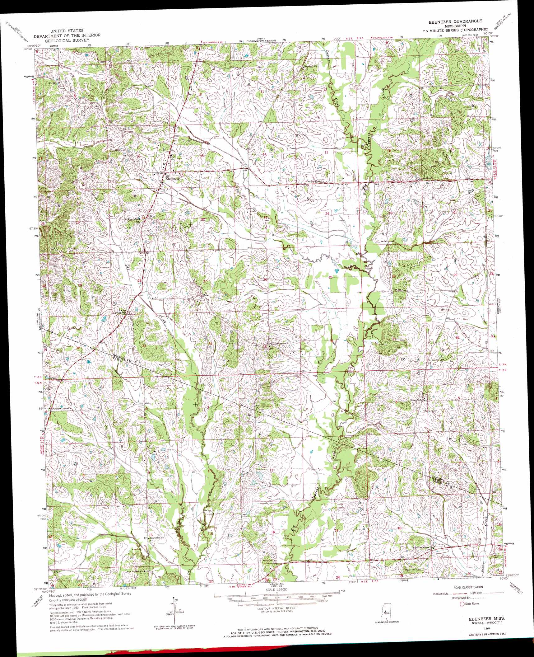
USGS Topo Quad 32090h1 - 1:24,000 scale
| Topo Map Name: | Ebenezer |
| USGS Topo Quad ID: | 32090h1 |
| Print Size: | ca. 21 1/4" wide x 27" high |
| Southeast Coordinates: | 32.875° N latitude / 90° W longitude |
| Map Center Coordinates: | 32.9375° N latitude / 90.0625° W longitude |
| U.S. State: | MS |
| Filename: | o32090h1.jpg |
| Download Map JPG Image: | Ebenezer topo map 1:24,000 scale |
| Map Type: | Topographic |
| Topo Series: | 7.5´ |
| Map Scale: | 1:24,000 |
| Source of Map Images: | United States Geological Survey (USGS) |
| Alternate Map Versions: |
Ebenezer MS 1964, updated 1965 Download PDF Buy paper map Ebenezer MS 2012 Download PDF Buy paper map Ebenezer MS 2015 Download PDF Buy paper map |
1:24,000 Topo Quads surrounding Ebenezer
Marcella |
Tchula |
Lexington North |
Bowling Green |
West |
Thornton |
Howard |
Lexington South |
Owens Wells |
Durant |
Eden |
Zeiglerville |
Ebenezer |
Goodman |
Newport |
Benton |
Linwood |
Vaughan |
Cameron |
Camden |
Bentonia |
Berryville |
Way |
Sharon |
Farmhaven |
> Back to 32090e1 at 1:100,000 scale
> Back to 32090a1 at 1:250,000 scale
> Back to U.S. Topo Maps home
Ebenezer topo map: Gazetteer
Ebenezer: Crossings
Interchange 139 elevation 95m 311′Ebenezer: Dams
Bryan Swilley Pond Dam elevation 78m 255′E F Crenshaw Junior Pond Dam elevation 100m 328′
Tackett Watershed 11 Dam elevation 91m 298′
Twin Lakes Subdivision Lake Dam elevation 94m 308′
W H Austin Pond Dam elevation 101m 331′
Ebenezer: Populated Places
Ebenezer elevation 101m 331′Ebenezer: Streams
Cypress Creek elevation 80m 262′Ebenezer digital topo map on disk
Buy this Ebenezer topo map showing relief, roads, GPS coordinates and other geographical features, as a high-resolution digital map file on DVD: