Zeiglerville Topo Map Mississippi
To zoom in, hover over the map of Zeiglerville
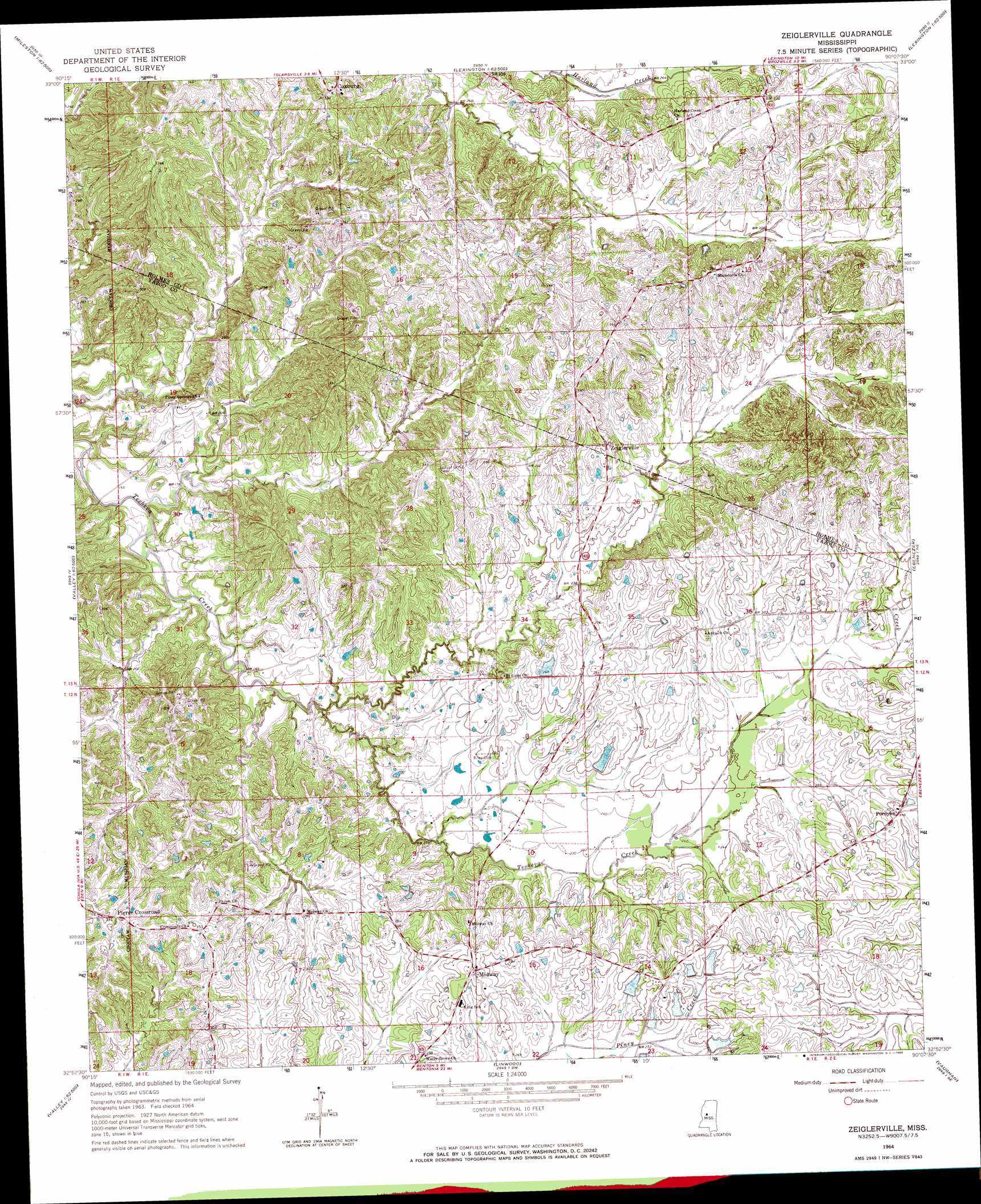
USGS Topo Quad 32090h2 - 1:24,000 scale
| Topo Map Name: | Zeiglerville |
| USGS Topo Quad ID: | 32090h2 |
| Print Size: | ca. 21 1/4" wide x 27" high |
| Southeast Coordinates: | 32.875° N latitude / 90.125° W longitude |
| Map Center Coordinates: | 32.9375° N latitude / 90.1875° W longitude |
| U.S. State: | MS |
| Filename: | o32090h2.jpg |
| Download Map JPG Image: | Zeiglerville topo map 1:24,000 scale |
| Map Type: | Topographic |
| Topo Series: | 7.5´ |
| Map Scale: | 1:24,000 |
| Source of Map Images: | United States Geological Survey (USGS) |
| Alternate Map Versions: |
Zeiglerville MS 1964, updated 1965 Download PDF Buy paper map Zeiglerville MS 1964, updated 1986 Download PDF Buy paper map Zeiglerville MS 2012 Download PDF Buy paper map Zeiglerville MS 2015 Download PDF Buy paper map |
1:24,000 Topo Quads surrounding Zeiglerville
Belzoni |
Marcella |
Tchula |
Lexington North |
Bowling Green |
Silver City |
Thornton |
Howard |
Lexington South |
Owens Wells |
Carter |
Eden |
Zeiglerville |
Ebenezer |
Goodman |
Yazoo City |
Benton |
Linwood |
Vaughan |
Cameron |
Tinsley |
Bentonia |
Berryville |
Way |
Sharon |
> Back to 32090e1 at 1:100,000 scale
> Back to 32090a1 at 1:250,000 scale
> Back to U.S. Topo Maps home
Zeiglerville topo map: Gazetteer
Zeiglerville: Dams
O Reilly Pond Dam elevation 70m 229′Shipp Lake Dam elevation 72m 236′
Swayze Lake Dam elevation 89m 291′
Swayze Lake Dam elevation 91m 298′
Swayze Lake Dam elevation 85m 278′
Swayze Lake Dam elevation 92m 301′
Swayze Pond Dam elevation 85m 278′
Zeiglerville: Populated Places
Coxburg elevation 104m 341′Fordyke elevation 94m 308′
Midway elevation 98m 321′
Pierce Crossroad elevation 103m 337′
Zeiglerville elevation 85m 278′
Zeiglerville digital topo map on disk
Buy this Zeiglerville topo map showing relief, roads, GPS coordinates and other geographical features, as a high-resolution digital map file on DVD: