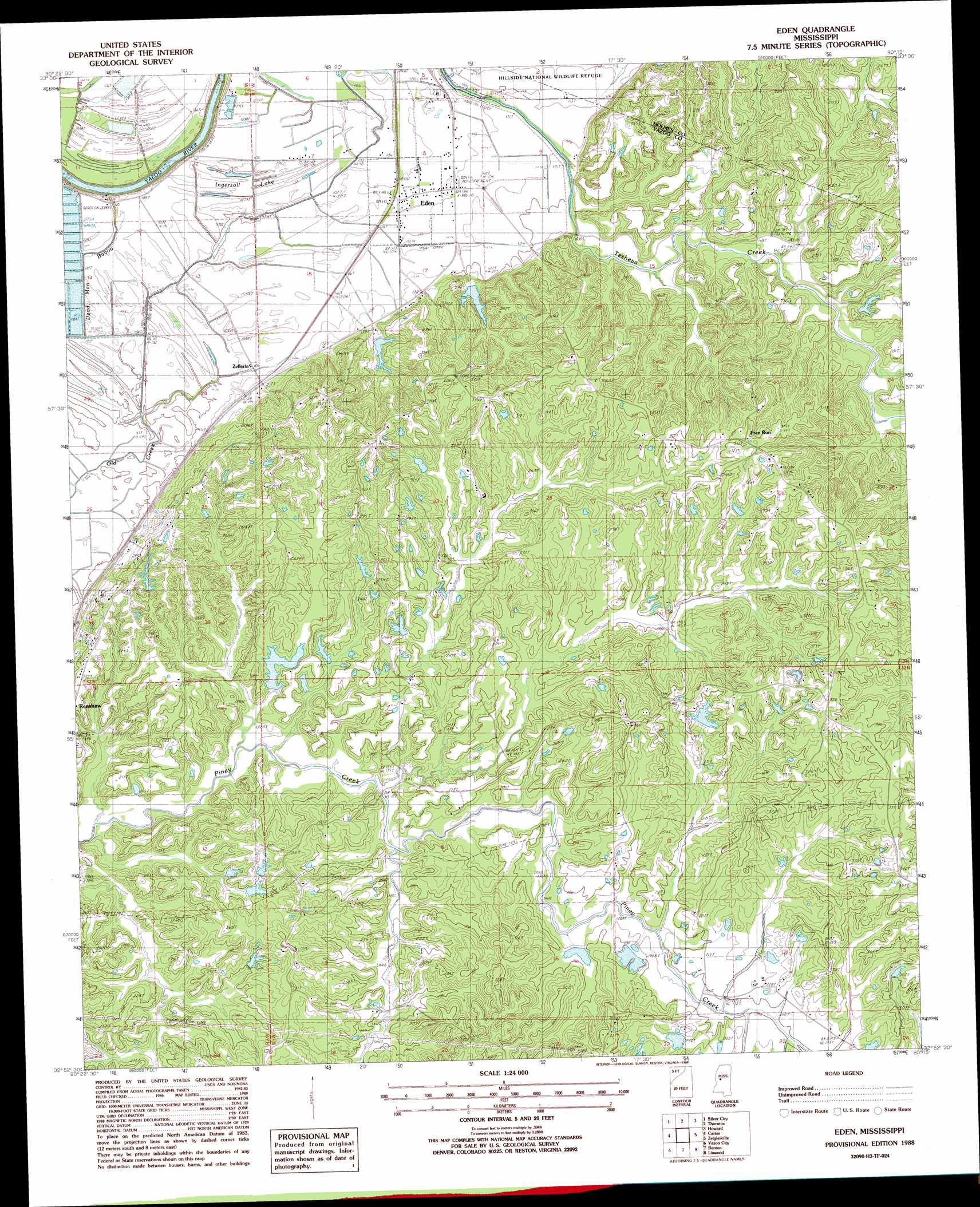
Eden Topo Map Mississippi
To zoom in, hover over the map of Eden
USGS Topo Quad 32090h3 - 1:24,000 scale
| Topo Map Name: | Eden |
| USGS Topo Quad ID: | 32090h3 |
| Print Size: | ca. 21 1/4" wide x 27" high |
| Southeast Coordinates: | 32.875° N latitude / 90.25° W longitude |
| Map Center Coordinates: | 32.9375° N latitude / 90.3125° W longitude |
| U.S. State: | MS |
| Filename: | o32090h3.jpg |
| Download Map JPG Image: | Eden topo map 1:24,000 scale |
| Map Type: | Topographic |
| Topo Series: | 7.5´ |
| Map Scale: | 1:24,000 |
| Source of Map Images: | United States Geological Survey (USGS) |
| Alternate Map Versions: |
Eden MS 1988, updated 1988 Download PDF Buy paper map Eden MS 2012 Download PDF Buy paper map Eden MS 2015 Download PDF Buy paper map |
1:24,000 Topo Quads surrounding Eden
Bellewood |
Belzoni |
Marcella |
Tchula |
Lexington North |
Midnight |
Silver City |
Thornton |
Howard |
Lexington South |
Louise |
Carter |
Eden |
Zeiglerville |
Ebenezer |
Bayland Se |
Yazoo City |
Benton |
Linwood |
Vaughan |
Satartia |
Tinsley |
Bentonia |
Berryville |
Way |
> Back to 32090e1 at 1:100,000 scale
> Back to 32090a1 at 1:250,000 scale
> Back to U.S. Topo Maps home
Eden topo map: Gazetteer
Eden: Dams
Coleman Ponds Dam elevation 62m 203′Eden Creek Watershed Number 10 Dam elevation 86m 282′
Eden Creek Watershed Y-370-3 Dam elevation 87m 285′
Fouche Lake Dam elevation 55m 180′
Johnston Lake Dam elevation 90m 295′
Piney Creek Watershed Structure 23 Dam elevation 71m 232′
Piney Creek Watershed Y-38-3 Dam elevation 45m 147′
Piney Creek Watershed Y-38-35 Dam elevation 54m 177′
Piney Watershed Y-38-33 Dam elevation 67m 219′
Strickland Lake Dam elevation 68m 223′
Eden: Populated Places
Dover (historical) elevation 32m 104′Eden elevation 35m 114′
Free Run elevation 92m 301′
Pearce (historical) elevation 91m 298′
Zelleria elevation 32m 104′
Eden: Streams
Dead Man Bayou elevation 29m 95′Old Creek elevation 32m 104′
Eden: Swamps
Ingersoll Lake elevation 30m 98′Eden digital topo map on disk
Buy this Eden topo map showing relief, roads, GPS coordinates and other geographical features, as a high-resolution digital map file on DVD: