Bayland Topo Map Mississippi
To zoom in, hover over the map of Bayland
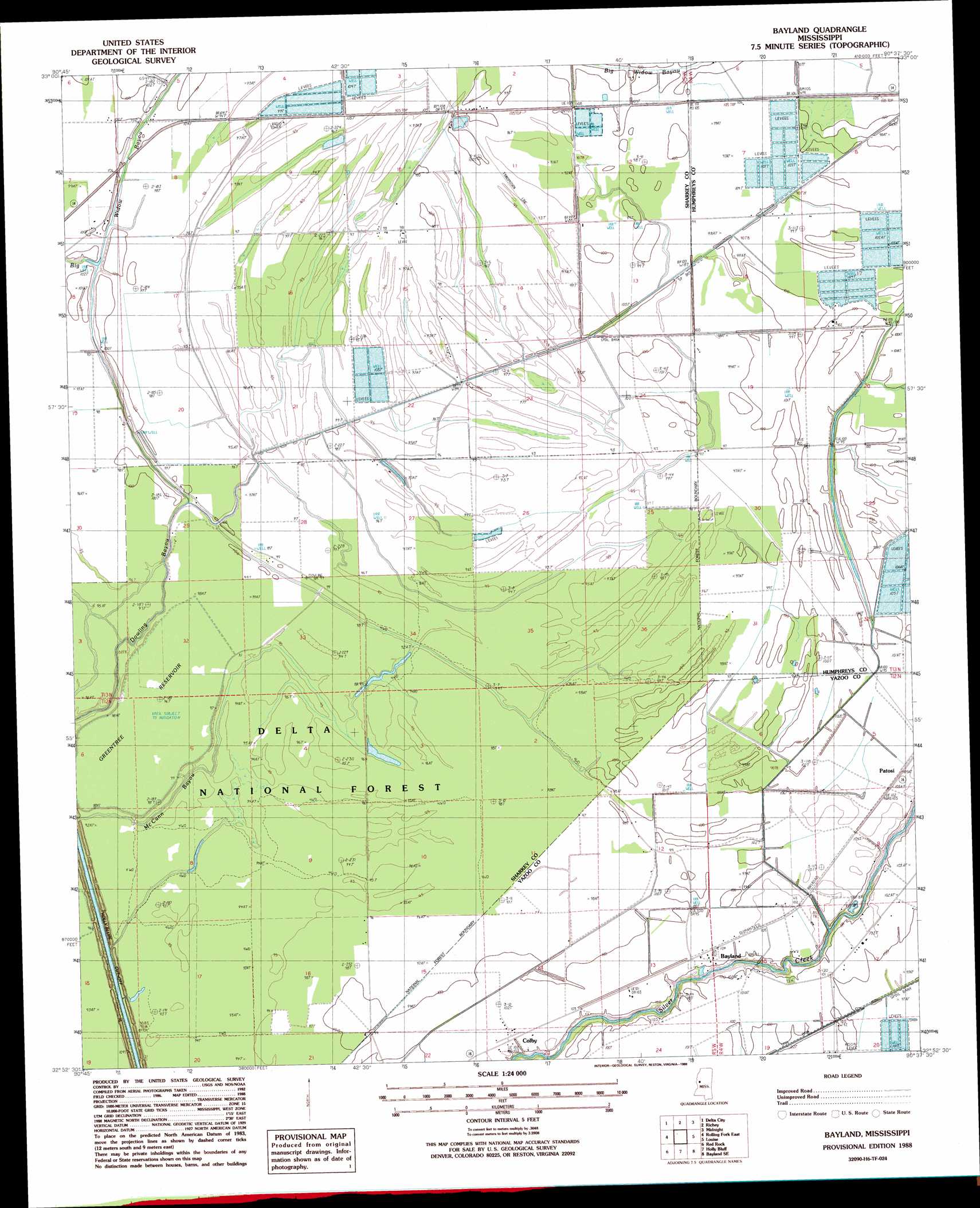
USGS Topo Quad 32090h6 - 1:24,000 scale
| Topo Map Name: | Bayland |
| USGS Topo Quad ID: | 32090h6 |
| Print Size: | ca. 21 1/4" wide x 27" high |
| Southeast Coordinates: | 32.875° N latitude / 90.625° W longitude |
| Map Center Coordinates: | 32.9375° N latitude / 90.6875° W longitude |
| U.S. State: | MS |
| Filename: | o32090h6.jpg |
| Download Map JPG Image: | Bayland topo map 1:24,000 scale |
| Map Type: | Topographic |
| Topo Series: | 7.5´ |
| Map Scale: | 1:24,000 |
| Source of Map Images: | United States Geological Survey (USGS) |
| Alternate Map Versions: |
Bayland MS 1988, updated 1988 Download PDF Buy paper map Bayland MS 2000, updated 2002 Download PDF Buy paper map Bayland MS 2012 Download PDF Buy paper map Bayland MS 2015 Download PDF Buy paper map |
| FStopo: | US Forest Service topo Bayland is available: Download FStopo PDF Download FStopo TIF |
1:24,000 Topo Quads surrounding Bayland
Swan Lake Nw |
Hollandale |
Midnight Nw |
Bellewood |
Belzoni |
Percy |
Delta City |
Richey |
Midnight |
Silver City |
Rolling Fork West |
Rolling Fork East |
Bayland |
Louise |
Carter |
Cary |
Red Rock |
Holly Bluff |
Bayland Se |
Yazoo City |
Onward |
Valley Park |
Lucre |
Satartia |
Tinsley |
> Back to 32090e1 at 1:100,000 scale
> Back to 32090a1 at 1:250,000 scale
> Back to U.S. Topo Maps home
Bayland topo map: Gazetteer
Bayland: Canals
Holly Bluff Cut-Off elevation 26m 85′Bayland: Dams
W H Hodnett Catfish Ponds Dam elevation 30m 98′Bayland: Guts
Dowling Bayou elevation 24m 78′McCann Bayou elevation 29m 95′
Bayland: Populated Places
Bayland elevation 30m 98′Colby elevation 28m 91′
Hollands (historical) elevation 30m 98′
Bayland digital topo map on disk
Buy this Bayland topo map showing relief, roads, GPS coordinates and other geographical features, as a high-resolution digital map file on DVD: