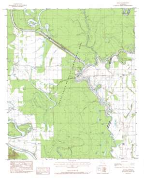
Mason Topo Map Louisiana
To zoom in, hover over the map of Mason
USGS Topo Quad 32091a8 - 1:24,000 scale
| Topo Map Name: | Mason |
| USGS Topo Quad ID: | 32091a8 |
| Print Size: | ca. 21 1/4" wide x 27" high |
| Southeast Coordinates: | 32° N latitude / 91.875° W longitude |
| Map Center Coordinates: | 32.0625° N latitude / 91.9375° W longitude |
| U.S. State: | LA |
| Filename: | o32091a8.jpg |
| Download Map JPG Image: | Mason topo map 1:24,000 scale |
| Map Type: | Topographic |
| Topo Series: | 7.5´ |
| Map Scale: | 1:24,000 |
| Source of Map Images: | United States Geological Survey (USGS) |
| Alternate Map Versions: |
Mason LA 1983, updated 1984 Download PDF Buy paper map Mason LA 2012 Download PDF Buy paper map Mason LA 2015 Download PDF Buy paper map |
1:24,000 Topo Quads surrounding Mason
> Back to 32091a1 at 1:100,000 scale
> Back to 32090a1 at 1:250,000 scale
> Back to U.S. Topo Maps home
Mason topo map: Gazetteer
Mason: Bends
Ox Bow Bend elevation 12m 39′Mason: Channels
Bayou Lafourche Cutoff elevation 12m 39′Crew Bayou Cutoff elevation 14m 45′
Mason: Crossings
Grassy Bend Ford elevation 12m 39′Hudson Ferry (historical) elevation 10m 32′
Mason: Guts
Ash Slough elevation 18m 59′Bayou Morengo elevation 14m 45′
Crew Bayou elevation 16m 52′
Joe Bayou Boeuf River elevation 11m 36′
Sawyer Pond Bayou elevation 17m 55′
Mason: Islands
Eagle Island elevation 16m 52′Mason: Lakes
Broad Lake elevation 12m 39′Brushy Lagoon elevation 17m 55′
Clarks Coupe elevation 14m 45′
Crew Lake elevation 17m 55′
Dry Lake elevation 12m 39′
Ford Lake elevation 12m 39′
Forest Lake elevation 13m 42′
Hinze Lake elevation 13m 42′
Little Long Lake elevation 12m 39′
Locust Thicket Lake elevation 13m 42′
Open Lake elevation 14m 45′
Sawyer Pond elevation 16m 52′
Stove Lake elevation 12m 39′
Thompson Brake elevation 16m 52′
Twin Lakes elevation 12m 39′
Mason: Parks
Boeuf State Wildlife Management Area elevation 15m 49′Fort Necessity Recreation Area elevation 17m 55′
Mason: Populated Places
Fredericksburg (historical) elevation 20m 65′Mason elevation 18m 59′
Mason: Reservoirs
Peers Lake elevation 17m 55′Mason: Streams
Bayou Lafourche elevation 12m 39′Bayou Wade elevation 15m 49′
Big Bayou elevation 11m 36′
Lower Eagle Creek elevation 17m 55′
Muddy Bayou elevation 11m 36′
Skinny Bayou elevation 13m 42′
Upper Eagle Creek elevation 12m 39′
Mason: Swamps
Alligator Hole elevation 15m 49′Bushy Lagoon elevation 17m 55′
Jones Brake elevation 16m 52′
Mason digital topo map on disk
Buy this Mason topo map showing relief, roads, GPS coordinates and other geographical features, as a high-resolution digital map file on DVD:


