Bedford Topo Map Mississippi
To zoom in, hover over the map of Bedford
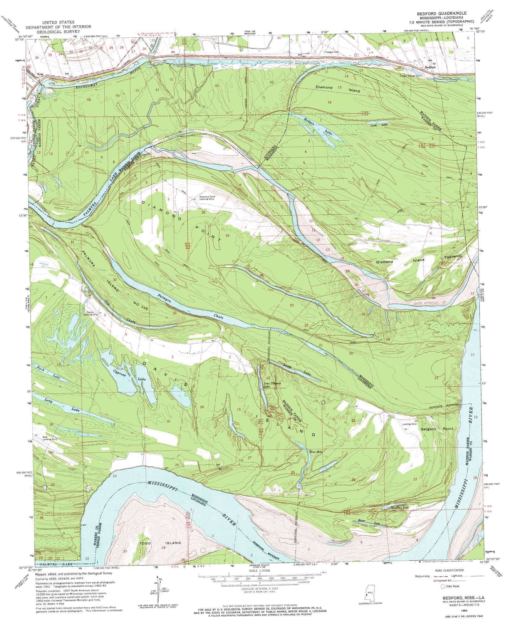
USGS Topo Quad 32091b1 - 1:24,000 scale
| Topo Map Name: | Bedford |
| USGS Topo Quad ID: | 32091b1 |
| Print Size: | ca. 21 1/4" wide x 27" high |
| Southeast Coordinates: | 32.125° N latitude / 91° W longitude |
| Map Center Coordinates: | 32.1875° N latitude / 91.0625° W longitude |
| U.S. States: | MS, LA |
| Filename: | o32091b1.jpg |
| Download Map JPG Image: | Bedford topo map 1:24,000 scale |
| Map Type: | Topographic |
| Topo Series: | 7.5´ |
| Map Scale: | 1:24,000 |
| Source of Map Images: | United States Geological Survey (USGS) |
| Alternate Map Versions: |
Bedford LA 1963, updated 1964 Download PDF Buy paper map Bedford LA 1963, updated 1964 Download PDF Buy paper map Bedford LA 2012 Download PDF Buy paper map Bedford LA 2015 Download PDF Buy paper map |
1:24,000 Topo Quads surrounding Bedford
Tendal |
Tallulah |
Ashly |
Long Lake |
Redwood |
Waverly Se |
Fortune Fork |
Mound |
Vicksburg West |
Vicksburg East |
Westwood |
Somerset |
Bedford |
Yokena |
Big Black |
Saranac |
Newellton |
Grand Gulf |
Willows |
Carlisle |
Lake Bruin |
Saint Joseph |
Widows Creek |
Port Gibson |
Hermanville |
> Back to 32091a1 at 1:100,000 scale
> Back to 32090a1 at 1:250,000 scale
> Back to U.S. Topo Maps home
Bedford topo map: Gazetteer
Bedford: Airports
Dale Landing Strip elevation 26m 85′Diamond Point Landing Strip elevation 27m 88′
Parker Landing Strip elevation 26m 85′
Bedford: Areas
Davis Island elevation 24m 78′Diamond Island elevation 25m 82′
Diamond Island Towhead elevation 25m 82′
Palmyra Island Number One Hundred Six elevation 26m 85′
Bedford: Bars
Newton Bend Bar elevation 12m 39′Ursino Bar elevation 13m 42′
Bedford: Bends
Davis Island Bend elevation 18m 59′Newtown Bend elevation 12m 39′
Oak Bend elevation 10m 32′
Bedford: Canals
Hodges Canal elevation 24m 78′Bedford: Capes
Diamond Point elevation 26m 85′Sargent Point elevation 24m 78′
Bedford: Channels
Killikrankia Cutoff elevation 12m 39′Bedford: Dams
Coxs Towing Company Lake Dam elevation 12m 39′Bedford: Guts
Bayou Vidal elevation 23m 75′Old Chute elevation 18m 59′
Bedford: Islands
Davis Island elevation 23m 75′Bedford: Lakes
Blue Hole elevation 20m 65′Blue Lake elevation 20m 65′
Cook Lake elevation 19m 62′
Cypress Lake elevation 22m 72′
Duck Lake elevation 24m 78′
Hodges Lake elevation 19m 62′
Hodges Lake elevation 19m 62′
John Thomas Lake elevation 22m 72′
Long Lake elevation 19m 62′
Long Lake elevation 24m 78′
River Lake elevation 19m 62′
Sandbar Lake elevation 17m 55′
Bedford: Levees
Diamond Revetment elevation 19m 62′Bedford: Populated Places
Bedford elevation 28m 91′King elevation 25m 82′
Bedford: Streams
Palmyra Chute elevation 14m 45′Bedford digital topo map on disk
Buy this Bedford topo map showing relief, roads, GPS coordinates and other geographical features, as a high-resolution digital map file on DVD: