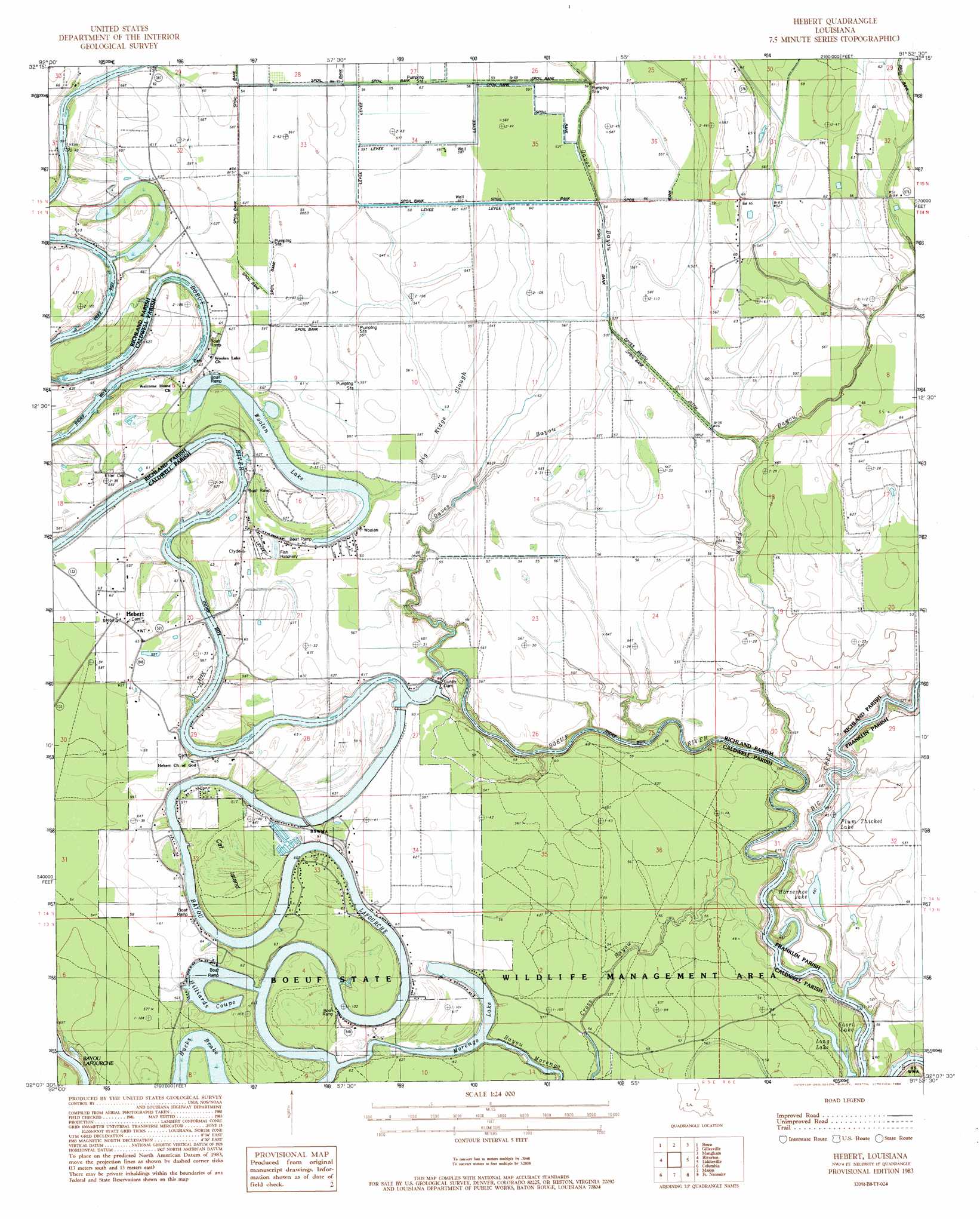
Hebert Topo Map Louisiana
To zoom in, hover over the map of Hebert
USGS Topo Quad 32091b8 - 1:24,000 scale
| Topo Map Name: | Hebert |
| USGS Topo Quad ID: | 32091b8 |
| Print Size: | ca. 21 1/4" wide x 27" high |
| Southeast Coordinates: | 32.125° N latitude / 91.875° W longitude |
| Map Center Coordinates: | 32.1875° N latitude / 91.9375° W longitude |
| U.S. State: | LA |
| Filename: | o32091b8.jpg |
| Download Map JPG Image: | Hebert topo map 1:24,000 scale |
| Map Type: | Topographic |
| Topo Series: | 7.5´ |
| Map Scale: | 1:24,000 |
| Source of Map Images: | United States Geological Survey (USGS) |
| Alternate Map Versions: |
Hebert LA 1983, updated 1984 Download PDF Buy paper map Hebert LA 2012 Download PDF Buy paper map Hebert LA 2015 Download PDF Buy paper map |
1:24,000 Topo Quads surrounding Hebert
West Monroe South |
Monroe South |
Crew Lake |
Rayville |
Bee Bayou |
Luna |
Bosco |
Gilleyville |
Mangham |
Baskinton |
Blankston |
Riverton |
Hebert |
Liddieville |
Winnsboro |
Clark |
Columbia |
Mason |
Fort Necessity |
Gilbert |
Olla East |
Holum |
Enterprise |
Extension |
Wisner |
> Back to 32091a1 at 1:100,000 scale
> Back to 32090a1 at 1:250,000 scale
> Back to U.S. Topo Maps home
Hebert topo map: Gazetteer
Hebert: Canals
Daves Bayou Ditch elevation 15m 49′Hebert: Crossings
Duchene Ferry (historical) elevation 15m 49′Eitere Ferry (historical) elevation 15m 49′
Roberts Ferry (historical) elevation 15m 49′
Hebert: Dams
Boeuf River Dam Mile 51 elevation 19m 62′Gunby Dam elevation 18m 59′
Hebert: Guts
Bayou Lafourche elevation 14m 45′Big Ridge Slough elevation 17m 55′
Cross Bayou elevation 16m 52′
Hebert: Lakes
Hilliards Coupe elevation 14m 45′Horseshoe Lake elevation 14m 45′
Long Lake elevation 14m 45′
Morengo Lake elevation 14m 45′
Plum Thicket Lake elevation 12m 39′
Short Lake elevation 14m 45′
Woolen Lake elevation 17m 55′
Hebert: Populated Places
Hebert elevation 19m 62′Hebert: Post Offices
Hebert Post Office elevation 18m 59′Hebert: Streams
Big Creek elevation 11m 36′Daves Bayou elevation 13m 42′
Muddy Bayou elevation 17m 55′
Hebert: Swamps
Bucks Brake elevation 16m 52′Hebert digital topo map on disk
Buy this Hebert topo map showing relief, roads, GPS coordinates and other geographical features, as a high-resolution digital map file on DVD: