Fortune Fork Topo Map Louisiana
To zoom in, hover over the map of Fortune Fork
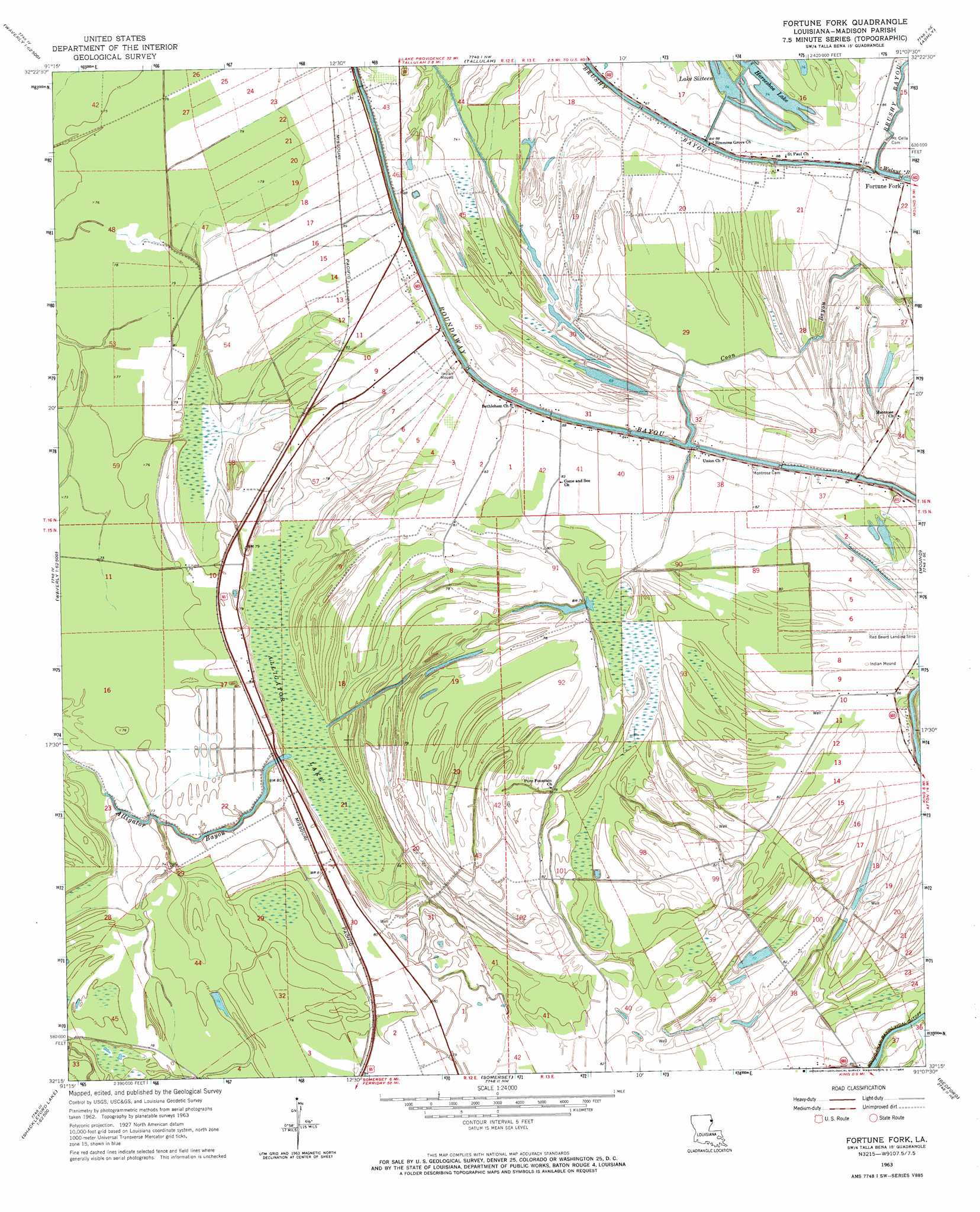
USGS Topo Quad 32091c2 - 1:24,000 scale
| Topo Map Name: | Fortune Fork |
| USGS Topo Quad ID: | 32091c2 |
| Print Size: | ca. 21 1/4" wide x 27" high |
| Southeast Coordinates: | 32.25° N latitude / 91.125° W longitude |
| Map Center Coordinates: | 32.3125° N latitude / 91.1875° W longitude |
| U.S. State: | LA |
| Filename: | o32091c2.jpg |
| Download Map JPG Image: | Fortune Fork topo map 1:24,000 scale |
| Map Type: | Topographic |
| Topo Series: | 7.5´ |
| Map Scale: | 1:24,000 |
| Source of Map Images: | United States Geological Survey (USGS) |
| Alternate Map Versions: |
Fortune Fork LA 1963, updated 1964 Download PDF Buy paper map Fortune Fork LA 1994, updated 1997 Download PDF Buy paper map Fortune Fork LA 2012 Download PDF Buy paper map Fortune Fork LA 2015 Download PDF Buy paper map |
1:24,000 Topo Quads surrounding Fortune Fork
Epps |
Panther Lake |
Sondheimer |
Eagle Bend |
Cane Bayou |
Africa Lake |
Tendal |
Tallulah |
Ashly |
Long Lake |
Indian Lake |
Waverly Se |
Fortune Fork |
Mound |
Vicksburg West |
Tensas Bluff |
Westwood |
Somerset |
Bedford |
Yokena |
Newlight |
Saranac |
Newellton |
Grand Gulf |
Willows |
> Back to 32091a1 at 1:100,000 scale
> Back to 32090a1 at 1:250,000 scale
> Back to U.S. Topo Maps home
Fortune Fork topo map: Gazetteer
Fortune Fork: Airports
Red Beard Dusting Service Airport elevation 25m 82′Fortune Fork: Guts
Alligator Bayou elevation 20m 65′Coon Bayou elevation 21m 68′
Roundaway Bayou elevation 23m 75′
Fortune Fork: Lakes
Horseshoe Lake elevation 23m 75′Lake Sixteen elevation 23m 75′
Fortune Fork: Populated Places
Fortune Fork elevation 26m 85′Islington (historical) elevation 26m 85′
Fortune Fork: Swamps
Alligator Lake elevation 20m 65′Fortune Fork digital topo map on disk
Buy this Fortune Fork topo map showing relief, roads, GPS coordinates and other geographical features, as a high-resolution digital map file on DVD: