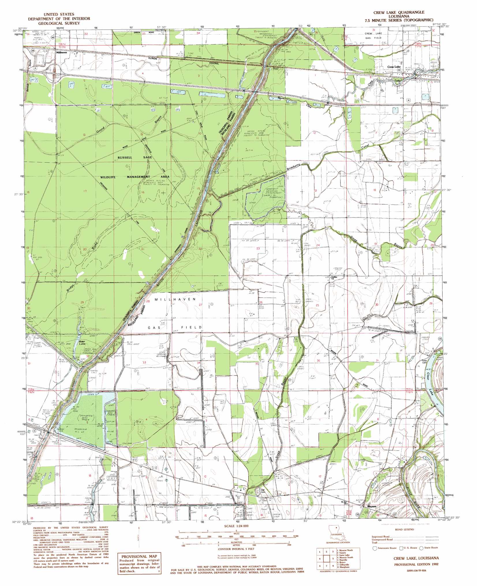
Crew Lake Topo Map Louisiana
To zoom in, hover over the map of Crew Lake
USGS Topo Quad 32091d8 - 1:24,000 scale
| Topo Map Name: | Crew Lake |
| USGS Topo Quad ID: | 32091d8 |
| Print Size: | ca. 21 1/4" wide x 27" high |
| Southeast Coordinates: | 32.375° N latitude / 91.875° W longitude |
| Map Center Coordinates: | 32.4375° N latitude / 91.9375° W longitude |
| U.S. State: | LA |
| Filename: | o32091d8.jpg |
| Download Map JPG Image: | Crew Lake topo map 1:24,000 scale |
| Map Type: | Topographic |
| Topo Series: | 7.5´ |
| Map Scale: | 1:24,000 |
| Source of Map Images: | United States Geological Survey (USGS) |
| Alternate Map Versions: |
Crew Lake LA 1982, updated 1983 Download PDF Buy paper map Crew Lake LA 2012 Download PDF Buy paper map Crew Lake LA 2015 Download PDF Buy paper map |
1:24,000 Topo Quads surrounding Crew Lake
Rocky Branch |
Sterlington |
Collinston West |
Collinston East |
Whitney Island North |
West Monroe North |
Monroe North |
Swartz |
Irwin Lake |
Whitney Island South |
West Monroe South |
Monroe South |
Crew Lake |
Rayville |
Bee Bayou |
Luna |
Bosco |
Gilleyville |
Mangham |
Baskinton |
Blankston |
Riverton |
Hebert |
Liddieville |
Winnsboro |
> Back to 32091a1 at 1:100,000 scale
> Back to 32090a1 at 1:250,000 scale
> Back to U.S. Topo Maps home
Crew Lake topo map: Gazetteer
Crew Lake: Canals
Brimberrry Canal elevation 17m 55′Crew Lake: Crossings
Interchange 124 elevation 21m 68′Crew Lake: Lakes
Clear Lake elevation 21m 68′Water Lake elevation 17m 55′
Crew Lake: Oilfields
Millhaven Gas Field elevation 18m 59′Crew Lake: Populated Places
Crew Lake elevation 20m 65′Millhaven elevation 21m 68′
Rhymes elevation 23m 75′
Crew Lake: Streams
Bayou Crew elevation 11m 36′Bennet Bayou elevation 17m 55′
Crew Lake: Swamps
Bridge Brake elevation 17m 55′Crew Lake digital topo map on disk
Buy this Crew Lake topo map showing relief, roads, GPS coordinates and other geographical features, as a high-resolution digital map file on DVD: