Transylvania Topo Map Louisiana
To zoom in, hover over the map of Transylvania
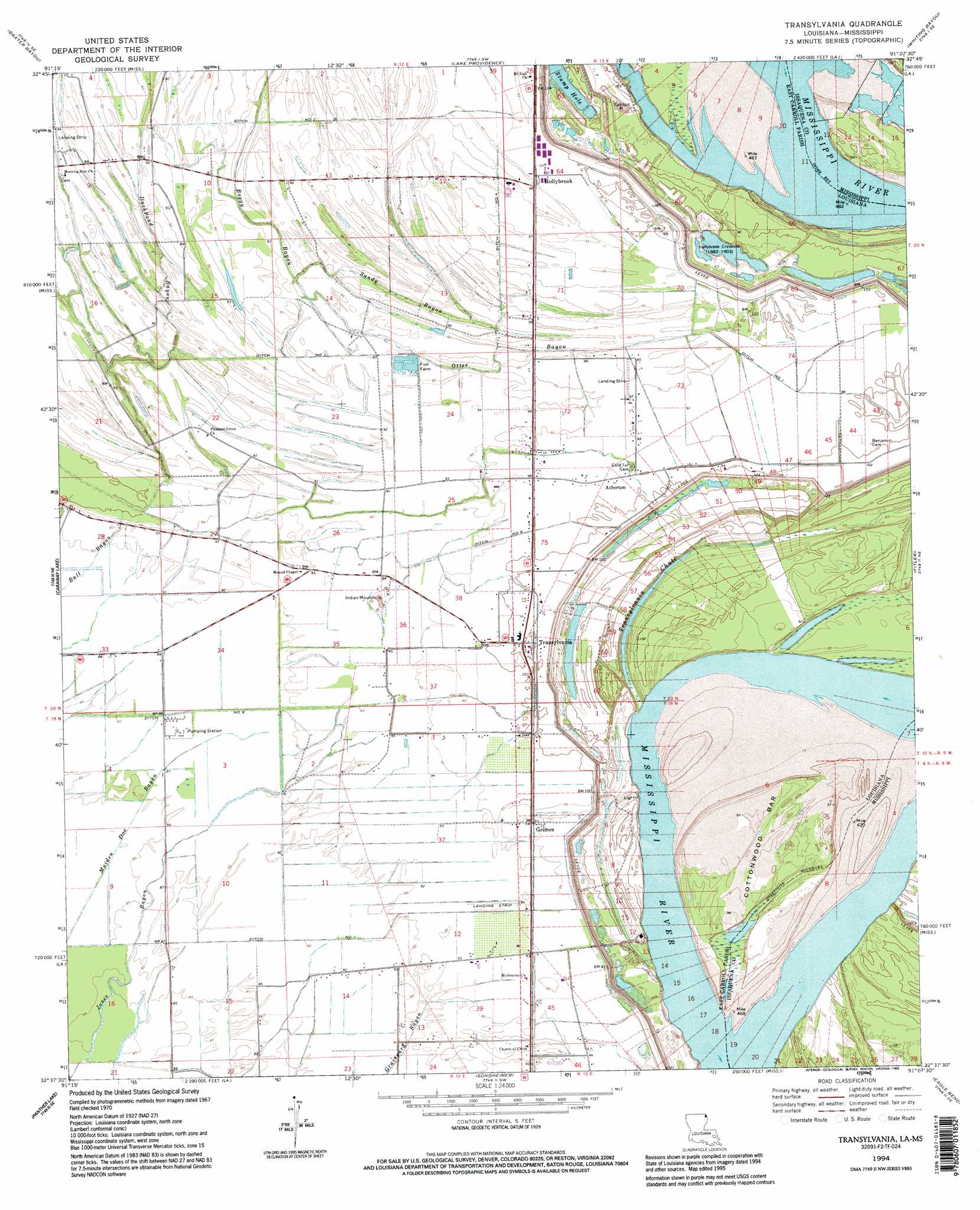
USGS Topo Quad 32091f2 - 1:24,000 scale
| Topo Map Name: | Transylvania |
| USGS Topo Quad ID: | 32091f2 |
| Print Size: | ca. 21 1/4" wide x 27" high |
| Southeast Coordinates: | 32.625° N latitude / 91.125° W longitude |
| Map Center Coordinates: | 32.6875° N latitude / 91.1875° W longitude |
| U.S. States: | LA, MS |
| Filename: | o32091f2.jpg |
| Download Map JPG Image: | Transylvania topo map 1:24,000 scale |
| Map Type: | Topographic |
| Topo Series: | 7.5´ |
| Map Scale: | 1:24,000 |
| Source of Map Images: | United States Geological Survey (USGS) |
| Alternate Map Versions: |
Transylvania LA 1970, updated 1972 Download PDF Buy paper map Transylvania LA 1970, updated 1977 Download PDF Buy paper map Transylvania LA 1994, updated 1995 Download PDF Buy paper map Transylvania LA 2012 Download PDF Buy paper map Transylvania LA 2015 Download PDF Buy paper map |
1:24,000 Topo Quads surrounding Transylvania
Fiske |
Kilbourne |
Millikin |
Mayersville |
Rolling Fork West |
Oak Grove |
Baxter Bayou |
Lake Providence |
Whiting Bayou |
Cary |
Pioneer |
Caraway Lake |
Transylvania |
Fitler |
Onward |
Epps |
Panther Lake |
Sondheimer |
Eagle Bend |
Cane Bayou |
Africa Lake |
Tendal |
Tallulah |
Ashly |
Long Lake |
> Back to 32091e1 at 1:100,000 scale
> Back to 32090a1 at 1:250,000 scale
> Back to U.S. Topo Maps home
Transylvania topo map: Gazetteer
Transylvania: Airports
Batton Airstrip elevation 27m 88′Transylvania: Bars
Atherton Towhead elevation 29m 95′Cottonwood Bar elevation 27m 88′
Transylvania: Basins
Hollybrook Crevasse elevation 25m 82′Transylvania: Bends
Alsatia-Salem Bend elevation 20m 65′Transylvania: Canals
Ditch Number Eight elevation 29m 95′Ditch Number Four elevation 28m 91′
Ditch Number Nine elevation 26m 85′
Ditch Number One elevation 27m 88′
Transylvania: Capes
Arcadia Point elevation 23m 75′Transylvania: Guts
Duckpond Bayou elevation 25m 82′Otter Bayou elevation 26m 85′
Sandy Bayou elevation 26m 85′
Transylvania Chute elevation 24m 78′
Transylvania: Islands
Cottonwood Bar elevation 28m 91′Transylvania: Populated Places
Arcadia (historical) elevation 20m 65′Atherton elevation 30m 98′
Grimes elevation 30m 98′
Hollybrook elevation 29m 95′
Transylvania elevation 30m 98′
Wilman elevation 38m 124′
Transylvania: Post Offices
Transylvania Post Office (historical) elevation 30m 98′Transylvania: Streams
Boggy Bayou elevation 27m 88′Transylvania digital topo map on disk
Buy this Transylvania topo map showing relief, roads, GPS coordinates and other geographical features, as a high-resolution digital map file on DVD: