Pioneer Topo Map Louisiana
To zoom in, hover over the map of Pioneer
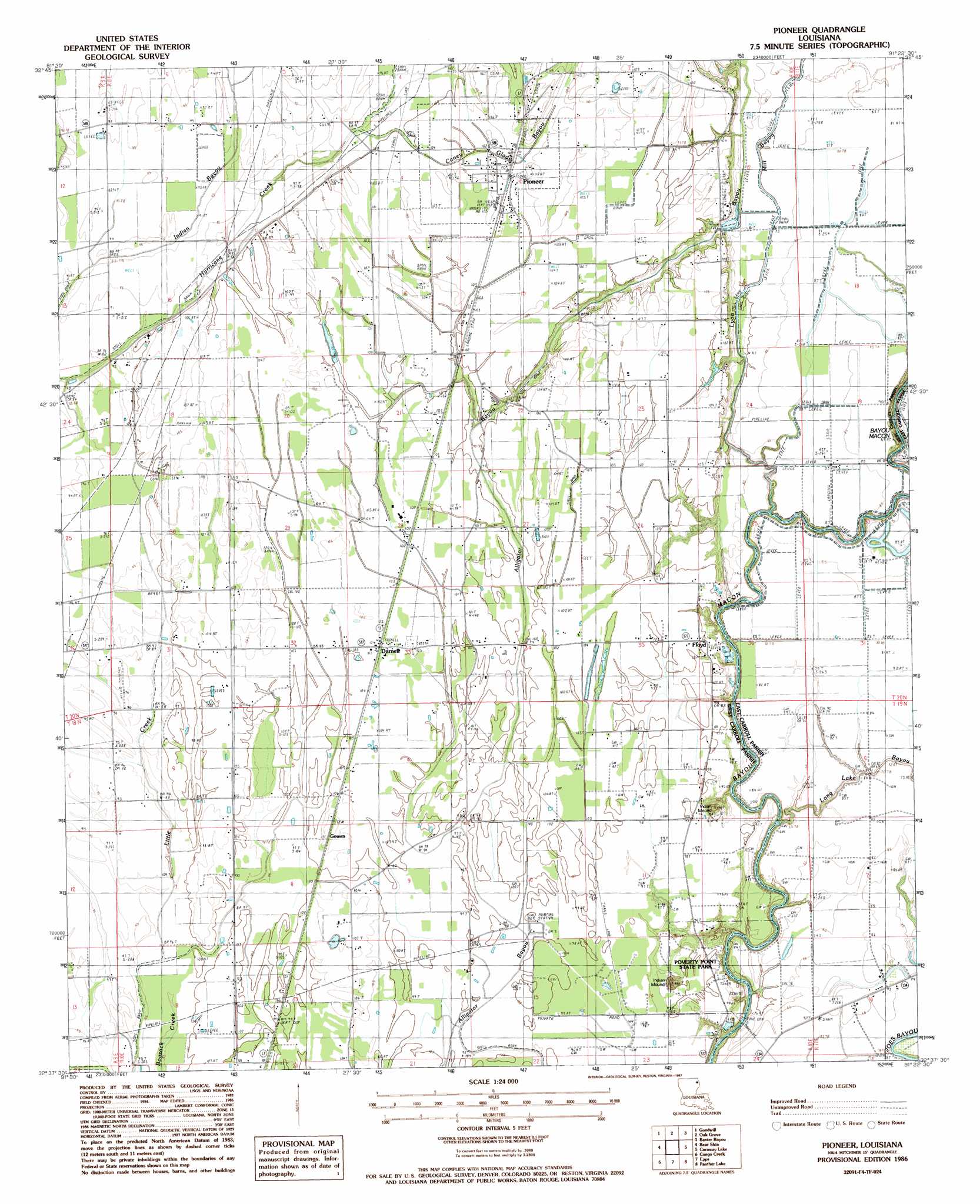
USGS Topo Quad 32091f4 - 1:24,000 scale
| Topo Map Name: | Pioneer |
| USGS Topo Quad ID: | 32091f4 |
| Print Size: | ca. 21 1/4" wide x 27" high |
| Southeast Coordinates: | 32.625° N latitude / 91.375° W longitude |
| Map Center Coordinates: | 32.6875° N latitude / 91.4375° W longitude |
| U.S. State: | LA |
| Filename: | o32091f4.jpg |
| Download Map JPG Image: | Pioneer topo map 1:24,000 scale |
| Map Type: | Topographic |
| Topo Series: | 7.5´ |
| Map Scale: | 1:24,000 |
| Source of Map Images: | United States Geological Survey (USGS) |
| Alternate Map Versions: |
Pioneer LA 1986, updated 1987 Download PDF Buy paper map Pioneer LA 2012 Download PDF Buy paper map Pioneer LA 2015 Download PDF Buy paper map |
1:24,000 Topo Quads surrounding Pioneer
Bonita |
Laark |
Fiske |
Kilbourne |
Millikin |
Bonita Sw |
Goodwill |
Oak Grove |
Baxter Bayou |
Lake Providence |
Whitney Island North |
Bear Skin |
Pioneer |
Caraway Lake |
Transylvania |
Whitney Island South |
Congo Creek |
Epps |
Panther Lake |
Sondheimer |
Bee Bayou |
Dunn |
Africa Lake |
Tendal |
Tallulah |
> Back to 32091e1 at 1:100,000 scale
> Back to 32090a1 at 1:250,000 scale
> Back to U.S. Topo Maps home
Pioneer topo map: Gazetteer
Pioneer: Airports
Bayou Meadows Airport elevation 25m 82′Pioneer: Capes
Poverty Point elevation 29m 95′Pioneer: Crossings
Montgomery Ferry (historical) elevation 19m 62′Pioneer: Guts
Alligator Bayou elevation 27m 88′Pioneer: Oilfields
Epps Gas Field elevation 29m 95′South Epps Gas Field elevation 30m 98′
Pioneer: Parks
Poverty Point National Monument elevation 29m 95′Poverty Point State Historic Site elevation 30m 98′
Pioneer: Populated Places
Darnell elevation 31m 101′Floyd elevation 30m 98′
Floyd Landing elevation 18m 59′
Gowen elevation 33m 108′
Pioneer elevation 32m 104′
Pioneer: Post Offices
Darnell Post Office elevation 32m 104′Pioneer Post Office elevation 32m 104′
Pioneer: Streams
Boggy Bayou elevation 27m 88′Caney Glade Bayou elevation 29m 95′
Little Creek elevation 29m 95′
Long Lake Bayou elevation 20m 65′
Lyon Bayou elevation 20m 65′
Mill Bayou elevation 21m 68′
Pioneer digital topo map on disk
Buy this Pioneer topo map showing relief, roads, GPS coordinates and other geographical features, as a high-resolution digital map file on DVD: