Collinston West Topo Map Louisiana
To zoom in, hover over the map of Collinston West
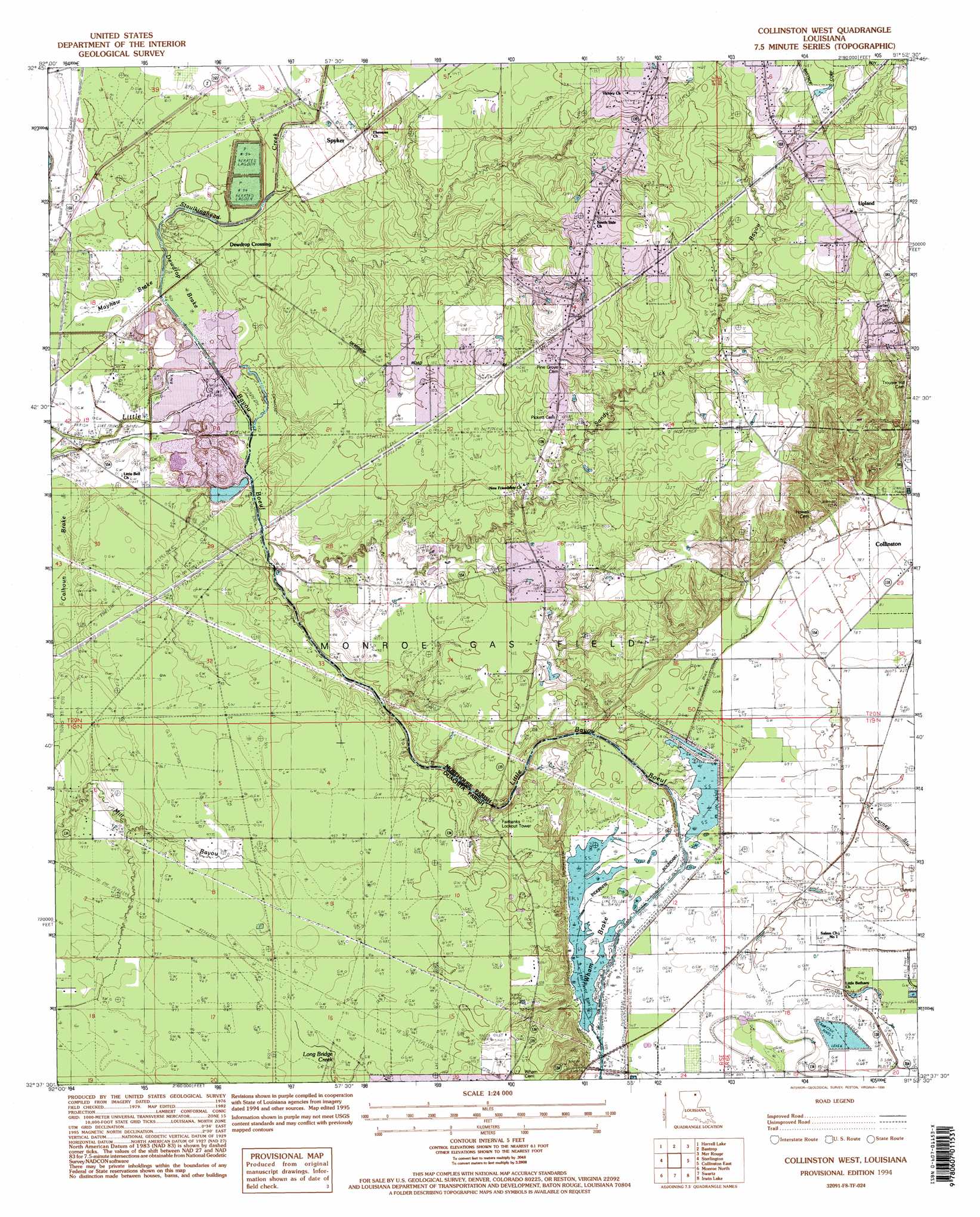
USGS Topo Quad 32091f8 - 1:24,000 scale
| Topo Map Name: | Collinston West |
| USGS Topo Quad ID: | 32091f8 |
| Print Size: | ca. 21 1/4" wide x 27" high |
| Southeast Coordinates: | 32.625° N latitude / 91.875° W longitude |
| Map Center Coordinates: | 32.6875° N latitude / 91.9375° W longitude |
| U.S. State: | LA |
| Filename: | o32091f8.jpg |
| Download Map JPG Image: | Collinston West topo map 1:24,000 scale |
| Map Type: | Topographic |
| Topo Series: | 7.5´ |
| Map Scale: | 1:24,000 |
| Source of Map Images: | United States Geological Survey (USGS) |
| Alternate Map Versions: |
Collinston West LA 1982, updated 1983 Download PDF Buy paper map Collinston West LA 1994, updated 1995 Download PDF Buy paper map Collinston West LA 2012 Download PDF Buy paper map Collinston West LA 2015 Download PDF Buy paper map |
1:24,000 Topo Quads surrounding Collinston West
Marion East |
Fish Lake |
Beckman |
Twin Oaks |
Bonita |
Haille |
Harrell Lake |
Bastrop |
Mer Rouge |
Bonita Sw |
Rocky Branch |
Sterlington |
Collinston West |
Collinston East |
Whitney Island North |
West Monroe North |
Monroe North |
Swartz |
Irwin Lake |
Whitney Island South |
West Monroe South |
Monroe South |
Crew Lake |
Rayville |
Bee Bayou |
> Back to 32091e1 at 1:100,000 scale
> Back to 32090a1 at 1:250,000 scale
> Back to U.S. Topo Maps home
Collinston West topo map: Gazetteer
Collinston West: Parks
Cities Service Wildlife Management Area elevation 29m 95′Collinston West: Populated Places
Doss (historical) elevation 23m 75′Marcarco elevation 24m 78′
Spyker elevation 30m 98′
Upland elevation 45m 147′
Wham elevation 22m 72′
Windsor elevation 22m 72′
Collinston West: Streams
Jordan Creek elevation 23m 75′Sandy Lick Bayou elevation 22m 72′
Staulkinghead Creek elevation 25m 82′
Collinston West: Swamps
Mayhaw Brake elevation 22m 72′Collinston West digital topo map on disk
Buy this Collinston West topo map showing relief, roads, GPS coordinates and other geographical features, as a high-resolution digital map file on DVD: