Whiting Bayou Topo Map Mississippi
To zoom in, hover over the map of Whiting Bayou
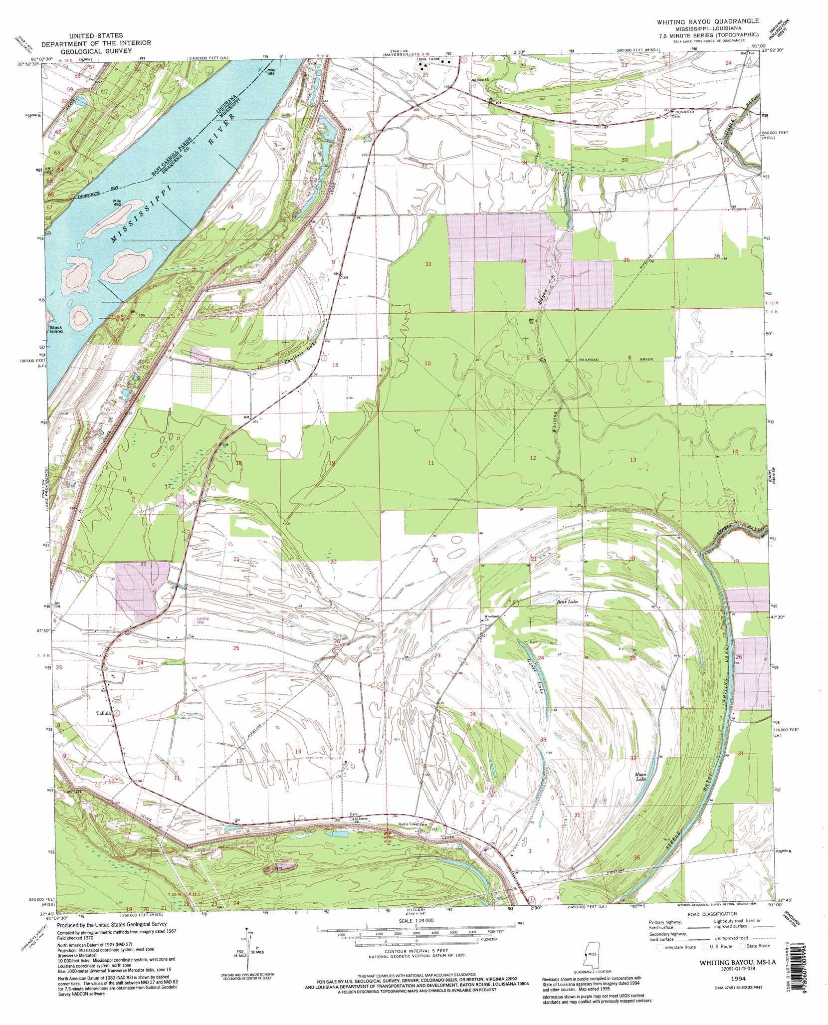
USGS Topo Quad 32091g1 - 1:24,000 scale
| Topo Map Name: | Whiting Bayou |
| USGS Topo Quad ID: | 32091g1 |
| Print Size: | ca. 21 1/4" wide x 27" high |
| Southeast Coordinates: | 32.75° N latitude / 91° W longitude |
| Map Center Coordinates: | 32.8125° N latitude / 91.0625° W longitude |
| U.S. States: | MS, LA |
| Filename: | o32091g1.jpg |
| Download Map JPG Image: | Whiting Bayou topo map 1:24,000 scale |
| Map Type: | Topographic |
| Topo Series: | 7.5´ |
| Map Scale: | 1:24,000 |
| Source of Map Images: | United States Geological Survey (USGS) |
| Alternate Map Versions: |
Longwood MS 1909 Download PDF Buy paper map Whiting Bayou MS 1970, updated 1972 Download PDF Buy paper map Whiting Bayou MS 1994, updated 1995 Download PDF Buy paper map Whiting Bayou MS 2012 Download PDF Buy paper map Whiting Bayou MS 2015 Download PDF Buy paper map |
1:24,000 Topo Quads surrounding Whiting Bayou
Eudora South |
Readland |
Glen Allan |
Percy |
Delta City |
Kilbourne |
Millikin |
Mayersville |
Rolling Fork West |
Rolling Fork East |
Baxter Bayou |
Lake Providence |
Whiting Bayou |
Cary |
Red Rock |
Caraway Lake |
Transylvania |
Fitler |
Onward |
Valley Park |
Panther Lake |
Sondheimer |
Eagle Bend |
Cane Bayou |
Floweree |
> Back to 32091e1 at 1:100,000 scale
> Back to 32090a1 at 1:250,000 scale
> Back to U.S. Topo Maps home
Whiting Bayou topo map: Gazetteer
Whiting Bayou: Lakes
Bear Lake elevation 29m 95′Carlisle Lake elevation 30m 98′
Goose Lake elevation 27m 88′
Moon Lake elevation 26m 85′
Whiting Lake elevation 23m 75′
Whiting Bayou: Parks
Anderson-Tully State Wildlife Management Area elevation 29m 95′Whiting Bayou: Populated Places
Alexander (historical) elevation 29m 95′Benham (historical) elevation 30m 98′
Elleslie elevation 31m 101′
Homochitto (historical) elevation 32m 104′
Tallula elevation 32m 104′
Whiting Bayou: Streams
Whiting Bayou elevation 24m 78′Whiting Bayou digital topo map on disk
Buy this Whiting Bayou topo map showing relief, roads, GPS coordinates and other geographical features, as a high-resolution digital map file on DVD: