Twin Oaks Topo Map Louisiana
To zoom in, hover over the map of Twin Oaks
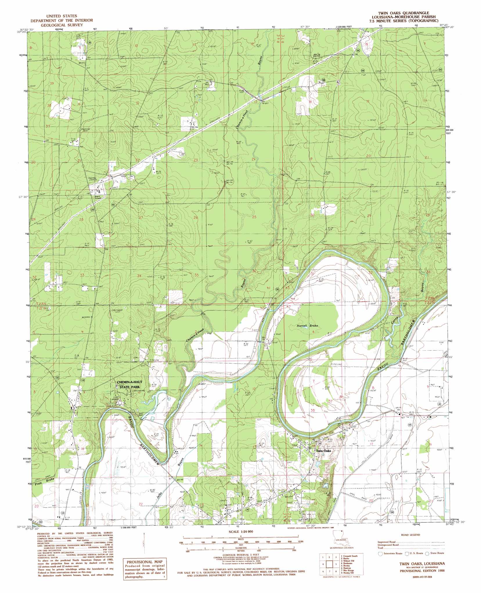
USGS Topo Quad 32091h7 - 1:24,000 scale
| Topo Map Name: | Twin Oaks |
| USGS Topo Quad ID: | 32091h7 |
| Print Size: | ca. 21 1/4" wide x 27" high |
| Southeast Coordinates: | 32.875° N latitude / 91.75° W longitude |
| Map Center Coordinates: | 32.9375° N latitude / 91.8125° W longitude |
| U.S. State: | LA |
| Filename: | o32091h7.jpg |
| Download Map JPG Image: | Twin Oaks topo map 1:24,000 scale |
| Map Type: | Topographic |
| Topo Series: | 7.5´ |
| Map Scale: | 1:24,000 |
| Source of Map Images: | United States Geological Survey (USGS) |
| Alternate Map Versions: |
Twin Oaks LA 1988, updated 1988 Download PDF Buy paper map Twin Oaks LA 2012 Download PDF Buy paper map Twin Oaks LA 2015 Download PDF Buy paper map |
1:24,000 Topo Quads surrounding Twin Oaks
Marais Saline |
Crossett North |
Hamburg |
Wilmot Nw |
Portland |
Felsenthal Dam |
Crossett South |
Berlin |
Wilmot Sw |
Wilmot |
Fish Lake |
Beckman |
Twin Oaks |
Bonita |
Laark |
Harrell Lake |
Bastrop |
Mer Rouge |
Bonita Sw |
Goodwill |
Sterlington |
Collinston West |
Collinston East |
Whitney Island North |
Bear Skin |
> Back to 32091e1 at 1:100,000 scale
> Back to 32090a1 at 1:250,000 scale
> Back to U.S. Topo Maps home
Twin Oaks topo map: Gazetteer
Twin Oaks: Bridges
Vester Bridge elevation 24m 78′Twin Oaks: Dams
Chemin A Haut Lake Dam elevation 29m 95′Twin Oaks: Parks
Chemin-A-Haut State Park elevation 32m 104′Twin Oaks: Populated Places
Brodnax (historical) elevation 46m 150′Causey (historical) elevation 44m 144′
Plantersville (historical) elevation 28m 91′
Tipton (historical) elevation 41m 134′
Twin Oaks elevation 42m 137′
Twin Oaks: Streams
Caney Bayou elevation 23m 75′Chemin-A-Haut Bayou elevation 23m 75′
Chemin-A-Haut Bayou elevation 23m 75′
Twin Oaks: Swamps
Harrell Brake elevation 29m 95′Morehouse Brake (historical) elevation 28m 91′
Nunn Brake (historical) elevation 29m 95′
Twin Oaks digital topo map on disk
Buy this Twin Oaks topo map showing relief, roads, GPS coordinates and other geographical features, as a high-resolution digital map file on DVD: