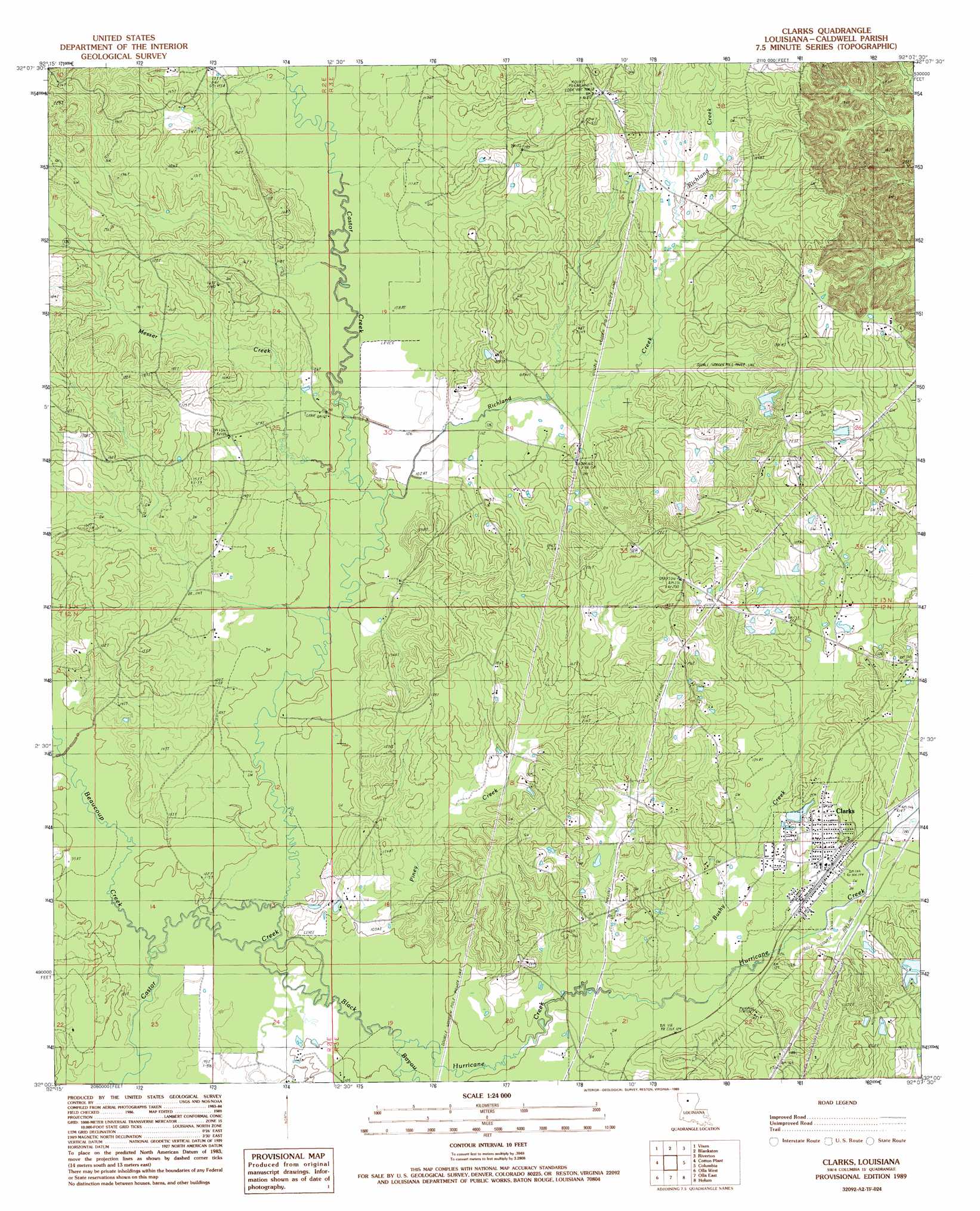
Clark Topo Map Louisiana
To zoom in, hover over the map of Clark
USGS Topo Quad 32092a2 - 1:24,000 scale
| Topo Map Name: | Clark |
| USGS Topo Quad ID: | 32092a2 |
| Print Size: | ca. 21 1/4" wide x 27" high |
| Southeast Coordinates: | 32° N latitude / 92.125° W longitude |
| Map Center Coordinates: | 32.0625° N latitude / 92.1875° W longitude |
| U.S. State: | LA |
| Filename: | o32092a2.jpg |
| Download Map JPG Image: | Clark topo map 1:24,000 scale |
| Map Type: | Topographic |
| Topo Series: | 7.5´ |
| Map Scale: | 1:24,000 |
| Source of Map Images: | United States Geological Survey (USGS) |
| Alternate Map Versions: |
Clark LA 1989, updated 1989 Download PDF Buy paper map Clark LA 2012 Download PDF Buy paper map Clark LA 2015 Download PDF Buy paper map |
1:24,000 Topo Quads surrounding Clark
Chatham |
Chatham Se |
Luna |
Bosco |
Gilleyville |
Womack |
Vixen |
Blankston |
Riverton |
Hebert |
Sikes |
Cotton Plant |
Clark |
Columbia |
Mason |
Flat Creek |
Fords Creek |
Olla East |
Holum |
Enterprise |
Georgetown |
Tullas |
Summerville |
Nickel |
Aimwell |
> Back to 32092a1 at 1:100,000 scale
> Back to 32092a1 at 1:250,000 scale
> Back to U.S. Topo Maps home
Clark topo map: Gazetteer
Clark: Oilfields
Banks Springs Gas Field elevation 61m 200′Bethel Church Gas Field elevation 31m 101′
Kelly School Gas Field elevation 29m 95′
North Clarks Gas Field elevation 46m 150′
West Clarks Gas Field elevation 42m 137′
Clark: Populated Places
Clarks elevation 43m 141′Cooper (historical) elevation 32m 104′
Clark: Post Offices
Clarks Post Office elevation 43m 141′Clark: Streams
Beaucoup Creek elevation 27m 88′Black Bayou elevation 27m 88′
Bushy Creek elevation 34m 111′
Hurricane Creek elevation 28m 91′
Messer Creek elevation 30m 98′
Piney Creek elevation 27m 88′
Richland Creek elevation 30m 98′
Clark digital topo map on disk
Buy this Clark topo map showing relief, roads, GPS coordinates and other geographical features, as a high-resolution digital map file on DVD: