Sikes Topo Map Louisiana
To zoom in, hover over the map of Sikes
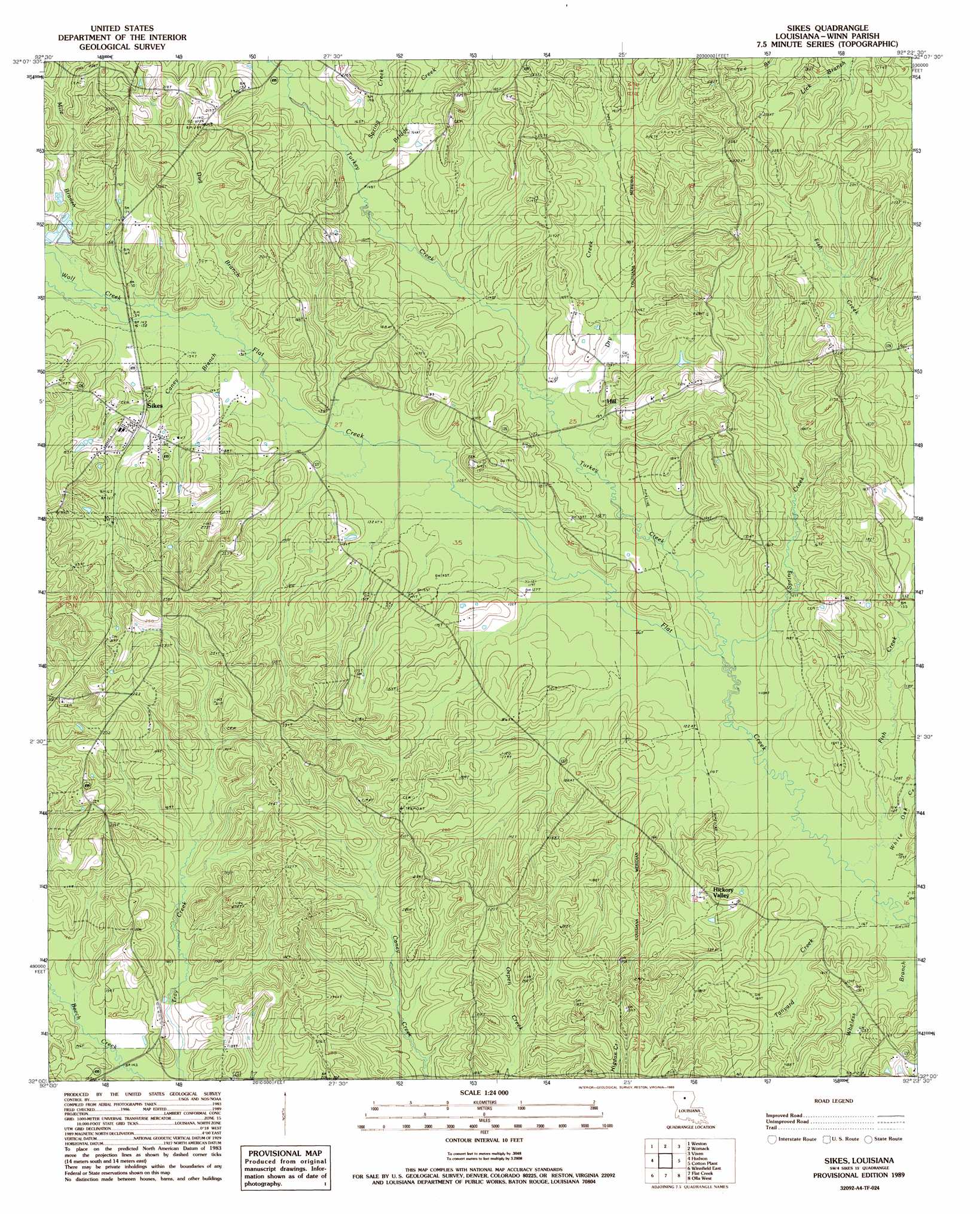
USGS Topo Quad 32092a4 - 1:24,000 scale
| Topo Map Name: | Sikes |
| USGS Topo Quad ID: | 32092a4 |
| Print Size: | ca. 21 1/4" wide x 27" high |
| Southeast Coordinates: | 32° N latitude / 92.375° W longitude |
| Map Center Coordinates: | 32.0625° N latitude / 92.4375° W longitude |
| U.S. State: | LA |
| Filename: | o32092a4.jpg |
| Download Map JPG Image: | Sikes topo map 1:24,000 scale |
| Map Type: | Topographic |
| Topo Series: | 7.5´ |
| Map Scale: | 1:24,000 |
| Source of Map Images: | United States Geological Survey (USGS) |
| Alternate Map Versions: |
Sikes LA 1989, updated 1989 Download PDF Buy paper map Sikes LA 2012 Download PDF Buy paper map Sikes LA 2015 Download PDF Buy paper map |
1:24,000 Topo Quads surrounding Sikes
Jonesboro North |
Curr Creek |
Chatham |
Chatham Se |
Luna |
Jonesboro South |
Weston |
Womack |
Vixen |
Blankston |
Dodson |
Hudson |
Sikes |
Cotton Plant |
Clark |
Winnfield West |
Winnfield East |
Flat Creek |
Fords Creek |
Olla East |
Atlanta |
Packton |
Georgetown |
Tullas |
Summerville |
> Back to 32092a1 at 1:100,000 scale
> Back to 32092a1 at 1:250,000 scale
> Back to U.S. Topo Maps home
Sikes topo map: Gazetteer
Sikes: Oilfields
East Sikes Gas Field elevation 38m 124′Spring Creek Gas Field elevation 42m 137′
Tanyard Creek Gas Field elevation 58m 190′
West Hickory Valley Gas Field elevation 65m 213′
Sikes: Populated Places
Hickory Valley elevation 47m 154′Hill elevation 47m 154′
Sikes elevation 52m 170′
Sikes: Post Offices
Sikes Post Office elevation 53m 173′Sikes: Streams
Bridge Creek elevation 44m 144′Caney Branch elevation 41m 134′
Dry Creek elevation 38m 124′
Dug Branch elevation 42m 137′
Fish Creek elevation 37m 121′
Little Creek elevation 42m 137′
Mile Branch elevation 42m 137′
Spring Creek elevation 44m 144′
Spring Creek elevation 33m 108′
Tanyard Creek elevation 32m 104′
Turkey Creek elevation 33m 108′
Wheless Branch elevation 32m 104′
White Oak Creek elevation 32m 104′
Wolf Creek elevation 42m 137′
Sikes digital topo map on disk
Buy this Sikes topo map showing relief, roads, GPS coordinates and other geographical features, as a high-resolution digital map file on DVD: