Blankston Topo Map Louisiana
To zoom in, hover over the map of Blankston
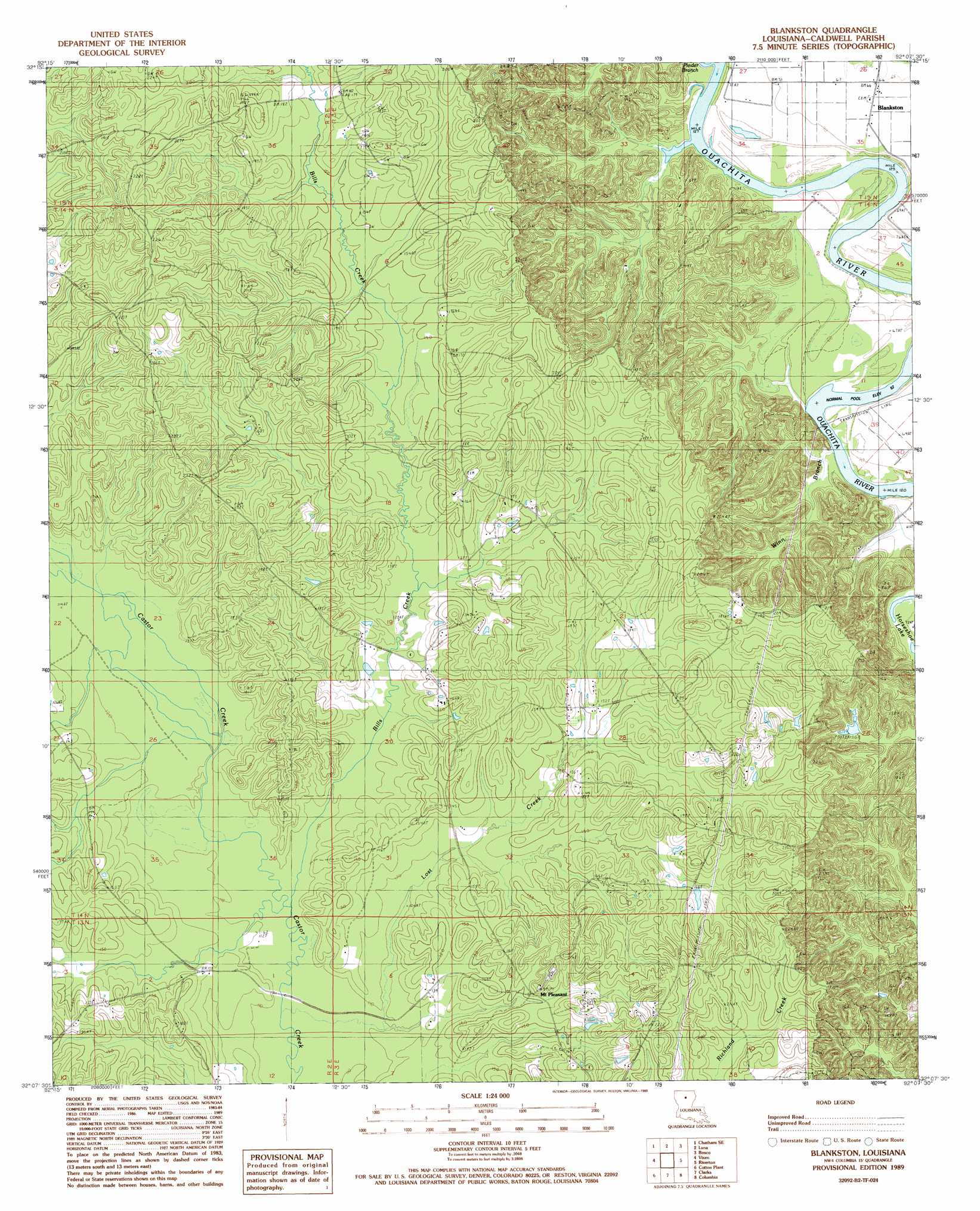
USGS Topo Quad 32092b2 - 1:24,000 scale
| Topo Map Name: | Blankston |
| USGS Topo Quad ID: | 32092b2 |
| Print Size: | ca. 21 1/4" wide x 27" high |
| Southeast Coordinates: | 32.125° N latitude / 92.125° W longitude |
| Map Center Coordinates: | 32.1875° N latitude / 92.1875° W longitude |
| U.S. State: | LA |
| Filename: | o32092b2.jpg |
| Download Map JPG Image: | Blankston topo map 1:24,000 scale |
| Map Type: | Topographic |
| Topo Series: | 7.5´ |
| Map Scale: | 1:24,000 |
| Source of Map Images: | United States Geological Survey (USGS) |
| Alternate Map Versions: |
Blankston LA 1989, updated 1989 Download PDF Buy paper map Blankston LA 1998, updated 2004 Download PDF Buy paper map Blankston LA 2012 Download PDF Buy paper map Blankston LA 2015 Download PDF Buy paper map |
1:24,000 Topo Quads surrounding Blankston
Eros |
Cadeville |
West Monroe South |
Monroe South |
Crew Lake |
Chatham |
Chatham Se |
Luna |
Bosco |
Gilleyville |
Womack |
Vixen |
Blankston |
Riverton |
Hebert |
Sikes |
Cotton Plant |
Clark |
Columbia |
Mason |
Flat Creek |
Fords Creek |
Olla East |
Holum |
Enterprise |
> Back to 32092a1 at 1:100,000 scale
> Back to 32092a1 at 1:250,000 scale
> Back to U.S. Topo Maps home
Blankston topo map: Gazetteer
Blankston: Cliffs
Lone Grave Bluff elevation 47m 154′Blankston: Oilfields
Lost Creek Gas Field elevation 46m 150′Blankston: Populated Places
Blankston elevation 21m 68′Mount Pleasant elevation 49m 160′
Old Mount Pleasant (historical) elevation 43m 141′
Blankston: Streams
Bills Creek elevation 33m 108′Lost Creek elevation 33m 108′
Pinder Branch elevation 19m 62′
Upper Lone Grave Bayou elevation 16m 52′
Winn Branch elevation 16m 52′
Blankston digital topo map on disk
Buy this Blankston topo map showing relief, roads, GPS coordinates and other geographical features, as a high-resolution digital map file on DVD: