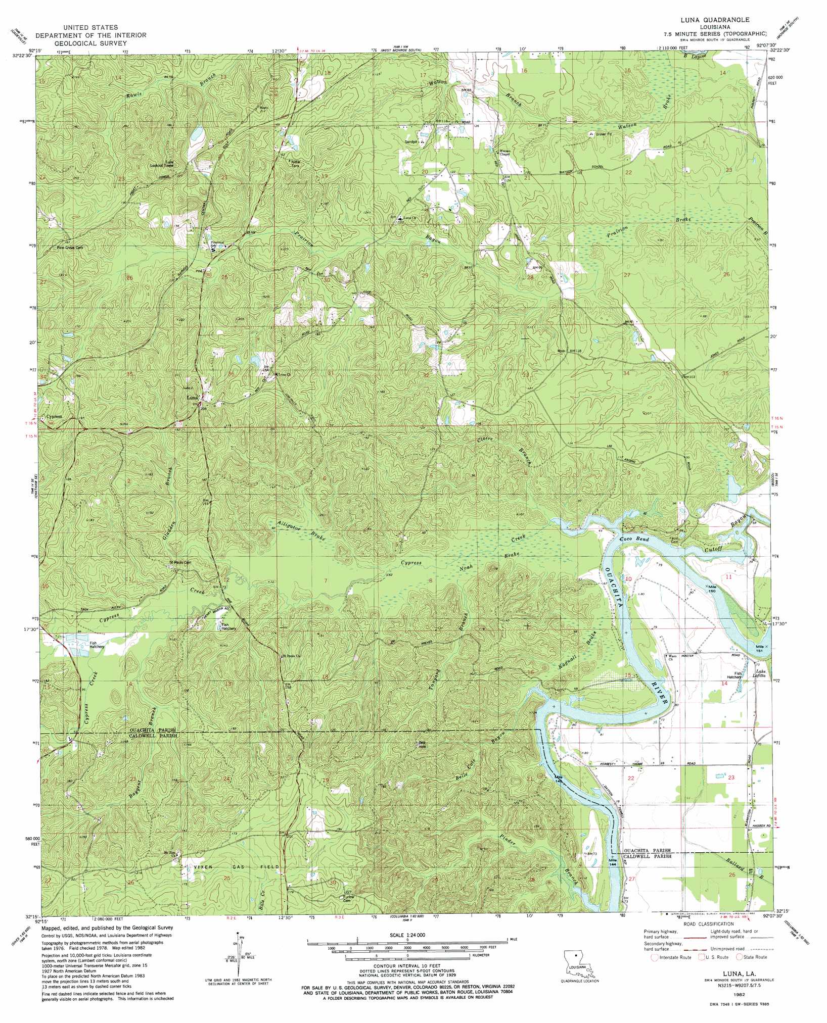
Luna Topo Map Louisiana
To zoom in, hover over the map of Luna
USGS Topo Quad 32092c2 - 1:24,000 scale
| Topo Map Name: | Luna |
| USGS Topo Quad ID: | 32092c2 |
| Print Size: | ca. 21 1/4" wide x 27" high |
| Southeast Coordinates: | 32.25° N latitude / 92.125° W longitude |
| Map Center Coordinates: | 32.3125° N latitude / 92.1875° W longitude |
| U.S. State: | LA |
| Filename: | o32092c2.jpg |
| Download Map JPG Image: | Luna topo map 1:24,000 scale |
| Map Type: | Topographic |
| Topo Series: | 7.5´ |
| Map Scale: | 1:24,000 |
| Source of Map Images: | United States Geological Survey (USGS) |
| Alternate Map Versions: |
Luna LA 1982, updated 1982 Download PDF Buy paper map Luna LA 2012 Download PDF Buy paper map Luna LA 2015 Download PDF Buy paper map |
1:24,000 Topo Quads surrounding Luna
Downsville South |
Calhoun |
West Monroe North |
Monroe North |
Swartz |
Eros |
Cadeville |
West Monroe South |
Monroe South |
Crew Lake |
Chatham |
Chatham Se |
Luna |
Bosco |
Gilleyville |
Womack |
Vixen |
Blankston |
Riverton |
Hebert |
Sikes |
Cotton Plant |
Clark |
Columbia |
Mason |
> Back to 32092a1 at 1:100,000 scale
> Back to 32092a1 at 1:250,000 scale
> Back to U.S. Topo Maps home
Luna topo map: Gazetteer
Luna: Bends
Coco Bend elevation 16m 52′Luna: Oilfields
Vixen Gas Field elevation 51m 167′Luna: Populated Places
Cypress elevation 63m 206′Luna elevation 59m 193′
Luna: Streams
Baygent Branch elevation 23m 75′Belle Cove Bayou elevation 16m 52′
Claire Branch elevation 16m 52′
Cypress Creek elevation 16m 52′
Gladden Branch elevation 21m 68′
Little Cypress Creek elevation 26m 85′
Tanyard Branch elevation 17m 55′
Watson Branch elevation 19m 62′
Luna: Swamps
Alligator Brake elevation 19m 62′Noah Brake elevation 17m 55′
Prairion Brake elevation 17m 55′
Ragnall Brake elevation 19m 62′
Watson Brake elevation 18m 59′
Luna digital topo map on disk
Buy this Luna topo map showing relief, roads, GPS coordinates and other geographical features, as a high-resolution digital map file on DVD: