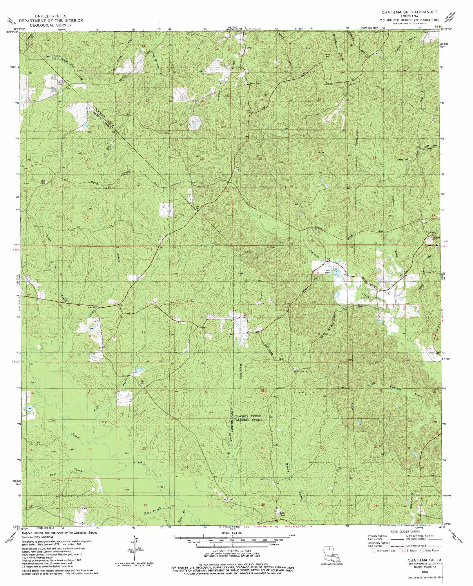
Chatham Se Topo Map Louisiana
To zoom in, hover over the map of Chatham Se
USGS Topo Quad 32092c3 - 1:24,000 scale
| Topo Map Name: | Chatham Se |
| USGS Topo Quad ID: | 32092c3 |
| Print Size: | ca. 21 1/4" wide x 27" high |
| Southeast Coordinates: | 32.25° N latitude / 92.25° W longitude |
| Map Center Coordinates: | 32.3125° N latitude / 92.3125° W longitude |
| U.S. State: | LA |
| Filename: | o32092c3.jpg |
| Download Map JPG Image: | Chatham Se topo map 1:24,000 scale |
| Map Type: | Topographic |
| Topo Series: | 7.5´ |
| Map Scale: | 1:24,000 |
| Source of Map Images: | United States Geological Survey (USGS) |
| Alternate Map Versions: |
Chatham SE LA 1982, updated 1982 Download PDF Buy paper map Chatham SE LA 2012 Download PDF Buy paper map Chatham SE LA 2015 Download PDF Buy paper map |
1:24,000 Topo Quads surrounding Chatham Se
Ruston East |
Downsville South |
Calhoun |
West Monroe North |
Monroe North |
Vernon |
Eros |
Cadeville |
West Monroe South |
Monroe South |
Curr Creek |
Chatham |
Chatham Se |
Luna |
Bosco |
Weston |
Womack |
Vixen |
Blankston |
Riverton |
Hudson |
Sikes |
Cotton Plant |
Clark |
Columbia |
> Back to 32092a1 at 1:100,000 scale
> Back to 32092a1 at 1:250,000 scale
> Back to U.S. Topo Maps home
Chatham Se topo map: Gazetteer
Chatham Se: Oilfields
North Vixen Gas Field elevation 51m 167′Chatham Se: Populated Places
Anabel elevation 29m 95′Tama elevation 49m 160′
Chatham Se: Streams
Bear Creek elevation 39m 127′Biles Branch elevation 39m 127′
Cow Creek elevation 41m 134′
Cub Creek elevation 40m 131′
Glade Creek elevation 43m 141′
Little Glade Creek elevation 45m 147′
Chatham Se digital topo map on disk
Buy this Chatham Se topo map showing relief, roads, GPS coordinates and other geographical features, as a high-resolution digital map file on DVD: