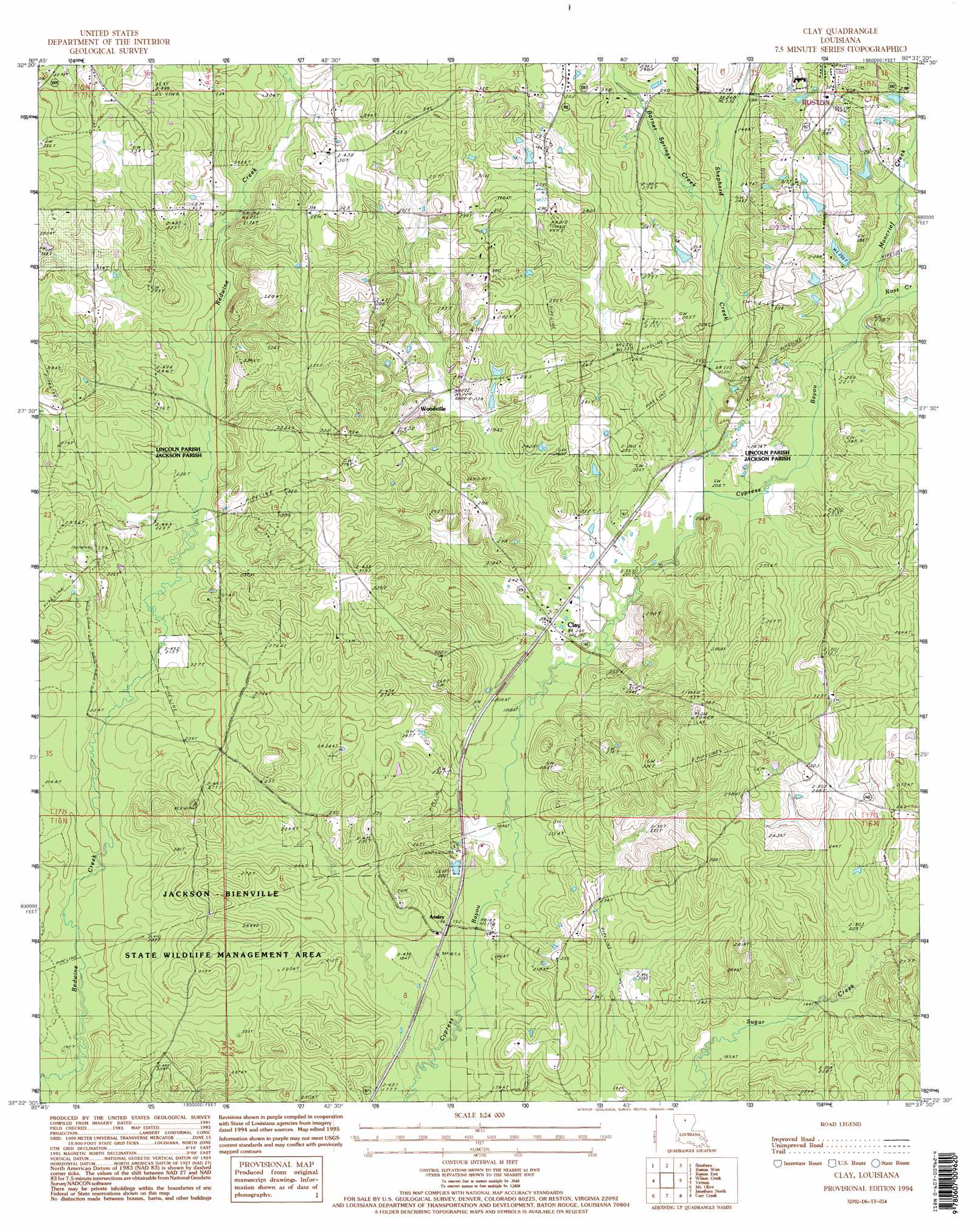
Clay Topo Map Louisiana
To zoom in, hover over the map of Clay
USGS Topo Quad 32092d6 - 1:24,000 scale
| Topo Map Name: | Clay |
| USGS Topo Quad ID: | 32092d6 |
| Print Size: | ca. 21 1/4" wide x 27" high |
| Southeast Coordinates: | 32.375° N latitude / 92.625° W longitude |
| Map Center Coordinates: | 32.4375° N latitude / 92.6875° W longitude |
| U.S. State: | LA |
| Filename: | o32092d6.jpg |
| Download Map JPG Image: | Clay topo map 1:24,000 scale |
| Map Type: | Topographic |
| Topo Series: | 7.5´ |
| Map Scale: | 1:24,000 |
| Source of Map Images: | United States Geological Survey (USGS) |
| Alternate Map Versions: |
Clay LA 1985, updated 1986 Download PDF Buy paper map Clay LA 1994, updated 1994 Download PDF Buy paper map Clay LA 2012 Download PDF Buy paper map Clay LA 2015 Download PDF Buy paper map |
1:24,000 Topo Quads surrounding Clay
Marsalis |
Lake Foursome |
Dubach |
Cedarton |
Downsville North |
Arcadia |
Simsboro |
Ruston West |
Ruston East |
Downsville South |
Bryceland |
Wilson Creek |
Clay |
Vernon |
Eros |
Bienville |
Mount Olive |
Jonesboro North |
Curr Creek |
Chatham |
Saline |
Danville |
Jonesboro South |
Weston |
Womack |
> Back to 32092a1 at 1:100,000 scale
> Back to 32092a1 at 1:250,000 scale
> Back to U.S. Topo Maps home
Clay topo map: Gazetteer
Clay: Oilfields
Clay Gas Field elevation 74m 242′Clay: Populated Places
Ansley elevation 60m 196′Bonner (historical) elevation 96m 314′
Clay elevation 63m 206′
Pleasant Hill elevation 100m 328′
Redwine (historical) elevation 107m 351′
Shull (historical) elevation 108m 354′
Woodville elevation 88m 288′
Clay: Post Offices
Clay Post Office (historical) elevation 64m 209′Clay: Streams
Barnet Springs Creek elevation 69m 226′Edmiston Creek elevation 61m 200′
Moncrief Creek elevation 69m 226′
Ross Creek elevation 69m 226′
Shepherd Creek elevation 62m 203′
Clay digital topo map on disk
Buy this Clay topo map showing relief, roads, GPS coordinates and other geographical features, as a high-resolution digital map file on DVD: