Wilson Creek Topo Map Louisiana
To zoom in, hover over the map of Wilson Creek
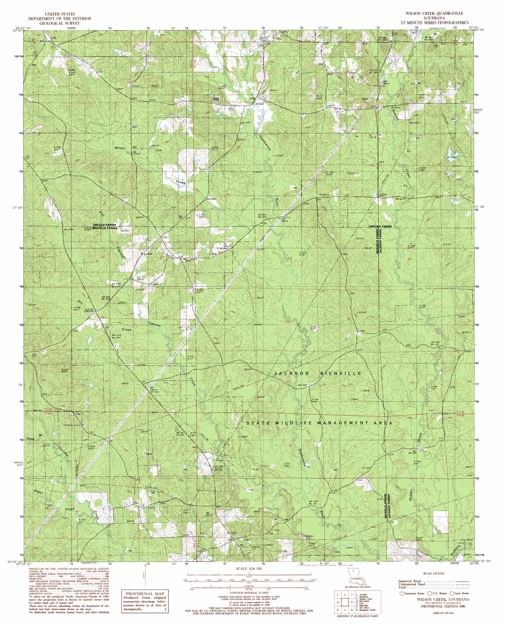
USGS Topo Quad 32092d7 - 1:24,000 scale
| Topo Map Name: | Wilson Creek |
| USGS Topo Quad ID: | 32092d7 |
| Print Size: | ca. 21 1/4" wide x 27" high |
| Southeast Coordinates: | 32.375° N latitude / 92.75° W longitude |
| Map Center Coordinates: | 32.4375° N latitude / 92.8125° W longitude |
| U.S. State: | LA |
| Filename: | o32092d7.jpg |
| Download Map JPG Image: | Wilson Creek topo map 1:24,000 scale |
| Map Type: | Topographic |
| Topo Series: | 7.5´ |
| Map Scale: | 1:24,000 |
| Source of Map Images: | United States Geological Survey (USGS) |
| Alternate Map Versions: |
Wilson Creek LA 1986, updated 1986 Download PDF Buy paper map Wilson Creek LA 2012 Download PDF Buy paper map Wilson Creek LA 2015 Download PDF Buy paper map |
1:24,000 Topo Quads surrounding Wilson Creek
Athens |
Marsalis |
Lake Foursome |
Dubach |
Cedarton |
Gibsland |
Arcadia |
Simsboro |
Ruston West |
Ruston East |
Sailes |
Bryceland |
Wilson Creek |
Clay |
Vernon |
Sparta |
Bienville |
Mount Olive |
Jonesboro North |
Curr Creek |
Ashland |
Saline |
Danville |
Jonesboro South |
Weston |
> Back to 32092a1 at 1:100,000 scale
> Back to 32092a1 at 1:250,000 scale
> Back to U.S. Topo Maps home
Wilson Creek topo map: Gazetteer
Wilson Creek: Oilfields
Driscoll Gas Field elevation 56m 183′Simsboro Gas Field elevation 93m 305′
Wilson Creek: Parks
Jackson-Bienville State Wildlife Management Area elevation 57m 187′Wilson Creek: Populated Places
Oak Grove elevation 117m 383′Wilson Creek: Streams
Cypress Creek elevation 56m 183′Dry Creek elevation 70m 229′
Flat Cypress Creek elevation 72m 236′
Redwine Creek elevation 52m 170′
Sand Branch elevation 76m 249′
Sugar Creek elevation 68m 223′
Wilson Creek elevation 68m 223′
Wilson Creek digital topo map on disk
Buy this Wilson Creek topo map showing relief, roads, GPS coordinates and other geographical features, as a high-resolution digital map file on DVD: