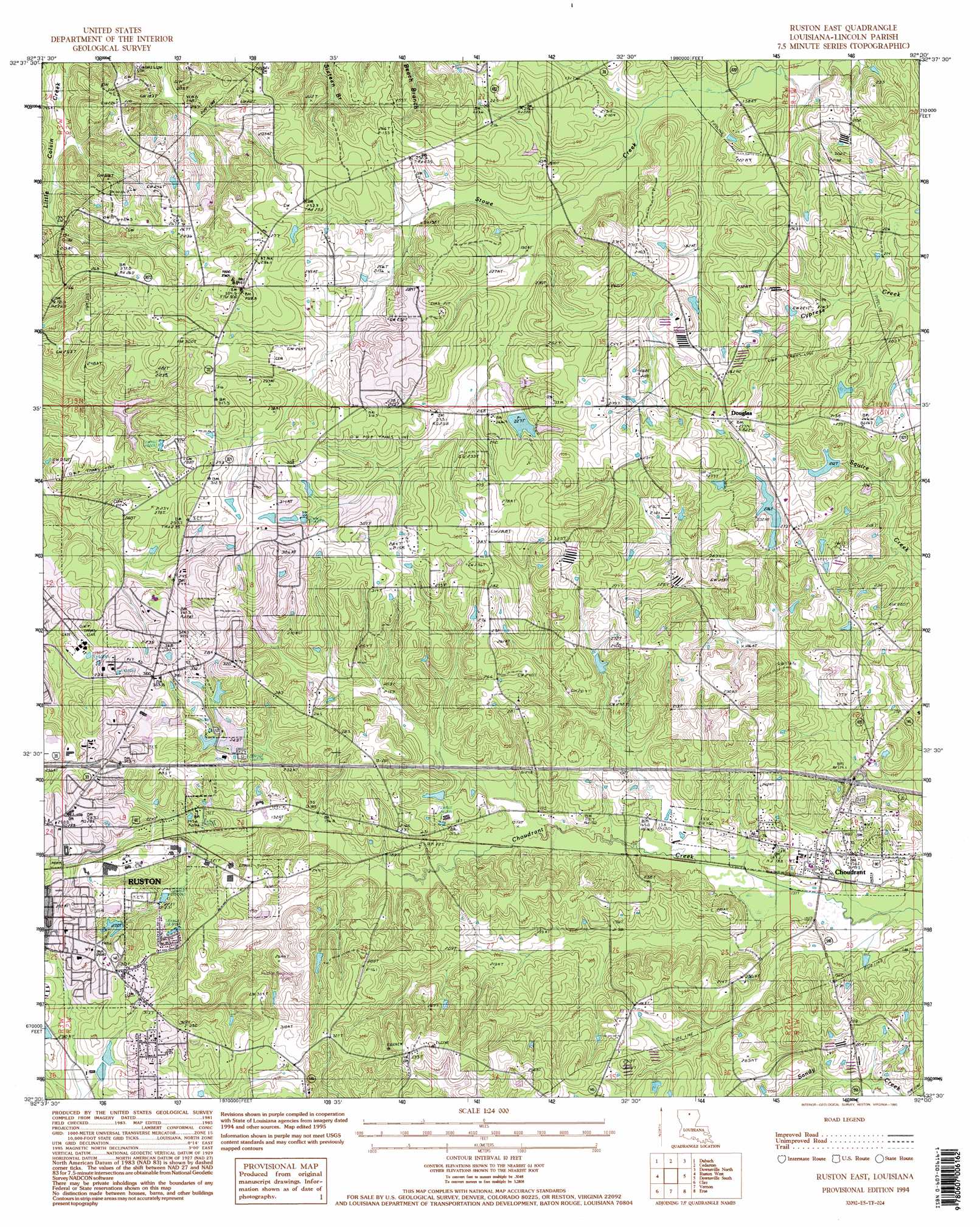
Ruston East Topo Map Louisiana
To zoom in, hover over the map of Ruston East
USGS Topo Quad 32092e5 - 1:24,000 scale
| Topo Map Name: | Ruston East |
| USGS Topo Quad ID: | 32092e5 |
| Print Size: | ca. 21 1/4" wide x 27" high |
| Southeast Coordinates: | 32.5° N latitude / 92.5° W longitude |
| Map Center Coordinates: | 32.5625° N latitude / 92.5625° W longitude |
| U.S. State: | LA |
| Filename: | o32092e5.jpg |
| Download Map JPG Image: | Ruston East topo map 1:24,000 scale |
| Map Type: | Topographic |
| Topo Series: | 7.5´ |
| Map Scale: | 1:24,000 |
| Source of Map Images: | United States Geological Survey (USGS) |
| Alternate Map Versions: |
Ruston East LA 1985, updated 1986 Download PDF Buy paper map Ruston East LA 1994, updated 1995 Download PDF Buy paper map Ruston East LA 2012 Download PDF Buy paper map Ruston East LA 2015 Download PDF Buy paper map |
1:24,000 Topo Quads surrounding Ruston East
Lisbon |
Bernice |
Shiloh |
Farmerville |
De Loutre |
Lake Foursome |
Dubach |
Cedarton |
Downsville North |
Point |
Simsboro |
Ruston West |
Ruston East |
Downsville South |
Calhoun |
Wilson Creek |
Clay |
Vernon |
Eros |
Cadeville |
Mount Olive |
Jonesboro North |
Curr Creek |
Chatham |
Chatham Se |
> Back to 32092e1 at 1:100,000 scale
> Back to 32092a1 at 1:250,000 scale
> Back to U.S. Topo Maps home
Ruston East topo map: Gazetteer
Ruston East: Crossings
Interchange 86 elevation 85m 278′Interchange 93 elevation 48m 157′
Ruston East: Dams
Douglas Pond Dam elevation 81m 265′Ruston East: Oilfields
Choudrant Gas Field elevation 100m 328′Ruston Gas Field elevation 74m 242′
Ruston East: Populated Places
Burgessville (historical) elevation 85m 278′Choudrant elevation 50m 164′
Douglas elevation 85m 278′
Sumpter (historical) elevation 96m 314′
Ruston East: Post Offices
Choudrant Post Office elevation 48m 157′Ruston East digital topo map on disk
Buy this Ruston East topo map showing relief, roads, GPS coordinates and other geographical features, as a high-resolution digital map file on DVD: