Spearsville Topo Map Louisiana
To zoom in, hover over the map of Spearsville
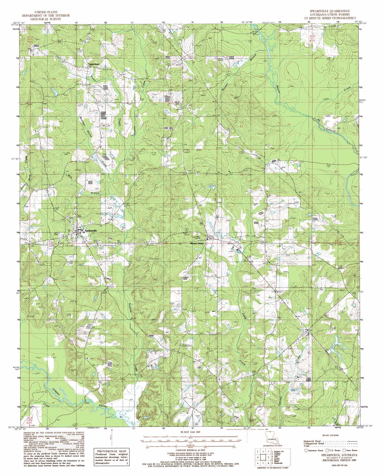
USGS Topo Quad 32092h5 - 1:24,000 scale
| Topo Map Name: | Spearsville |
| USGS Topo Quad ID: | 32092h5 |
| Print Size: | ca. 21 1/4" wide x 27" high |
| Southeast Coordinates: | 32.875° N latitude / 92.5° W longitude |
| Map Center Coordinates: | 32.9375° N latitude / 92.5625° W longitude |
| U.S. State: | LA |
| Filename: | o32092h5.jpg |
| Download Map JPG Image: | Spearsville topo map 1:24,000 scale |
| Map Type: | Topographic |
| Topo Series: | 7.5´ |
| Map Scale: | 1:24,000 |
| Source of Map Images: | United States Geological Survey (USGS) |
| Alternate Map Versions: |
Spearsville LA 1985, updated 1986 Download PDF Buy paper map Spearsville LA 2012 Download PDF Buy paper map Spearsville LA 2015 Download PDF Buy paper map |
1:24,000 Topo Quads surrounding Spearsville
Newell |
El Dorado West |
El Dorado East |
Urbana |
New London |
Wesson |
Junction City |
Lockhart |
Gardner |
Strong |
Summerfield |
Lillie |
Spearsville |
Truxno |
Marion West |
Lisbon |
Bernice |
Shiloh |
Farmerville |
De Loutre |
Lake Foursome |
Dubach |
Cedarton |
Downsville North |
Point |
> Back to 32092e1 at 1:100,000 scale
> Back to 32092a1 at 1:250,000 scale
> Back to U.S. Topo Maps home
Spearsville topo map: Gazetteer
Spearsville: Airports
Peter Creek Ranch Airport elevation 62m 203′Spearsville: Dams
Terral Dam elevation 44m 144′Spearsville: Populated Places
Carroll (historical) elevation 63m 206′Mount Union elevation 61m 200′
Spearsville elevation 58m 190′
Taylortown elevation 63m 206′
Spearsville: Reservoirs
Terral Lake elevation 44m 144′Spearsville: Streams
Dry Creek elevation 27m 88′Lion Creek elevation 37m 121′
Mile Branch elevation 37m 121′
Morgan Branch elevation 39m 127′
Peter Creek elevation 41m 134′
Resinger Hollis Creek elevation 40m 131′
Tenmile Creek elevation 24m 78′
Spearsville digital topo map on disk
Buy this Spearsville topo map showing relief, roads, GPS coordinates and other geographical features, as a high-resolution digital map file on DVD: