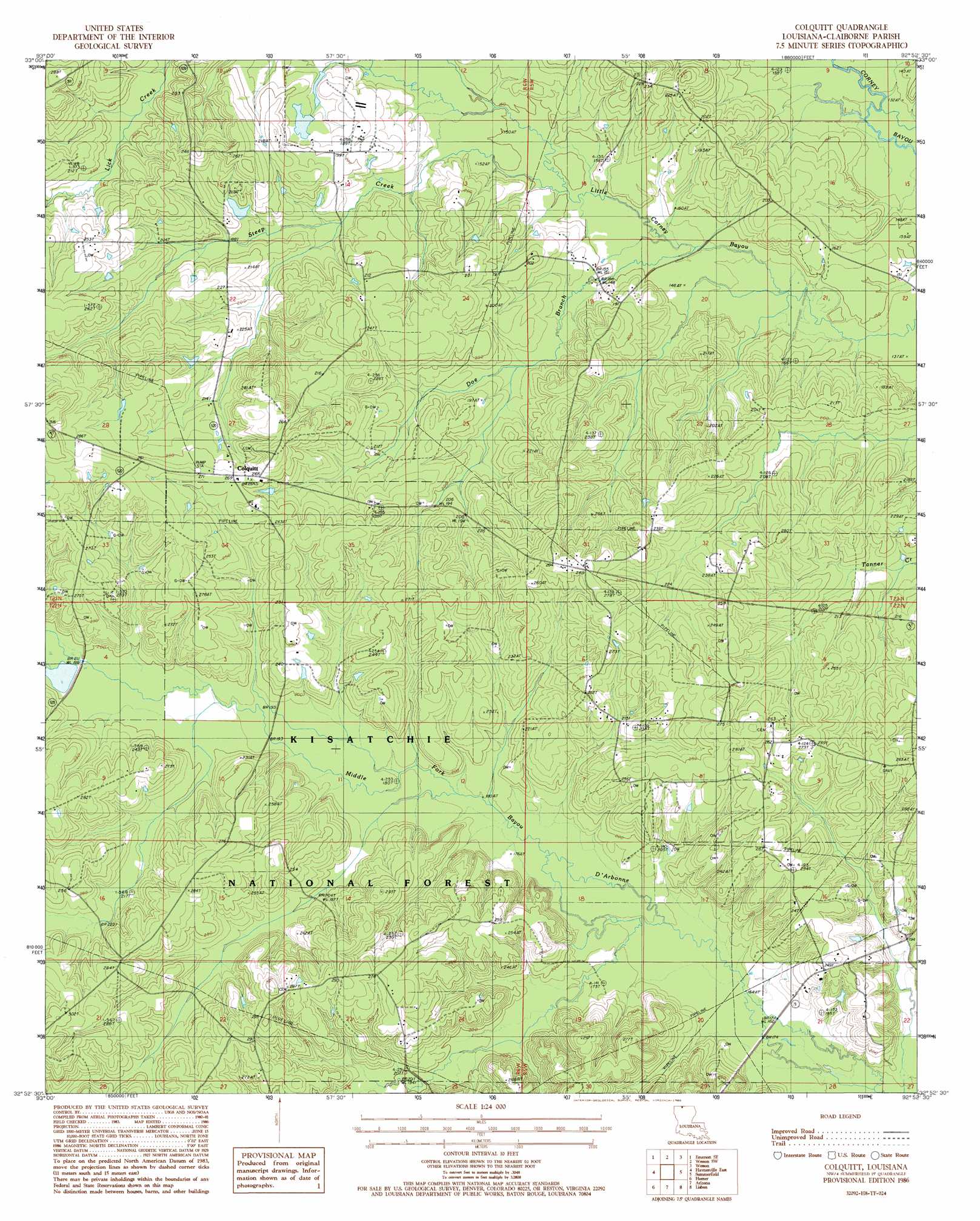
Colquitt Topo Map Louisiana
To zoom in, hover over the map of Colquitt
USGS Topo Quad 32092h8 - 1:24,000 scale
| Topo Map Name: | Colquitt |
| USGS Topo Quad ID: | 32092h8 |
| Print Size: | ca. 21 1/4" wide x 27" high |
| Southeast Coordinates: | 32.875° N latitude / 92.875° W longitude |
| Map Center Coordinates: | 32.9375° N latitude / 92.9375° W longitude |
| U.S. State: | LA |
| Filename: | o32092h8.jpg |
| Download Map JPG Image: | Colquitt topo map 1:24,000 scale |
| Map Type: | Topographic |
| Topo Series: | 7.5´ |
| Map Scale: | 1:24,000 |
| Source of Map Images: | United States Geological Survey (USGS) |
| Alternate Map Versions: |
Colquitt LA 1986, updated 1986 Download PDF Buy paper map Colquitt LA 2003, updated 2005 Download PDF Buy paper map Colquitt LA 2012 Download PDF Buy paper map Colquitt LA 2015 Download PDF Buy paper map |
| FStopo: | US Forest Service topo Colquitt is available: Download FStopo PDF Download FStopo TIF |
1:24,000 Topo Quads surrounding Colquitt
Calhoun |
Spotville |
Marysville |
Newell |
El Dorado West |
Emerson |
Emerson Se |
Wesson Sw |
Wesson |
Junction City |
Haynesville West |
Haynesville East |
Colquitt |
Summerfield |
Lillie |
Blackburn |
Homer |
Arizona |
Lisbon |
Bernice |
Langston |
Athens |
Marsalis |
Lake Foursome |
Dubach |
> Back to 32092e1 at 1:100,000 scale
> Back to 32092a1 at 1:250,000 scale
> Back to U.S. Topo Maps home
Colquitt topo map: Gazetteer
Colquitt: Dams
Speers Pond Dam elevation 54m 177′Colquitt: Oilfields
Antioch Oil and Gas Field elevation 68m 223′Colquitt Oil Field elevation 72m 236′
Mount Sinai Oil Field elevation 77m 252′
Northwest Antioch Gas Field elevation 80m 262′
Summerfield Oil Field elevation 63m 206′
Colquitt: Populated Places
Colquitt elevation 80m 262′Colquitt: Streams
Doe Branch elevation 42m 137′Steep Creek elevation 44m 144′
Tiger Creek elevation 60m 196′
Colquitt digital topo map on disk
Buy this Colquitt topo map showing relief, roads, GPS coordinates and other geographical features, as a high-resolution digital map file on DVD: