Holly Topo Map Louisiana
To zoom in, hover over the map of Holly
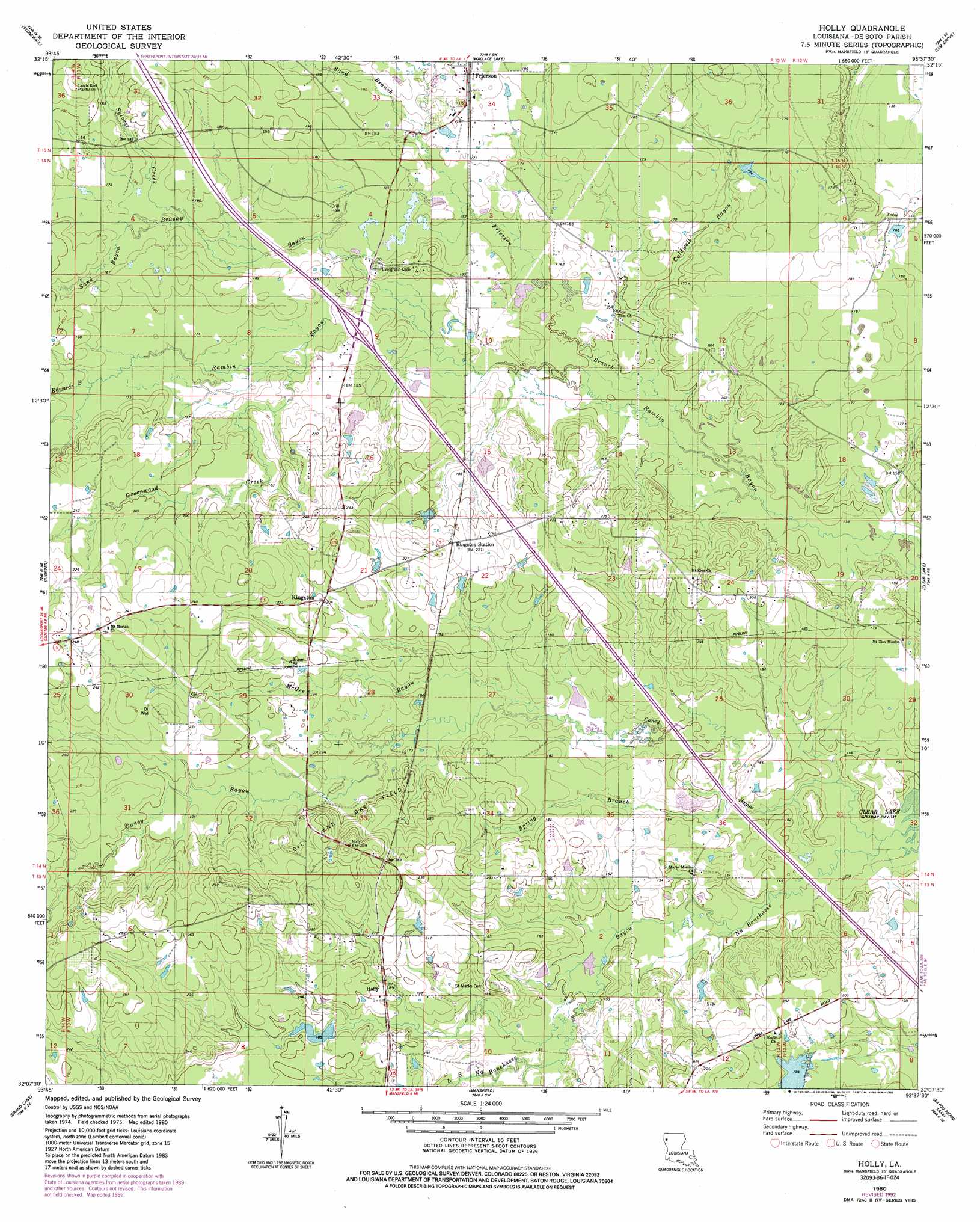
USGS Topo Quad 32093b6 - 1:24,000 scale
| Topo Map Name: | Holly |
| USGS Topo Quad ID: | 32093b6 |
| Print Size: | ca. 21 1/4" wide x 27" high |
| Southeast Coordinates: | 32.125° N latitude / 93.625° W longitude |
| Map Center Coordinates: | 32.1875° N latitude / 93.6875° W longitude |
| U.S. State: | LA |
| Filename: | o32093b6.jpg |
| Download Map JPG Image: | Holly topo map 1:24,000 scale |
| Map Type: | Topographic |
| Topo Series: | 7.5´ |
| Map Scale: | 1:24,000 |
| Source of Map Images: | United States Geological Survey (USGS) |
| Alternate Map Versions: |
Holly LA 1980, updated 1980 Download PDF Buy paper map Holly LA 1980, updated 1982 Download PDF Buy paper map Holly LA 2012 Download PDF Buy paper map Holly LA 2015 Download PDF Buy paper map |
1:24,000 Topo Quads surrounding Holly
Greenwood |
Shreveport West |
Shreveport East |
Sligo |
Koran |
Spring Ridge |
Stonewall |
Wallace Lake |
Elm Grove |
Bossier Point |
Keatchie |
Gloster |
Holly |
Clear Lake |
East Point |
Longstreet |
Grand Cane |
Mansfield |
Bayou Pierre Lake |
Harmon |
Logansport East |
Hunter |
Trenton |
Pelican |
Evelyn |
> Back to 32093a1 at 1:100,000 scale
> Back to 32092a1 at 1:250,000 scale
> Back to U.S. Topo Maps home
Holly topo map: Gazetteer
Holly: Oilfields
Holly Gas and Oil Field elevation 64m 209′North Holly Gas Field elevation 56m 183′
Holly: Populated Places
Holly elevation 58m 190′Kingston elevation 62m 203′
Holly: Post Offices
Frierson Post Office elevation 58m 190′Holly: Streams
Bayou Na Bonchasse elevation 41m 134′Brushy Bayou elevation 48m 157′
Caldwell Bayou elevation 44m 144′
Caney Bayou elevation 41m 134′
Edwards Bayou elevation 54m 177′
Frierson Branch elevation 43m 141′
Greenwood Creek elevation 51m 167′
McGee Bayou elevation 47m 154′
Sand Bayou elevation 53m 173′
Sand Branch elevation 50m 164′
Spring Branch elevation 47m 154′
Sylvest Creek elevation 51m 167′
Holly digital topo map on disk
Buy this Holly topo map showing relief, roads, GPS coordinates and other geographical features, as a high-resolution digital map file on DVD: