Ringgold Topo Map Louisiana
To zoom in, hover over the map of Ringgold
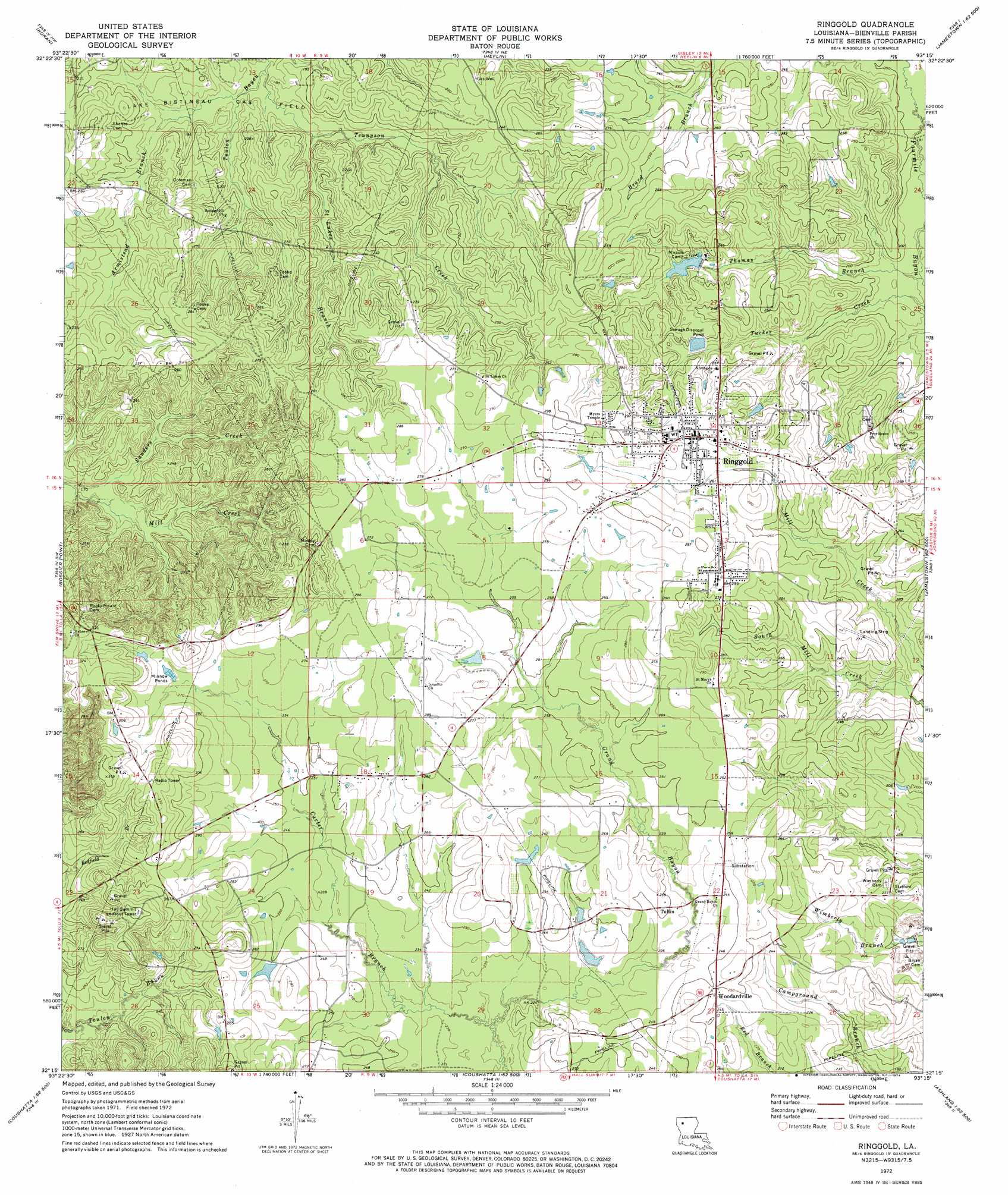
USGS Topo Quad 32093c3 - 1:24,000 scale
| Topo Map Name: | Ringgold |
| USGS Topo Quad ID: | 32093c3 |
| Print Size: | ca. 21 1/4" wide x 27" high |
| Southeast Coordinates: | 32.25° N latitude / 93.25° W longitude |
| Map Center Coordinates: | 32.3125° N latitude / 93.3125° W longitude |
| U.S. State: | LA |
| Filename: | o32093c3.jpg |
| Download Map JPG Image: | Ringgold topo map 1:24,000 scale |
| Map Type: | Topographic |
| Topo Series: | 7.5´ |
| Map Scale: | 1:24,000 |
| Source of Map Images: | United States Geological Survey (USGS) |
| Alternate Map Versions: |
Ringgold LA 1972, updated 1974 Download PDF Buy paper map Ringgold LA 2012 Download PDF Buy paper map Ringgold LA 2015 Download PDF Buy paper map |
1:24,000 Topo Quads surrounding Ringgold
Eastwood |
Doyline |
Minden South |
Ada |
Gibsland |
Sligo |
Koran |
Heflin |
Fryeburg |
Sailes |
Elm Grove |
Bossier Point |
Ringgold |
Jamestown |
Sparta |
Clear Lake |
East Point |
Hall Summit |
Troy |
Ashland |
Bayou Pierre Lake |
Harmon |
Coushatta |
Martin |
Chestnut |
> Back to 32093a1 at 1:100,000 scale
> Back to 32092a1 at 1:250,000 scale
> Back to U.S. Topo Maps home
Ringgold topo map: Gazetteer
Ringgold: Dams
Bible Memory Association Camp Dam elevation 72m 236′Ringgold: Oilfields
Ringgold Gas Field elevation 79m 259′Thomas Branch Gas Field elevation 72m 236′
West Ringgold Gas Field elevation 86m 282′
Woodardville Gas Field elevation 73m 239′
Ringgold: Populated Places
Manning (historical) elevation 84m 275′Ringgold elevation 85m 278′
Tullis elevation 73m 239′
Woodardville elevation 73m 239′
Ringgold: Streams
Armistead Branch elevation 49m 160′Carter Branch elevation 66m 216′
Davis Creek elevation 57m 187′
Fourmile Bayou elevation 55m 180′
Saint Lukes Branch elevation 53m 173′
Tennyson Creek elevation 48m 157′
Thomas Branch elevation 54m 177′
Tucker Creek elevation 55m 180′
Ringgold digital topo map on disk
Buy this Ringgold topo map showing relief, roads, GPS coordinates and other geographical features, as a high-resolution digital map file on DVD: