Fryeburg Topo Map Louisiana
To zoom in, hover over the map of Fryeburg
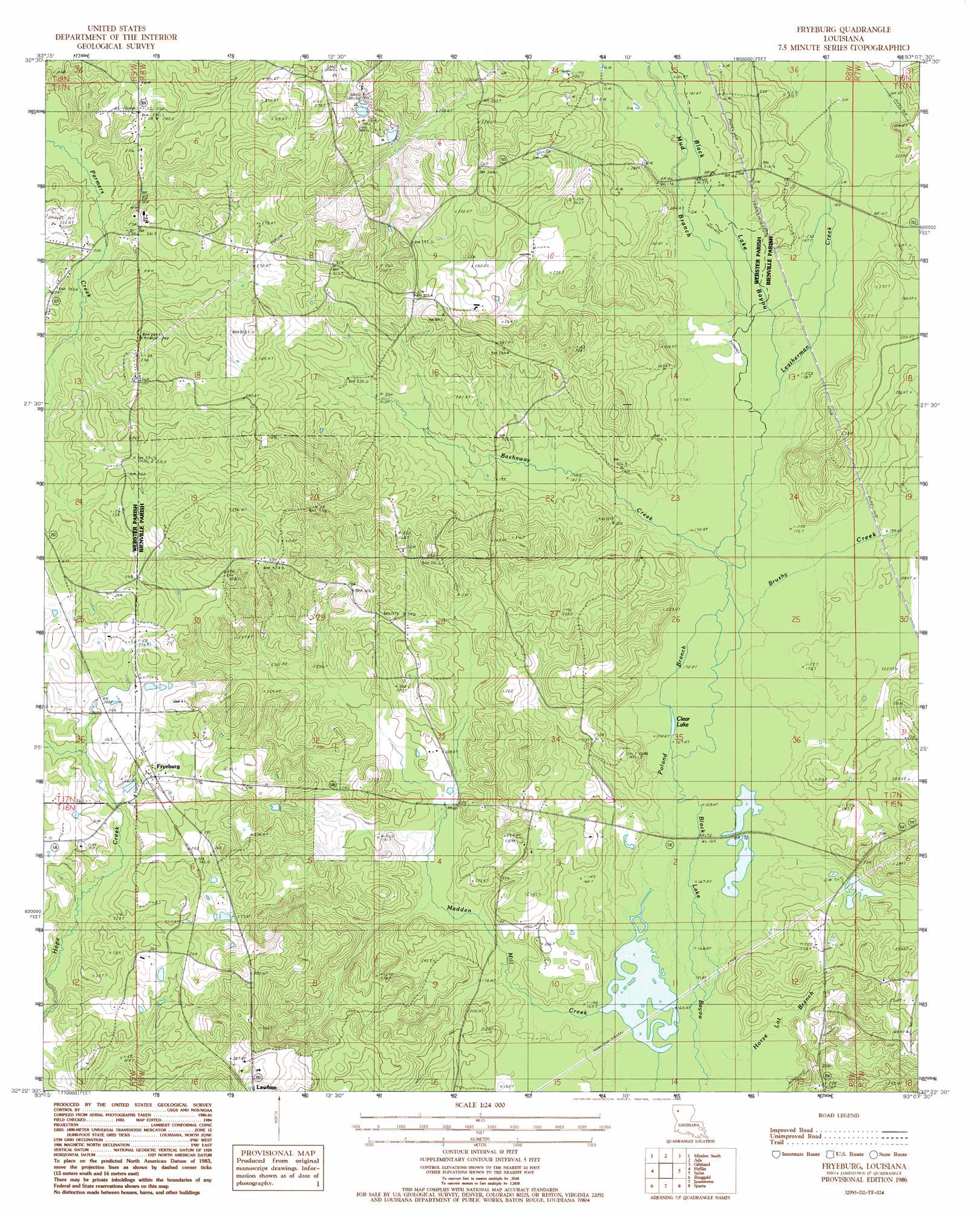
USGS Topo Quad 32093d2 - 1:24,000 scale
| Topo Map Name: | Fryeburg |
| USGS Topo Quad ID: | 32093d2 |
| Print Size: | ca. 21 1/4" wide x 27" high |
| Southeast Coordinates: | 32.375° N latitude / 93.125° W longitude |
| Map Center Coordinates: | 32.4375° N latitude / 93.1875° W longitude |
| U.S. State: | LA |
| Filename: | o32093d2.jpg |
| Download Map JPG Image: | Fryeburg topo map 1:24,000 scale |
| Map Type: | Topographic |
| Topo Series: | 7.5´ |
| Map Scale: | 1:24,000 |
| Source of Map Images: | United States Geological Survey (USGS) |
| Alternate Map Versions: |
Fryeburg LA 1986, updated 1986 Download PDF Buy paper map Fryeburg LA 2012 Download PDF Buy paper map Fryeburg LA 2015 Download PDF Buy paper map |
1:24,000 Topo Quads surrounding Fryeburg
Hortman |
Minden North |
Langston |
Athens |
Marsalis |
Doyline |
Minden South |
Ada |
Gibsland |
Arcadia |
Koran |
Heflin |
Fryeburg |
Sailes |
Bryceland |
Bossier Point |
Ringgold |
Jamestown |
Sparta |
Bienville |
East Point |
Hall Summit |
Troy |
Ashland |
Saline |
> Back to 32093a1 at 1:100,000 scale
> Back to 32092a1 at 1:250,000 scale
> Back to U.S. Topo Maps home
Fryeburg topo map: Gazetteer
Fryeburg: Airports
Charlie Airport elevation 82m 269′Fryeburg: Lakes
Clear Lake elevation 50m 164′Fryeburg: Oilfields
Ada Oil and Gas Field elevation 55m 180′Jamestown Gas Field elevation 73m 239′
Fryeburg: Populated Places
Fryeburg elevation 79m 259′Lawhon elevation 80m 262′
Fryeburg: Streams
Bashaway Creek elevation 51m 167′Brushy Creek elevation 51m 167′
Horse Lot Branch elevation 48m 157′
Leatherman Creek elevation 51m 167′
Mud Branch elevation 53m 173′
Poland Branch elevation 50m 164′
Fryeburg digital topo map on disk
Buy this Fryeburg topo map showing relief, roads, GPS coordinates and other geographical features, as a high-resolution digital map file on DVD: