Koran Topo Map Louisiana
To zoom in, hover over the map of Koran
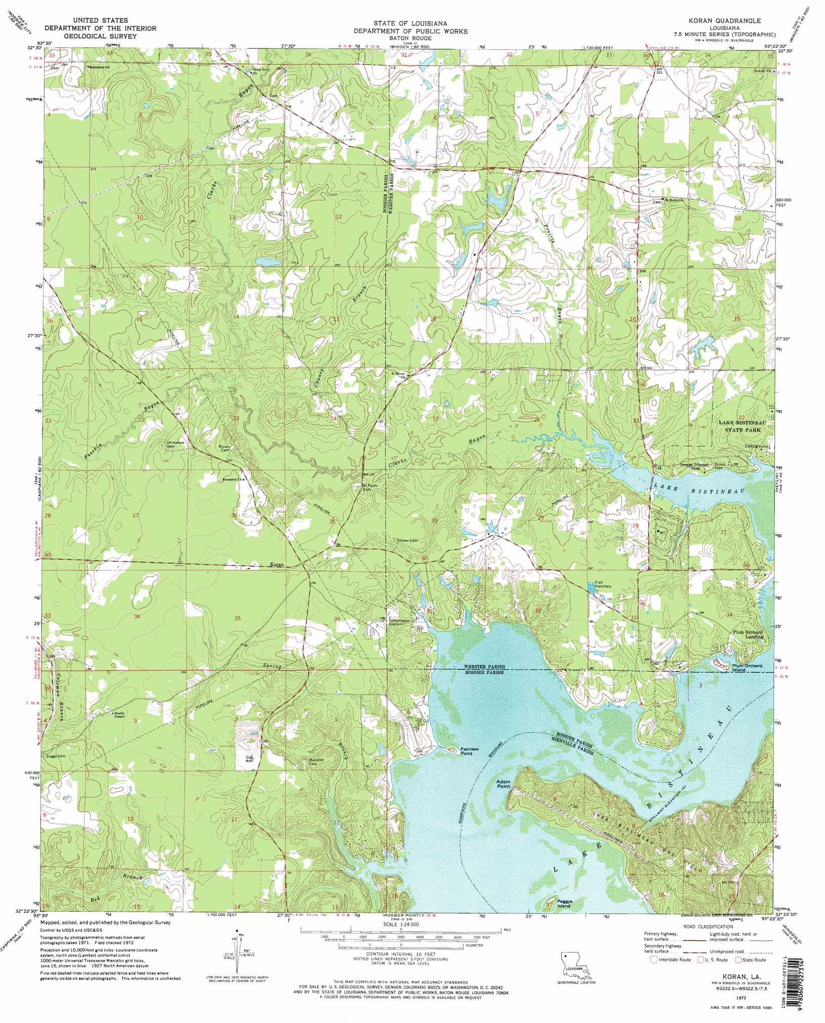
USGS Topo Quad 32093d4 - 1:24,000 scale
| Topo Map Name: | Koran |
| USGS Topo Quad ID: | 32093d4 |
| Print Size: | ca. 21 1/4" wide x 27" high |
| Southeast Coordinates: | 32.375° N latitude / 93.375° W longitude |
| Map Center Coordinates: | 32.4375° N latitude / 93.4375° W longitude |
| U.S. State: | LA |
| Filename: | o32093d4.jpg |
| Download Map JPG Image: | Koran topo map 1:24,000 scale |
| Map Type: | Topographic |
| Topo Series: | 7.5´ |
| Map Scale: | 1:24,000 |
| Source of Map Images: | United States Geological Survey (USGS) |
| Alternate Map Versions: |
Koran LA 1972, updated 1973 Download PDF Buy paper map Koran LA 1972, updated 1973 Download PDF Buy paper map Koran LA 2012 Download PDF Buy paper map Koran LA 2015 Download PDF Buy paper map |
1:24,000 Topo Quads surrounding Koran
Benton |
Bodcau Lake |
Hortman |
Minden North |
Langston |
Bossier City |
Eastwood |
Doyline |
Minden South |
Ada |
Shreveport East |
Sligo |
Koran |
Heflin |
Fryeburg |
Wallace Lake |
Elm Grove |
Bossier Point |
Ringgold |
Jamestown |
Holly |
Clear Lake |
East Point |
Hall Summit |
Troy |
> Back to 32093a1 at 1:100,000 scale
> Back to 32092a1 at 1:250,000 scale
> Back to U.S. Topo Maps home
Koran topo map: Gazetteer
Koran: Capes
Adam Point elevation 51m 167′Fairview Point elevation 44m 144′
Koran: Cliffs
Pine Bluff elevation 53m 173′Koran: Dams
McDowell Pond Dam elevation 65m 213′Shirley Willis Pond Dam elevation 59m 193′
Koran: Islands
Peggys Island elevation 45m 147′Plum Orchard Island elevation 45m 147′
Koran: Parks
Lake Bistineau State Park elevation 48m 157′Koran: Populated Places
Koran elevation 58m 190′Plum Orchard Landing elevation 46m 150′
Koran: Streams
Chaney Branch elevation 45m 147′Clarke Bayou elevation 43m 141′
Foxskin Bayou elevation 46m 150′
Prairie Bayou elevation 43m 141′
Spring Branch elevation 43m 141′
Koran digital topo map on disk
Buy this Koran topo map showing relief, roads, GPS coordinates and other geographical features, as a high-resolution digital map file on DVD: