Hughes Topo Map Louisiana
To zoom in, hover over the map of Hughes
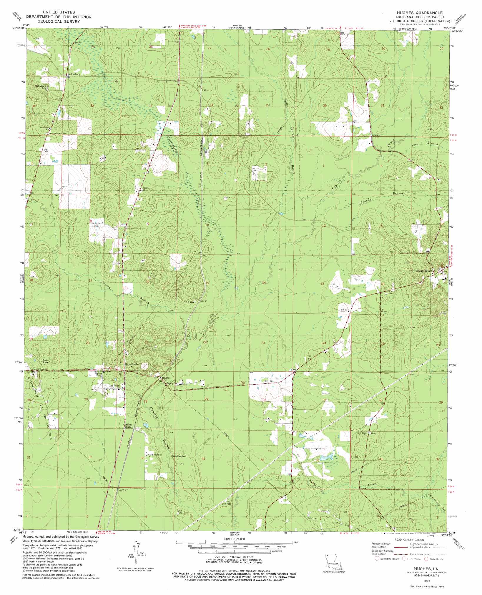
USGS Topo Quad 32093g6 - 1:24,000 scale
| Topo Map Name: | Hughes |
| USGS Topo Quad ID: | 32093g6 |
| Print Size: | ca. 21 1/4" wide x 27" high |
| Southeast Coordinates: | 32.75° N latitude / 93.625° W longitude |
| Map Center Coordinates: | 32.8125° N latitude / 93.6875° W longitude |
| U.S. State: | LA |
| Filename: | o32093g6.jpg |
| Download Map JPG Image: | Hughes topo map 1:24,000 scale |
| Map Type: | Topographic |
| Topo Series: | 7.5´ |
| Map Scale: | 1:24,000 |
| Source of Map Images: | United States Geological Survey (USGS) |
| Alternate Map Versions: |
Hughes LA 1981, updated 1981 Download PDF Buy paper map Hughes LA 2012 Download PDF Buy paper map Hughes LA 2015 Download PDF Buy paper map |
1:24,000 Topo Quads surrounding Hughes
Doddridge |
Doddridge Se |
Bradley |
Bradley Se |
Taylor |
Vivian North |
Wardview |
Plain Dealing |
Carterville |
Cullen |
Vivian South |
Gilliam |
Hughes |
Ivan |
Cotton Valley |
Mooringsport |
Dixie |
Benton |
Bodcau Lake |
Hortman |
Blanchard |
North Highlands |
Bossier City |
Eastwood |
Doyline |
> Back to 32093e1 at 1:100,000 scale
> Back to 32092a1 at 1:250,000 scale
> Back to U.S. Topo Maps home
Hughes topo map: Gazetteer
Hughes: Oilfields
Collinsburg Oil Field elevation 88m 288′Hughes: Populated Places
Alden Bridge elevation 67m 219′Collinsburg elevation 80m 262′
Hughes elevation 63m 206′
Rocky Mount elevation 124m 406′
Swindleville elevation 78m 255′
Hughes: Streams
Bounds Branch elevation 65m 213′Brushy Branch elevation 61m 200′
Collinsburg Creek elevation 62m 203′
Crossway Slu elevation 66m 216′
Flat Branch elevation 68m 223′
Little Cypress Bayou elevation 63m 206′
Hughes digital topo map on disk
Buy this Hughes topo map showing relief, roads, GPS coordinates and other geographical features, as a high-resolution digital map file on DVD: