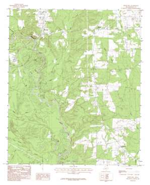
River Hill Topo Map Texas
To zoom in, hover over the map of River Hill
USGS Topo Quad 32094b2 - 1:24,000 scale
| Topo Map Name: | River Hill |
| USGS Topo Quad ID: | 32094b2 |
| Print Size: | ca. 21 1/4" wide x 27" high |
| Southeast Coordinates: | 32.125° N latitude / 94.125° W longitude |
| Map Center Coordinates: | 32.1875° N latitude / 94.1875° W longitude |
| U.S. State: | TX |
| Filename: | o32094b2.jpg |
| Download Map JPG Image: | River Hill topo map 1:24,000 scale |
| Map Type: | Topographic |
| Topo Series: | 7.5´ |
| Map Scale: | 1:24,000 |
| Source of Map Images: | United States Geological Survey (USGS) |
| Alternate Map Versions: |
River Hill TX 1983, updated 1983 Download PDF Buy paper map River Hill TX 2010 Download PDF Buy paper map River Hill TX 2013 Download PDF Buy paper map River Hill TX 2016 Download PDF Buy paper map |
1:24,000 Topo Quads surrounding River Hill
> Back to 32094a1 at 1:100,000 scale
> Back to 32094a1 at 1:250,000 scale
> Back to U.S. Topo Maps home
River Hill topo map: Gazetteer
River Hill: Dams
Alexander Lake Dam elevation 79m 259′Hickey Lake Dam elevation 89m 291′
River Hill: Lakes
Fish Lake elevation 60m 196′Hill Lake elevation 57m 187′
River Hill: Oilfields
Carthage Gas Field elevation 58m 190′River Hill: Populated Places
Deadwood elevation 81m 265′Midyett elevation 96m 314′
River Hill elevation 93m 305′
River Hill: Reservoirs
Alexander Lake elevation 79m 259′River Hill: Streams
Dark Slough elevation 60m 196′Fish Lake Slough elevation 58m 190′
Gum Slough elevation 61m 200′
Hog Bayou elevation 59m 193′
Hoggs Bayou elevation 58m 190′
Jackson Creek elevation 58m 190′
Mill Creek elevation 58m 190′
River Hill digital topo map on disk
Buy this River Hill topo map showing relief, roads, GPS coordinates and other geographical features, as a high-resolution digital map file on DVD:


