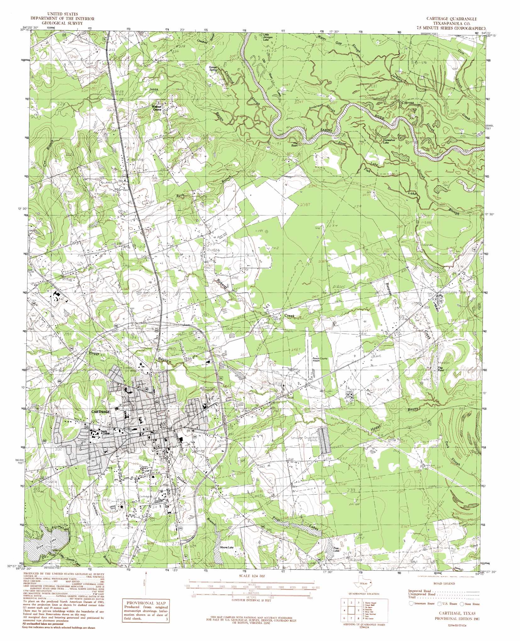
Carthage Topo Map Texas
To zoom in, hover over the map of Carthage
USGS Topo Quad 32094b3 - 1:24,000 scale
| Topo Map Name: | Carthage |
| USGS Topo Quad ID: | 32094b3 |
| Print Size: | ca. 21 1/4" wide x 27" high |
| Southeast Coordinates: | 32.125° N latitude / 94.25° W longitude |
| Map Center Coordinates: | 32.1875° N latitude / 94.3125° W longitude |
| U.S. State: | TX |
| Filename: | o32094b3.jpg |
| Download Map JPG Image: | Carthage topo map 1:24,000 scale |
| Map Type: | Topographic |
| Topo Series: | 7.5´ |
| Map Scale: | 1:24,000 |
| Source of Map Images: | United States Geological Survey (USGS) |
| Alternate Map Versions: |
Carthage TX 1983, updated 1983 Download PDF Buy paper map Carthage TX 2010 Download PDF Buy paper map Carthage TX 2013 Download PDF Buy paper map Carthage TX 2016 Download PDF Buy paper map |
1:24,000 Topo Quads surrounding Carthage
Easton |
Darco |
Colliers Creek |
Stricklin Springs |
Waskom |
Tatum |
Harris Chapel |
Grand Bluff |
De Berry |
Panola |
Fair Play |
Beckville |
Carthage |
River Hill |
Old Panola |
Long Branch |
Lake Murvaul |
Gary |
Old Center |
Galloway |
Caledonia |
Timpson |
Tenaha West |
Tenaha East |
Logansport West |
> Back to 32094a1 at 1:100,000 scale
> Back to 32094a1 at 1:250,000 scale
> Back to U.S. Topo Maps home
Carthage topo map: Gazetteer
Carthage: Airports
Panola County Airport elevation 74m 242′Panola County-Sharpe Field elevation 74m 242′
Panola General Hospital Heliport elevation 90m 295′
Carthage: Dams
Dixie Lake Dam elevation 81m 265′Moore Lake Dam elevation 78m 255′
Poss Lake Dam elevation 71m 232′
Prior Lake Number 1 Dam elevation 82m 269′
Prior Lake Number 2 Dam elevation 79m 259′
Carthage: Guts
Anderson Slough elevation 64m 209′Cypress Slough elevation 61m 200′
Carthage: Lakes
Horseshoe Lake elevation 61m 200′Moore Lake elevation 71m 232′
Old River Lakes elevation 62m 203′
Prior Lake elevation 77m 252′
The Basin elevation 62m 203′
Carthage: Parks
Davis Park elevation 91m 298′Carthage: Populated Places
Carthage elevation 95m 311′Hudson Mast elevation 72m 236′
Walnut Grove elevation 81m 265′
Carthage: Reservoirs
Dixie Lake elevation 79m 259′Moore Lake elevation 78m 255′
Moore Lake elevation 77m 252′
Poss Lake elevation 71m 232′
Prior Lake Number 1 elevation 82m 269′
Prior Lake Number 2 elevation 79m 259′
Carthage: Springs
Garner Spring elevation 61m 200′Carthage: Streams
Bean Lake Slough elevation 61m 200′Buck Branch elevation 61m 200′
Cox Branch elevation 67m 219′
Crawford Slough elevation 61m 200′
Irons Bayou elevation 60m 196′
Little Sixmile Creek elevation 81m 265′
Respass Creek elevation 61m 200′
Roberts Creek elevation 66m 216′
Water Gap Slough elevation 61m 200′
Carthage: Swamps
Flag Pond elevation 62m 203′Carthage digital topo map on disk
Buy this Carthage topo map showing relief, roads, GPS coordinates and other geographical features, as a high-resolution digital map file on DVD: