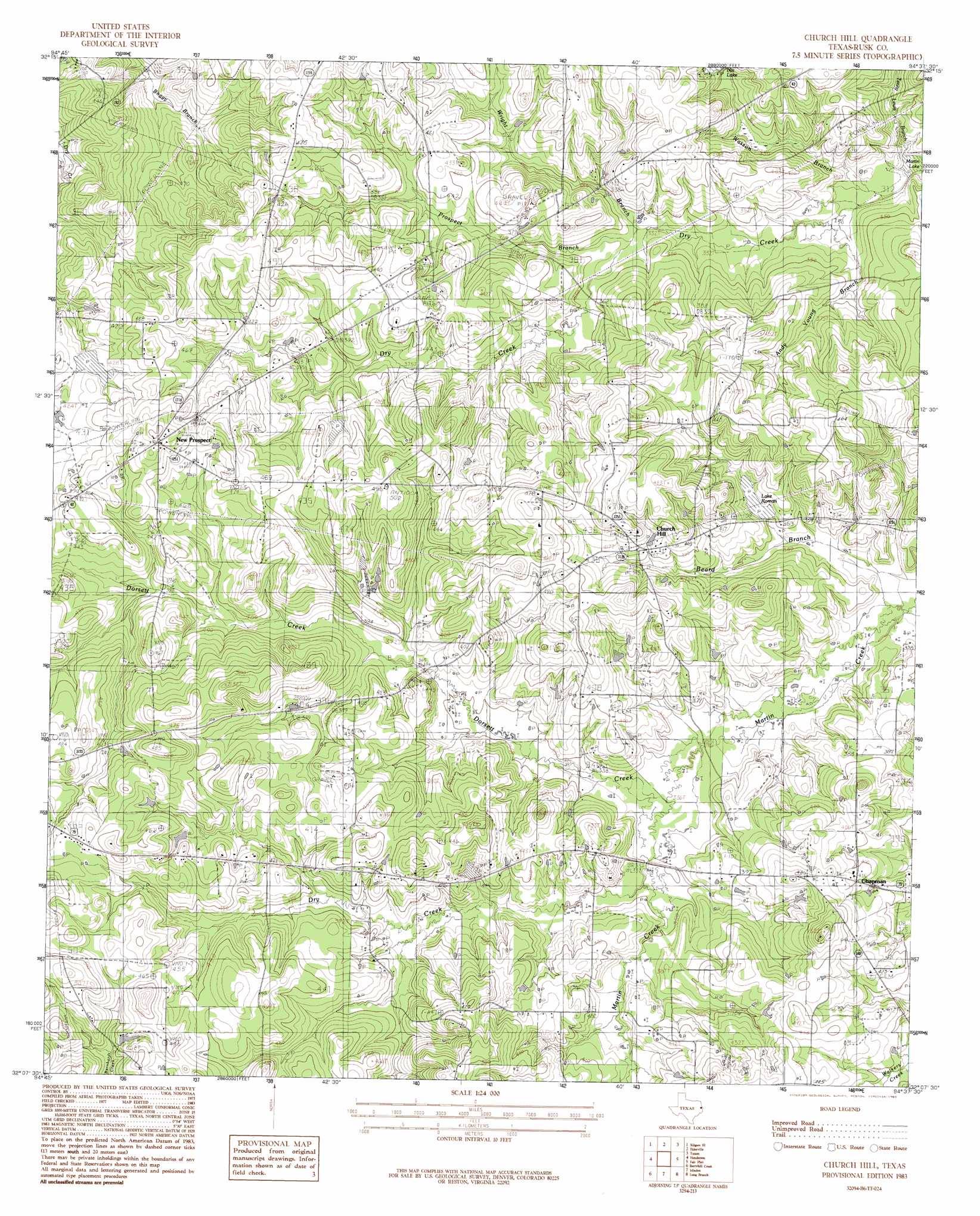
Church Hill Topo Map Texas
To zoom in, hover over the map of Church Hill
USGS Topo Quad 32094b6 - 1:24,000 scale
| Topo Map Name: | Church Hill |
| USGS Topo Quad ID: | 32094b6 |
| Print Size: | ca. 21 1/4" wide x 27" high |
| Southeast Coordinates: | 32.125° N latitude / 94.625° W longitude |
| Map Center Coordinates: | 32.1875° N latitude / 94.6875° W longitude |
| U.S. State: | TX |
| Filename: | o32094b6.jpg |
| Download Map JPG Image: | Church Hill topo map 1:24,000 scale |
| Map Type: | Topographic |
| Topo Series: | 7.5´ |
| Map Scale: | 1:24,000 |
| Source of Map Images: | United States Geological Survey (USGS) |
| Alternate Map Versions: |
Church Hill TX 1983, updated 1983 Download PDF Buy paper map Church Hill TX 2010 Download PDF Buy paper map Church Hill TX 2013 Download PDF Buy paper map Church Hill TX 2016 Download PDF Buy paper map |
1:24,000 Topo Quads surrounding Church Hill
Kilgore Nw |
Kilgore Ne |
Lakeport |
Easton |
Darco |
Kilgore Sw |
Kilgore Se |
Elderville |
Tatum |
Harris Chapel |
Price |
Henderson |
Church Hill |
Fair Play |
Beckville |
Gum Springs |
Berryhill Creek |
Minden |
Long Branch |
Lake Murvaul |
New Salem |
Laneville |
Mount Enterprise |
Caledonia |
Timpson |
> Back to 32094a1 at 1:100,000 scale
> Back to 32094a1 at 1:250,000 scale
> Back to U.S. Topo Maps home
Church Hill topo map: Gazetteer
Church Hill: Dams
Roman Lake Dam elevation 110m 360′Shaw Lake Dam elevation 131m 429′
Swiley Lake Dam elevation 113m 370′
T P Cannon Lake Dam elevation 130m 426′
Church Hill: Lakes
Nix Lake elevation 114m 374′Church Hill: Populated Places
Chapman elevation 126m 413′Church Hill elevation 127m 416′
New Prospect elevation 143m 469′
Church Hill: Reservoirs
Lake Roman elevation 106m 347′Roman Lake elevation 110m 360′
Shaw Lake elevation 131m 429′
Swiley Lake elevation 113m 370′
T P Cannon Lake elevation 130m 426′
Church Hill: Streams
Andy Young Branch elevation 97m 318′Dorsett Creek elevation 102m 334′
Dry Creek elevation 104m 341′
Prospect Branch elevation 102m 334′
Tenny Lewis Branch elevation 94m 308′
Wright Branch elevation 101m 331′
Church Hill digital topo map on disk
Buy this Church Hill topo map showing relief, roads, GPS coordinates and other geographical features, as a high-resolution digital map file on DVD: