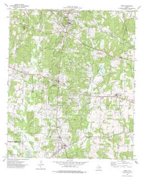
Price Topo Map Texas
To zoom in, hover over the map of Price
USGS Topo Quad 32094b8 - 1:24,000 scale
| Topo Map Name: | Price |
| USGS Topo Quad ID: | 32094b8 |
| Print Size: | ca. 21 1/4" wide x 27" high |
| Southeast Coordinates: | 32.125° N latitude / 94.875° W longitude |
| Map Center Coordinates: | 32.1875° N latitude / 94.9375° W longitude |
| U.S. State: | TX |
| Filename: | o32094b8.jpg |
| Download Map JPG Image: | Price topo map 1:24,000 scale |
| Map Type: | Topographic |
| Topo Series: | 7.5´ |
| Map Scale: | 1:24,000 |
| Source of Map Images: | United States Geological Survey (USGS) |
| Alternate Map Versions: |
Price TX 1973, updated 1977 Download PDF Buy paper map Price TX 2010 Download PDF Buy paper map Price TX 2013 Download PDF Buy paper map Price TX 2016 Download PDF Buy paper map |
1:24,000 Topo Quads surrounding Price
> Back to 32094a1 at 1:100,000 scale
> Back to 32094a1 at 1:250,000 scale
> Back to U.S. Topo Maps home
Price topo map: Gazetteer
Price: Dams
Miller Lake Dam elevation 126m 413′Price: Parks
Holt Stadium elevation 170m 557′Price: Populated Places
Friars elevation 153m 501′Joinerville elevation 135m 442′
London elevation 165m 541′
New London elevation 168m 551′
Old London elevation 155m 508′
Price elevation 108m 354′
Selman City elevation 124m 406′
Turnertown elevation 139m 456′
Wright City elevation 128m 419′
Price: Post Offices
Selman City Post Office elevation 139m 456′Price: Reservoirs
Miller Lake elevation 125m 410′Price: Streams
Allan Branch elevation 113m 370′Cooper Creek elevation 115m 377′
Denton Creek elevation 100m 328′
Henson Creek elevation 103m 337′
Horsepen Branch elevation 98m 321′
Horton Creek elevation 104m 341′
McNeil Creek elevation 97m 318′
Wright Branch elevation 107m 351′
Price: Swamps
Round Pond elevation 113m 370′Price digital topo map on disk
Buy this Price topo map showing relief, roads, GPS coordinates and other geographical features, as a high-resolution digital map file on DVD:


