Longview Heights Topo Map Texas
To zoom in, hover over the map of Longview Heights
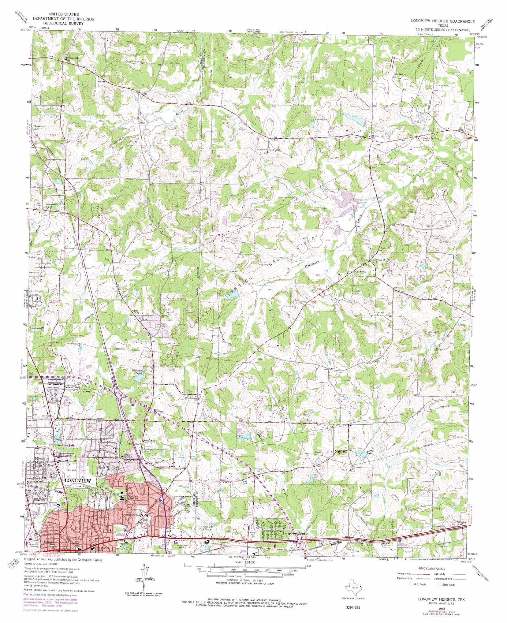
USGS Topo Quad 32094e6 - 1:24,000 scale
| Topo Map Name: | Longview Heights |
| USGS Topo Quad ID: | 32094e6 |
| Print Size: | ca. 21 1/4" wide x 27" high |
| Southeast Coordinates: | 32.5° N latitude / 94.625° W longitude |
| Map Center Coordinates: | 32.5625° N latitude / 94.6875° W longitude |
| U.S. State: | TX |
| Filename: | o32094e6.jpg |
| Download Map JPG Image: | Longview Heights topo map 1:24,000 scale |
| Map Type: | Topographic |
| Topo Series: | 7.5´ |
| Map Scale: | 1:24,000 |
| Source of Map Images: | United States Geological Survey (USGS) |
| Alternate Map Versions: |
Longview Heights TX 1962, updated 1964 Download PDF Buy paper map Longview Heights TX 1962, updated 1978 Download PDF Buy paper map Longview Heights TX 1962, updated 1978 Download PDF Buy paper map Longview Heights TX 2010 Download PDF Buy paper map Longview Heights TX 2013 Download PDF Buy paper map Longview Heights TX 2016 Download PDF Buy paper map |
1:24,000 Topo Quads surrounding Longview Heights
Bettie |
Coffeeville |
Ore City |
Lassater |
Kellyville |
Gilmer |
Glenwood |
Ashland |
Harleton |
Marshall Nw |
Gladewater |
White Oak |
Longview Heights |
Hallsville |
Marshall West |
Kilgore Nw |
Kilgore Ne |
Lakeport |
Easton |
Darco |
Kilgore Sw |
Kilgore Se |
Elderville |
Tatum |
Harris Chapel |
> Back to 32094e1 at 1:100,000 scale
> Back to 32094a1 at 1:250,000 scale
> Back to U.S. Topo Maps home
Longview Heights topo map: Gazetteer
Longview Heights: Airports
East Side Airport elevation 114m 374′Longview Heights: Dams
Clements Dam Number 1 elevation 83m 272′Clements Dam Number 4 elevation 87m 285′
Franklin Lake Dam elevation 93m 305′
Williams Lake Dam elevation 120m 393′
Longview Heights: Oilfields
North Lansing Gas Field elevation 111m 364′Longview Heights: Parks
Akin Park elevation 94m 308′Guthrie Park elevation 93m 305′
Ingram Park elevation 102m 334′
Lobo Stadium elevation 115m 377′
Patterson Park elevation 110m 360′
Teague Park elevation 108m 354′
Longview Heights: Populated Places
Lansing elevation 124m 406′Longview elevation 113m 370′
Longview Heights elevation 113m 370′
Longview Heights: Reservoirs
Clement Lake Number 1 elevation 83m 272′Clements Lake Number 4 elevation 87m 285′
Franklin Lake elevation 93m 305′
Johnston Lake elevation 101m 331′
Little Lake elevation 106m 347′
Whitehurst Lake elevation 112m 367′
Williams Lake elevation 120m 393′
Williams Lakes elevation 119m 390′
Longview Heights digital topo map on disk
Buy this Longview Heights topo map showing relief, roads, GPS coordinates and other geographical features, as a high-resolution digital map file on DVD: