Woodlawn Topo Map Texas
To zoom in, hover over the map of Woodlawn
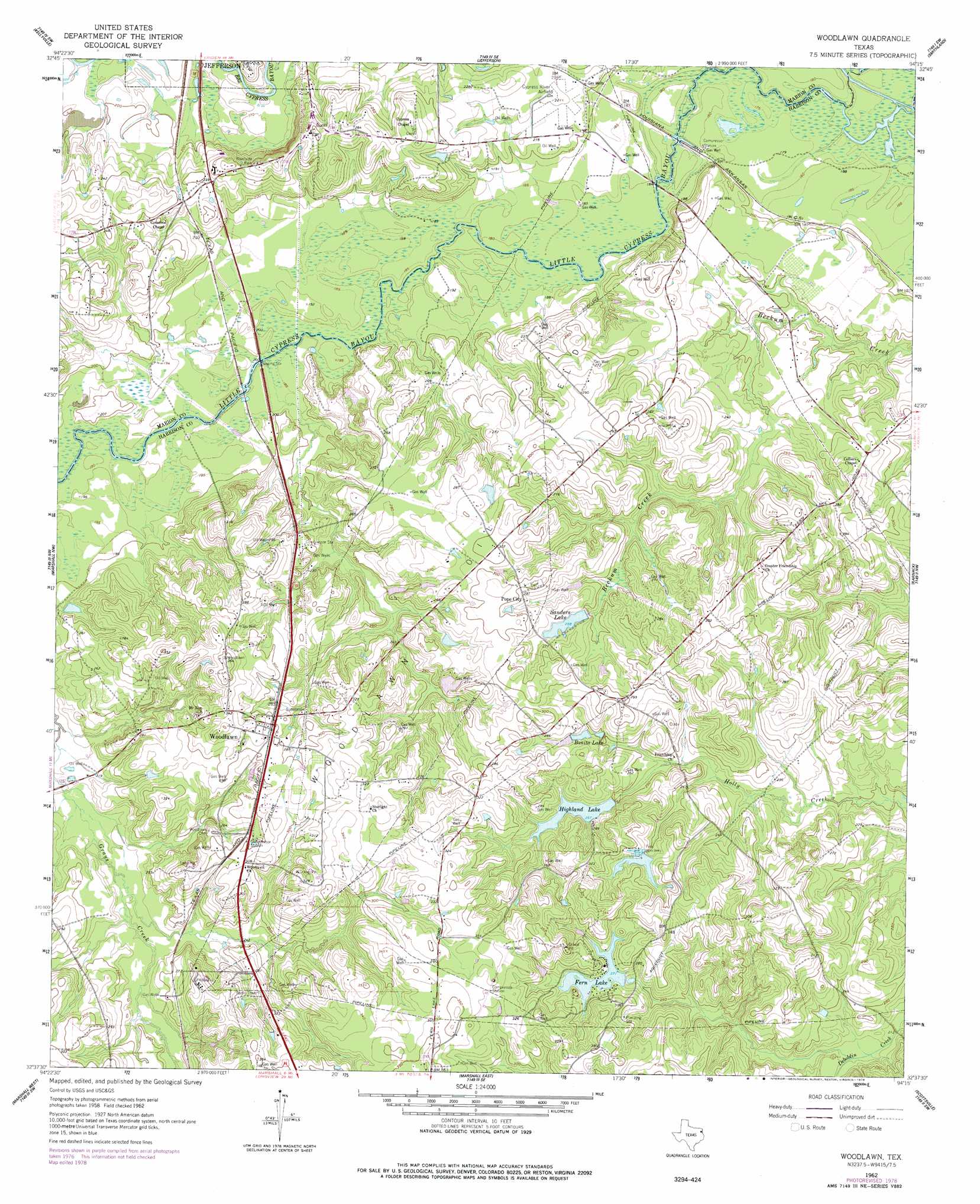
USGS Topo Quad 32094f3 - 1:24,000 scale
| Topo Map Name: | Woodlawn |
| USGS Topo Quad ID: | 32094f3 |
| Print Size: | ca. 21 1/4" wide x 27" high |
| Southeast Coordinates: | 32.625° N latitude / 94.25° W longitude |
| Map Center Coordinates: | 32.6875° N latitude / 94.3125° W longitude |
| U.S. State: | TX |
| Filename: | o32094f3.jpg |
| Download Map JPG Image: | Woodlawn topo map 1:24,000 scale |
| Map Type: | Topographic |
| Topo Series: | 7.5´ |
| Map Scale: | 1:24,000 |
| Source of Map Images: | United States Geological Survey (USGS) |
| Alternate Map Versions: |
Woodlawn TX 1962, updated 1963 Download PDF Buy paper map Woodlawn TX 1962, updated 1975 Download PDF Buy paper map Woodlawn TX 1962, updated 1978 Download PDF Buy paper map Woodlawn TX 2010 Download PDF Buy paper map Woodlawn TX 2013 Download PDF Buy paper map Woodlawn TX 2016 Download PDF Buy paper map |
1:24,000 Topo Quads surrounding Woodlawn
Avinger |
Cunningham Creek |
Lanier |
Kildare |
Mcleod |
Lassater |
Kellyville |
Jefferson |
Smithland |
Trees |
Harleton |
Marshall Nw |
Woodlawn |
Karnack |
Potters Point |
Hallsville |
Marshall West |
Marshall East |
Scottsville |
Latex |
Easton |
Darco |
Colliers Creek |
Stricklin Springs |
Waskom |
> Back to 32094e1 at 1:100,000 scale
> Back to 32094a1 at 1:250,000 scale
> Back to U.S. Topo Maps home
Woodlawn topo map: Gazetteer
Woodlawn: Airports
Cypress River Airport elevation 67m 219′Woodlawn: Dams
Highland Lake Dam elevation 90m 295′Lake Fern Dam elevation 88m 288′
Lake Margret Dam elevation 84m 275′
Sanders Lake Dam elevation 80m 262′
Woodlawn: Oilfields
Woodlawn Oil Field elevation 85m 278′Woodlawn: Populated Places
Pope City elevation 89m 291′Woodlawn elevation 98m 321′
Woodlawn: Reservoirs
Bonita Lake elevation 78m 255′Fern Lake elevation 81m 265′
Highland Lake elevation 79m 259′
Lake Fern Reservoir elevation 88m 288′
Lake Margret elevation 84m 275′
Sanders Lake elevation 78m 255′
Woodlawn digital topo map on disk
Buy this Woodlawn topo map showing relief, roads, GPS coordinates and other geographical features, as a high-resolution digital map file on DVD: