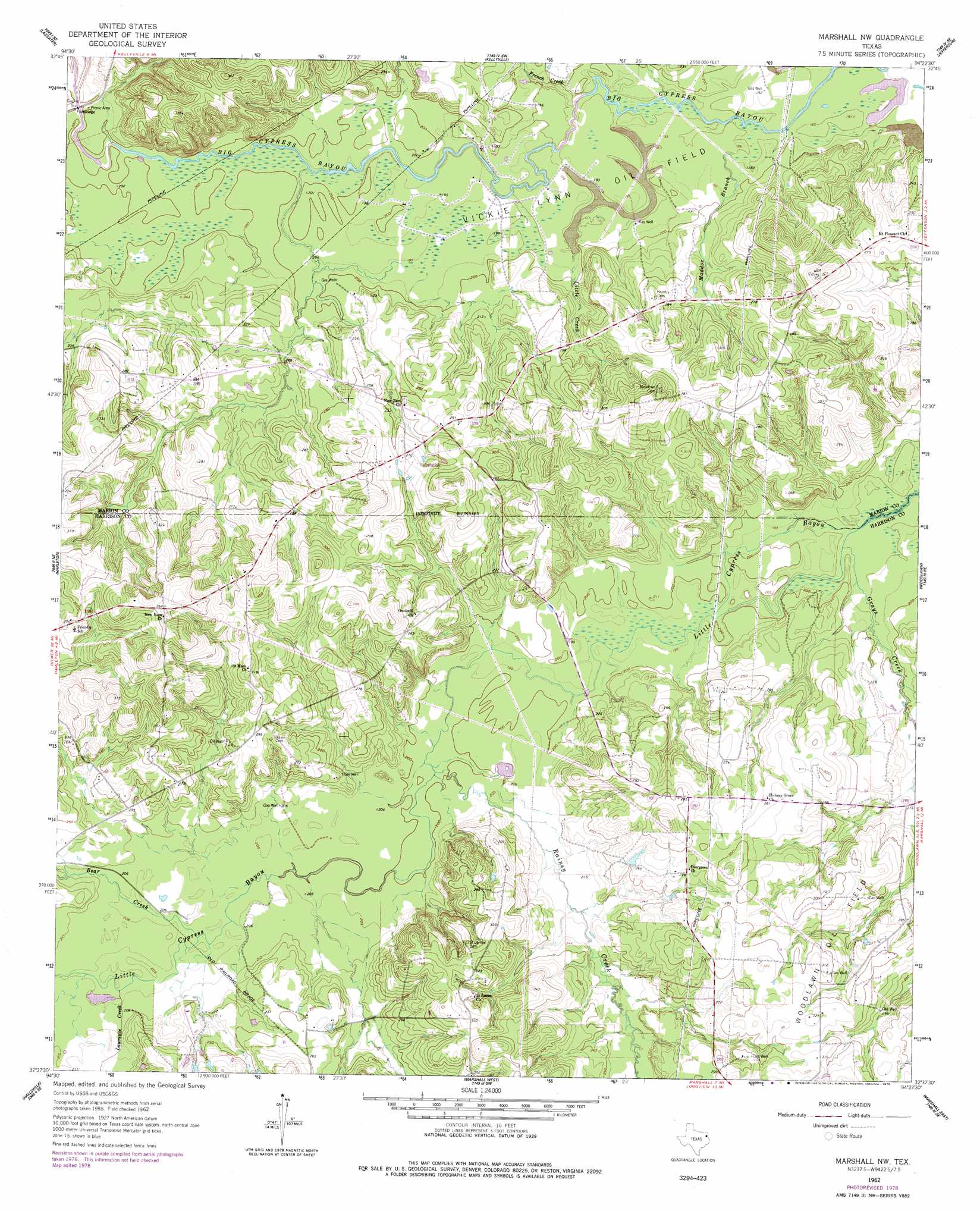
Marshall Nw Topo Map Texas
To zoom in, hover over the map of Marshall Nw
USGS Topo Quad 32094f4 - 1:24,000 scale
| Topo Map Name: | Marshall Nw |
| USGS Topo Quad ID: | 32094f4 |
| Print Size: | ca. 21 1/4" wide x 27" high |
| Southeast Coordinates: | 32.625° N latitude / 94.375° W longitude |
| Map Center Coordinates: | 32.6875° N latitude / 94.4375° W longitude |
| U.S. State: | TX |
| Filename: | o32094f4.jpg |
| Download Map JPG Image: | Marshall Nw topo map 1:24,000 scale |
| Map Type: | Topographic |
| Topo Series: | 7.5´ |
| Map Scale: | 1:24,000 |
| Source of Map Images: | United States Geological Survey (USGS) |
| Alternate Map Versions: |
Marshall NW TX 1962, updated 1963 Download PDF Buy paper map Marshall NW TX 1962, updated 1978 Download PDF Buy paper map Marshall NW TX 2010 Download PDF Buy paper map Marshall NW TX 2013 Download PDF Buy paper map Marshall NW TX 2016 Download PDF Buy paper map |
1:24,000 Topo Quads surrounding Marshall Nw
Lone Star |
Avinger |
Cunningham Creek |
Lanier |
Kildare |
Ore City |
Lassater |
Kellyville |
Jefferson |
Smithland |
Ashland |
Harleton |
Marshall Nw |
Woodlawn |
Karnack |
Longview Heights |
Hallsville |
Marshall West |
Marshall East |
Scottsville |
Lakeport |
Easton |
Darco |
Colliers Creek |
Stricklin Springs |
> Back to 32094e1 at 1:100,000 scale
> Back to 32094a1 at 1:250,000 scale
> Back to U.S. Topo Maps home
Marshall Nw topo map: Gazetteer
Marshall Nw: Oilfields
Vickie Lynn Oil Field elevation 59m 193′Marshall Nw: Streams
Bear Creek elevation 62m 203′French Creek elevation 57m 187′
Grays Creek elevation 56m 183′
Lawrence Creek elevation 62m 203′
Little Creek elevation 58m 190′
Maddox Branch elevation 57m 187′
Rainey Creek elevation 60m 196′
Marshall Nw digital topo map on disk
Buy this Marshall Nw topo map showing relief, roads, GPS coordinates and other geographical features, as a high-resolution digital map file on DVD: