Harleton Topo Map Texas
To zoom in, hover over the map of Harleton
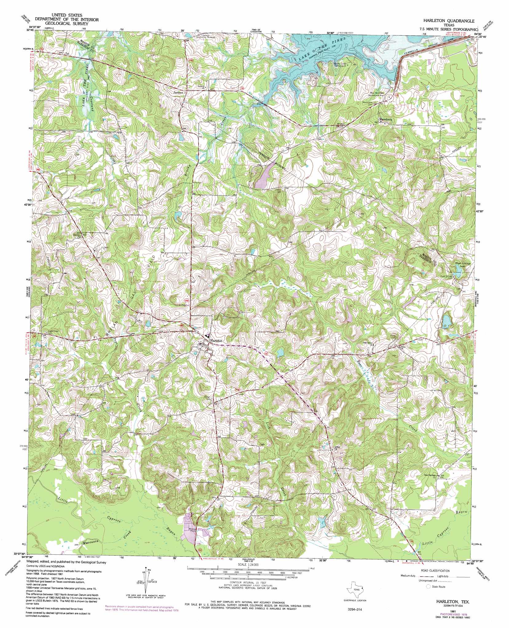
USGS Topo Quad 32094f5 - 1:24,000 scale
| Topo Map Name: | Harleton |
| USGS Topo Quad ID: | 32094f5 |
| Print Size: | ca. 21 1/4" wide x 27" high |
| Southeast Coordinates: | 32.625° N latitude / 94.5° W longitude |
| Map Center Coordinates: | 32.6875° N latitude / 94.5625° W longitude |
| U.S. State: | TX |
| Filename: | o32094f5.jpg |
| Download Map JPG Image: | Harleton topo map 1:24,000 scale |
| Map Type: | Topographic |
| Topo Series: | 7.5´ |
| Map Scale: | 1:24,000 |
| Source of Map Images: | United States Geological Survey (USGS) |
| Alternate Map Versions: |
Harleton TX 1961, updated 1964 Download PDF Buy paper map Harleton TX 1961, updated 1978 Download PDF Buy paper map Harleton TX 1961, updated 1992 Download PDF Buy paper map Harleton TX 2010 Download PDF Buy paper map Harleton TX 2013 Download PDF Buy paper map Harleton TX 2016 Download PDF Buy paper map |
1:24,000 Topo Quads surrounding Harleton
Lafayette |
Lone Star |
Avinger |
Cunningham Creek |
Lanier |
Coffeeville |
Ore City |
Lassater |
Kellyville |
Jefferson |
Glenwood |
Ashland |
Harleton |
Marshall Nw |
Woodlawn |
White Oak |
Longview Heights |
Hallsville |
Marshall West |
Marshall East |
Kilgore Ne |
Lakeport |
Easton |
Darco |
Colliers Creek |
> Back to 32094e1 at 1:100,000 scale
> Back to 32094a1 at 1:250,000 scale
> Back to U.S. Topo Maps home
Harleton topo map: Gazetteer
Harleton: Dams
Ferrells Bridge Dam elevation 84m 275′Lake Deerwood Estates Dam elevation 84m 275′
Harleton: Oilfields
Whelan Gas Field elevation 91m 298′Harleton: Parks
Lakeside Park elevation 70m 229′West Abutment Recreational Area elevation 95m 311′
Harleton: Populated Places
Harleton elevation 97m 318′Jackson elevation 100m 328′
Macedonia elevation 85m 278′
Harleton: Reservoirs
Hope Springs Lake elevation 86m 282′Lake Deerwood elevation 84m 275′
Harleton: Streams
Brushy Creek elevation 69m 226′Moccasin Creek elevation 67m 219′
Pope Creek elevation 67m 219′
Harleton digital topo map on disk
Buy this Harleton topo map showing relief, roads, GPS coordinates and other geographical features, as a high-resolution digital map file on DVD: