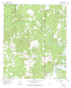
Trees Topo Map Texas
To zoom in, hover over the map of Trees
USGS Topo Quad 32094g1 - 1:24,000 scale
| Topo Map Name: | Trees |
| USGS Topo Quad ID: | 32094g1 |
| Print Size: | ca. 21 1/4" wide x 27" high |
| Southeast Coordinates: | 32.75° N latitude / 94° W longitude |
| Map Center Coordinates: | 32.8125° N latitude / 94.0625° W longitude |
| U.S. States: | TX, LA |
| Filename: | o32094g1.jpg |
| Download Map JPG Image: | Trees topo map 1:24,000 scale |
| Map Type: | Topographic |
| Topo Series: | 7.5´ |
| Map Scale: | 1:24,000 |
| Source of Map Images: | United States Geological Survey (USGS) |
| Alternate Map Versions: |
Trees LA 1962, updated 1963 Download PDF Buy paper map Trees LA 1962, updated 1975 Download PDF Buy paper map Trees LA 2010 Download PDF Buy paper map Trees LA 2012 Download PDF Buy paper map Trees LA 2015 Download PDF Buy paper map |
1:24,000 Topo Quads surrounding Trees
> Back to 32094e1 at 1:100,000 scale
> Back to 32094a1 at 1:250,000 scale
> Back to U.S. Topo Maps home
Trees topo map: Gazetteer
Trees: Airports
Vivian Airport elevation 77m 252′Trees: Bridges
Harts Ferry Bridge elevation 51m 167′Trees: Lakes
Dixon Pond elevation 53m 173′Monterey Lake elevation 52m 170′
Monterey Lake elevation 52m 170′
Stratford Lake elevation 55m 180′
Trees: Oilfields
Potter Oil Field elevation 62m 203′Potter Oil Field elevation 63m 206′
Vivian Oil Field elevation 52m 170′
Vivian Oil Field elevation 54m 177′
Trees: Populated Places
Bonham Landing elevation 59m 193′Gethsemane elevation 83m 272′
Gray elevation 74m 242′
Monterey elevation 53m 173′
Solley Hill elevation 70m 229′
Stacy Landing elevation 66m 216′
Trees elevation 68m 223′
Trees: Post Offices
Trees Post Office elevation 71m 232′Trees: Streams
Frazier Creek elevation 55m 180′Harold Creek elevation 51m 167′
Hunts Creek elevation 52m 170′
James Bayou elevation 51m 167′
Jim Bayou elevation 55m 180′
Mill Creek elevation 55m 180′
Trees digital topo map on disk
Buy this Trees topo map showing relief, roads, GPS coordinates and other geographical features, as a high-resolution digital map file on DVD:


