Smithland Topo Map Texas
To zoom in, hover over the map of Smithland
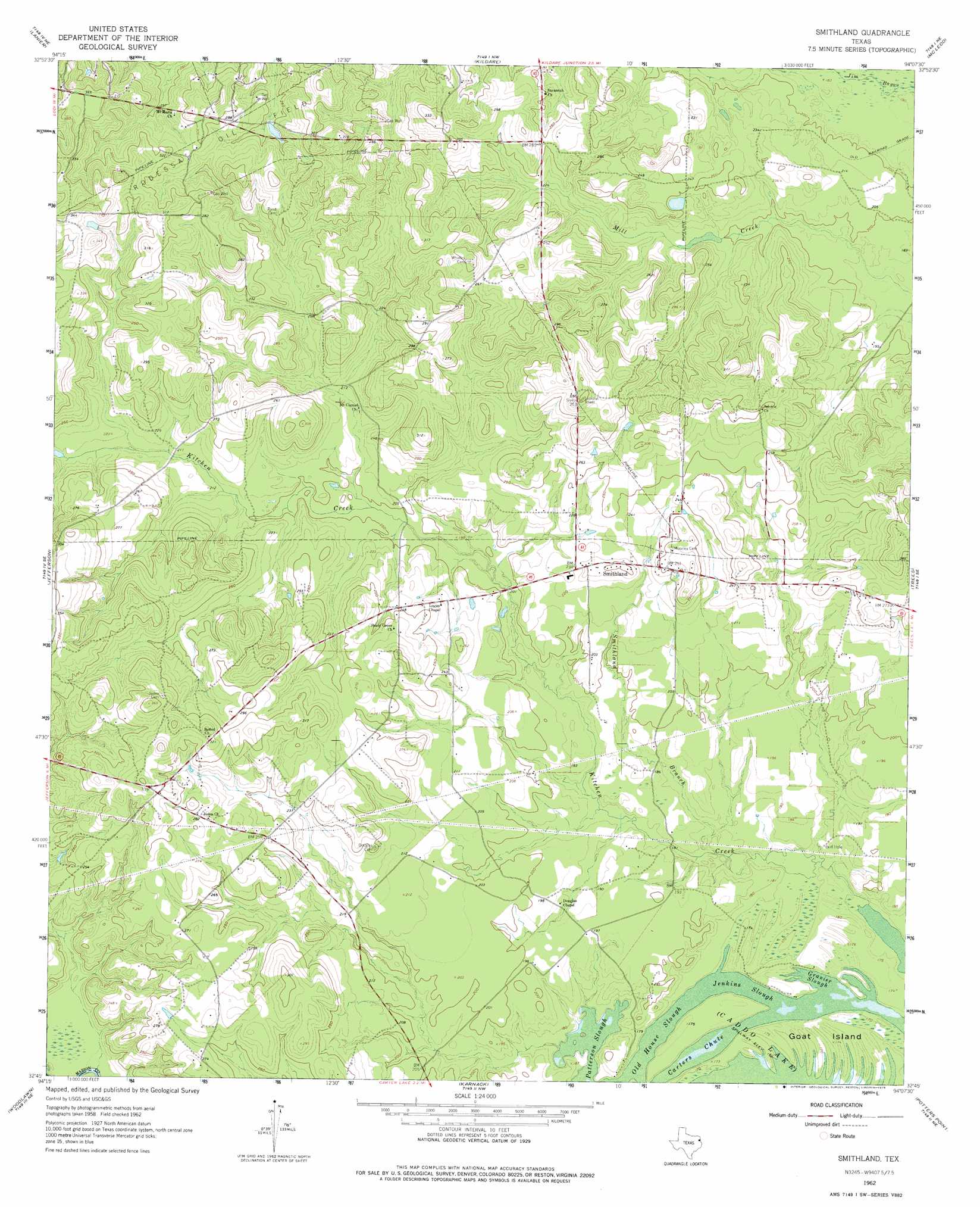
USGS Topo Quad 32094g2 - 1:24,000 scale
| Topo Map Name: | Smithland |
| USGS Topo Quad ID: | 32094g2 |
| Print Size: | ca. 21 1/4" wide x 27" high |
| Southeast Coordinates: | 32.75° N latitude / 94.125° W longitude |
| Map Center Coordinates: | 32.8125° N latitude / 94.1875° W longitude |
| U.S. State: | TX |
| Filename: | o32094g2.jpg |
| Download Map JPG Image: | Smithland topo map 1:24,000 scale |
| Map Type: | Topographic |
| Topo Series: | 7.5´ |
| Map Scale: | 1:24,000 |
| Source of Map Images: | United States Geological Survey (USGS) |
| Alternate Map Versions: |
Smithland TX 1962, updated 1963 Download PDF Buy paper map Smithland TX 1962, updated 1975 Download PDF Buy paper map Smithland TX 1962, updated 1975 Download PDF Buy paper map Smithland TX 2010 Download PDF Buy paper map Smithland TX 2013 Download PDF Buy paper map Smithland TX 2016 Download PDF Buy paper map |
1:24,000 Topo Quads surrounding Smithland
Carterville |
Linden |
Atlanta South |
Ravanna |
Doddridge |
Cunningham Creek |
Lanier |
Kildare |
Mcleod |
Vivian North |
Kellyville |
Jefferson |
Smithland |
Trees |
Vivian South |
Marshall Nw |
Woodlawn |
Karnack |
Potters Point |
Mooringsport |
Marshall West |
Marshall East |
Scottsville |
Latex |
Blanchard |
> Back to 32094e1 at 1:100,000 scale
> Back to 32094a1 at 1:250,000 scale
> Back to U.S. Topo Maps home
Smithland topo map: Gazetteer
Smithland: Guts
Gravier Slough elevation 51m 167′Jenkins Slough elevation 51m 167′
Old House Slough elevation 50m 164′
Patterson Slough elevation 50m 164′
Smithland: Islands
Goat Island elevation 52m 170′Smithland: Populated Places
Smithland elevation 77m 252′Smithland: Streams
Smithland Branch elevation 53m 173′Smithland digital topo map on disk
Buy this Smithland topo map showing relief, roads, GPS coordinates and other geographical features, as a high-resolution digital map file on DVD: