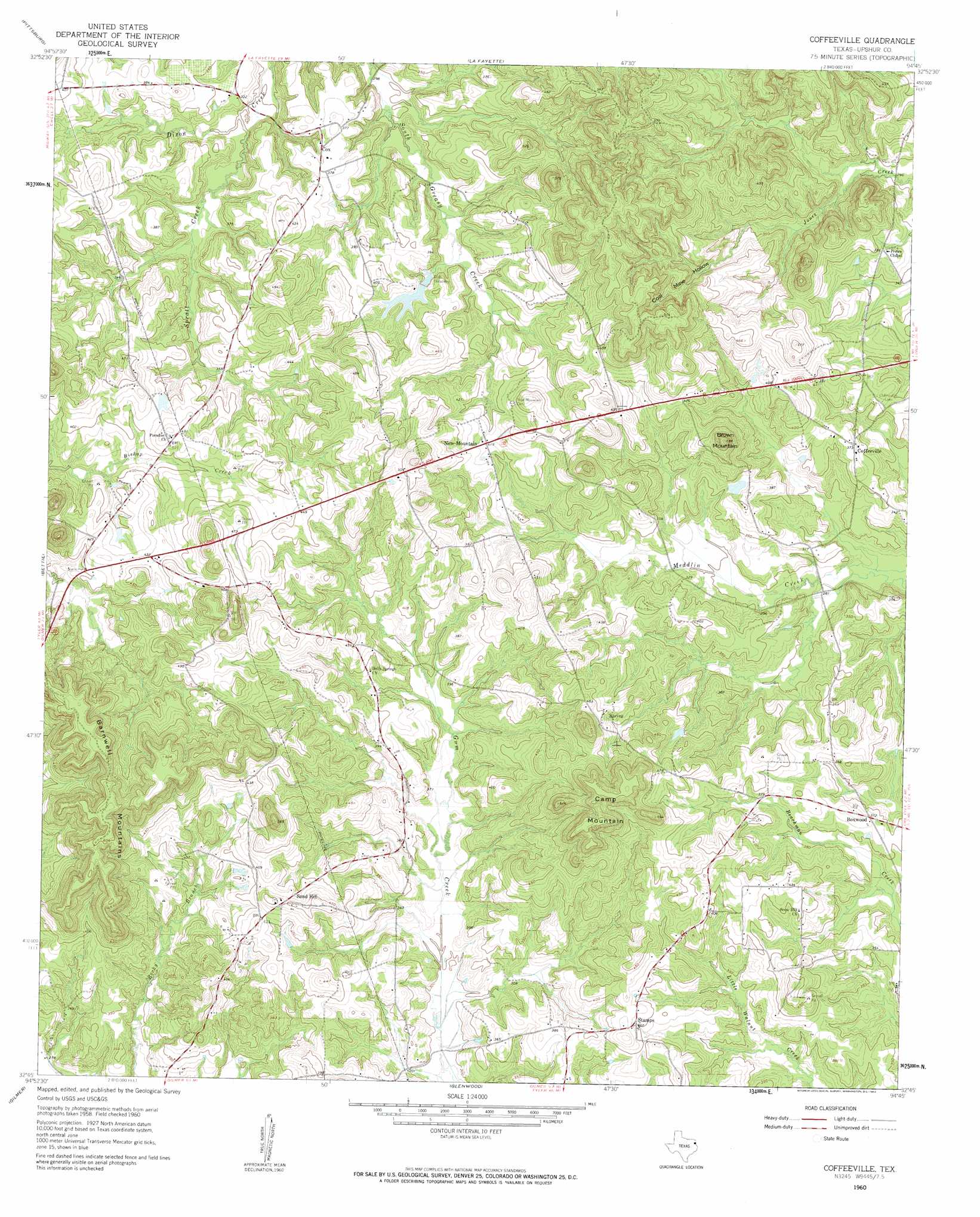
Coffeeville Topo Map Texas
To zoom in, hover over the map of Coffeeville
USGS Topo Quad 32094g7 - 1:24,000 scale
| Topo Map Name: | Coffeeville |
| USGS Topo Quad ID: | 32094g7 |
| Print Size: | ca. 21 1/4" wide x 27" high |
| Southeast Coordinates: | 32.75° N latitude / 94.75° W longitude |
| Map Center Coordinates: | 32.8125° N latitude / 94.8125° W longitude |
| U.S. State: | TX |
| Filename: | o32094g7.jpg |
| Download Map JPG Image: | Coffeeville topo map 1:24,000 scale |
| Map Type: | Topographic |
| Topo Series: | 7.5´ |
| Map Scale: | 1:24,000 |
| Source of Map Images: | United States Geological Survey (USGS) |
| Alternate Map Versions: |
Coffeeville TX 1960, updated 1962 Download PDF Buy paper map Coffeeville TX 1960, updated 1962 Download PDF Buy paper map Coffeeville TX 2010 Download PDF Buy paper map Coffeeville TX 2013 Download PDF Buy paper map Coffeeville TX 2016 Download PDF Buy paper map |
1:24,000 Topo Quads surrounding Coffeeville
Monticello |
Harvard |
Cason |
Daingerfield |
Sardis |
Leesburg |
Pittsburg |
Lafayette |
Lone Star |
Avinger |
Thomas |
Bettie |
Coffeeville |
Ore City |
Lassater |
Pritchett |
Gilmer |
Glenwood |
Ashland |
Harleton |
Big Sandy |
Gladewater |
White Oak |
Longview Heights |
Hallsville |
> Back to 32094e1 at 1:100,000 scale
> Back to 32094a1 at 1:250,000 scale
> Back to U.S. Topo Maps home
Coffeeville topo map: Gazetteer
Coffeeville: Dams
Beard Lake Dam elevation 106m 347′Duffey Lake Dam elevation 103m 337′
Russell Lake Dam elevation 123m 403′
Coffeeville: Populated Places
Boxwood elevation 113m 370′Coffeeville elevation 113m 370′
Cox elevation 110m 360′
New Mountain elevation 125m 410′
Sand Hill elevation 137m 449′
Snow Hill elevation 129m 423′
Stamps elevation 122m 400′
Coffeeville: Reservoirs
Beard Lake elevation 106m 347′Duffey Lake elevation 103m 337′
Russell Lake elevation 123m 403′
Coffeeville: Streams
Spratt Creek elevation 91m 298′Coffeeville: Summits
Barnwell Mountains elevation 192m 629′Brown Mountain elevation 178m 583′
Camp Mountain elevation 187m 613′
Coffeeville: Valleys
Coal Mine Hollow elevation 106m 347′Coffeeville digital topo map on disk
Buy this Coffeeville topo map showing relief, roads, GPS coordinates and other geographical features, as a high-resolution digital map file on DVD: