Griffin Topo Map Texas
To zoom in, hover over the map of Griffin
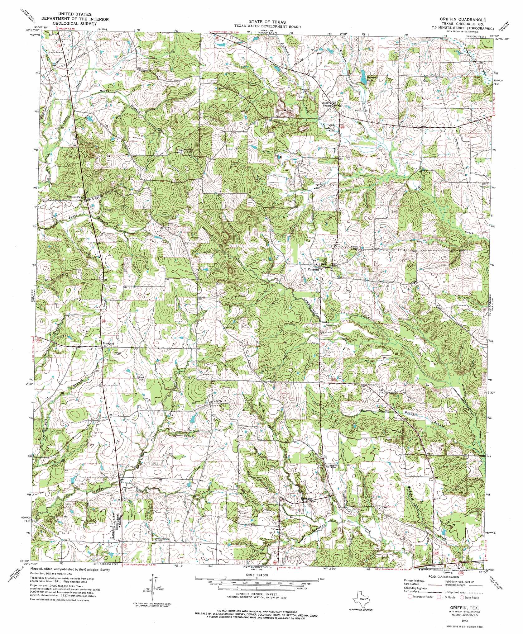
USGS Topo Quad 32095a1 - 1:24,000 scale
| Topo Map Name: | Griffin |
| USGS Topo Quad ID: | 32095a1 |
| Print Size: | ca. 21 1/4" wide x 27" high |
| Southeast Coordinates: | 32° N latitude / 95° W longitude |
| Map Center Coordinates: | 32.0625° N latitude / 95.0625° W longitude |
| U.S. State: | TX |
| Filename: | o32095a1.jpg |
| Download Map JPG Image: | Griffin topo map 1:24,000 scale |
| Map Type: | Topographic |
| Topo Series: | 7.5´ |
| Map Scale: | 1:24,000 |
| Source of Map Images: | United States Geological Survey (USGS) |
| Alternate Map Versions: |
Griffin TX 1973, updated 1977 Download PDF Buy paper map Griffin TX 2010 Download PDF Buy paper map Griffin TX 2012 Download PDF Buy paper map Griffin TX 2016 Download PDF Buy paper map |
1:24,000 Topo Quads surrounding Griffin
Tyler South |
Bascom |
Hope Pond |
Kilgore Sw |
Kilgore Se |
Bullard |
Troup West |
Troup East |
Price |
Henderson |
Mount Selman |
Tecula |
Griffin |
Gum Springs |
Berryhill Creek |
Jacksonville West |
Jacksonville East |
New Summerfield |
New Salem |
Laneville |
Maydelle |
Rusk |
Atoy |
Reklaw |
Cushing |
> Back to 32095a1 at 1:100,000 scale
> Back to 32094a1 at 1:250,000 scale
> Back to U.S. Topo Maps home
Griffin topo map: Gazetteer
Griffin: Canals
Willis Ditch elevation 91m 298′Griffin: Populated Places
Blackjack elevation 131m 429′Concord elevation 126m 413′
Emmaus elevation 113m 370′
Griffin elevation 142m 465′
Henrys Chapel elevation 118m 387′
Griffin: Reservoirs
Barrons Lake elevation 113m 370′Griffin: Streams
Barker Branch elevation 113m 370′Boggy Branch elevation 92m 301′
Campground Creek elevation 92m 301′
Grissom Creek elevation 101m 331′
Hampton Creek elevation 101m 331′
Griffin digital topo map on disk
Buy this Griffin topo map showing relief, roads, GPS coordinates and other geographical features, as a high-resolution digital map file on DVD: