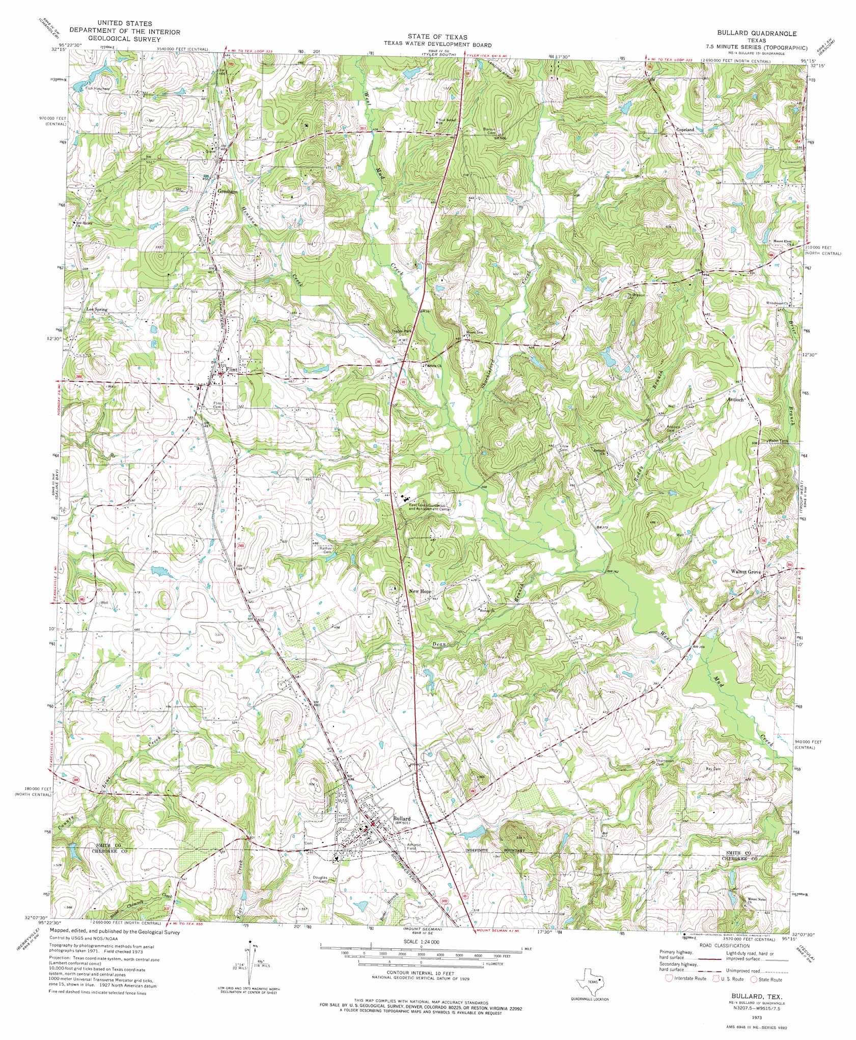
Bullard Topo Map Texas
To zoom in, hover over the map of Bullard
USGS Topo Quad 32095b3 - 1:24,000 scale
| Topo Map Name: | Bullard |
| USGS Topo Quad ID: | 32095b3 |
| Print Size: | ca. 21 1/4" wide x 27" high |
| Southeast Coordinates: | 32.125° N latitude / 95.25° W longitude |
| Map Center Coordinates: | 32.1875° N latitude / 95.3125° W longitude |
| U.S. State: | TX |
| Filename: | o32095b3.jpg |
| Download Map JPG Image: | Bullard topo map 1:24,000 scale |
| Map Type: | Topographic |
| Topo Series: | 7.5´ |
| Map Scale: | 1:24,000 |
| Source of Map Images: | United States Geological Survey (USGS) |
| Alternate Map Versions: |
Bullard TX 1973, updated 1977 Download PDF Buy paper map Bullard TX 2010 Download PDF Buy paper map Bullard TX 2012 Download PDF Buy paper map Bullard TX 2016 Download PDF Buy paper map |
1:24,000 Topo Quads surrounding Bullard
Carroll |
Mount Sylvan |
Tyler North |
Winona |
Starrville |
Brownsboro |
Chandler |
Tyler South |
Bascom |
Hope Pond |
Moore Station |
Saline Bay |
Bullard |
Troup West |
Troup East |
Poynor |
Berryville |
Mount Selman |
Tecula |
Griffin |
Pert |
Todd City |
Jacksonville West |
Jacksonville East |
New Summerfield |
> Back to 32095a1 at 1:100,000 scale
> Back to 32094a1 at 1:250,000 scale
> Back to U.S. Topo Maps home
Bullard topo map: Gazetteer
Bullard: Airports
Pineridge Stolport elevation 132m 433′Bullard: Populated Places
Antioch elevation 144m 472′Bullard elevation 154m 505′
Copeland elevation 169m 554′
Flint elevation 159m 521′
Gresham elevation 148m 485′
Lee Spring elevation 133m 436′
New Hope elevation 137m 449′
Walnut Grove elevation 145m 475′
Bullard: Springs
Rhome Spring elevation 160m 524′Bullard: Streams
Dean Branch elevation 109m 357′Henshaw Creek elevation 113m 370′
Roddy Branch elevation 110m 360′
Shackleford Creek elevation 113m 370′
Bullard digital topo map on disk
Buy this Bullard topo map showing relief, roads, GPS coordinates and other geographical features, as a high-resolution digital map file on DVD: