Stockard Topo Map Texas
To zoom in, hover over the map of Stockard
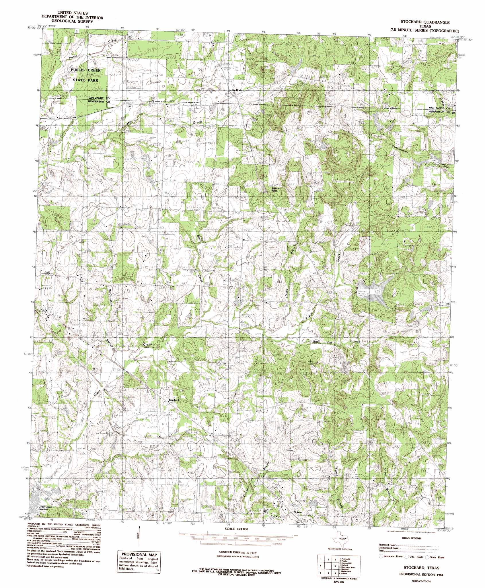
USGS Topo Quad 32095c8 - 1:24,000 scale
| Topo Map Name: | Stockard |
| USGS Topo Quad ID: | 32095c8 |
| Print Size: | ca. 21 1/4" wide x 27" high |
| Southeast Coordinates: | 32.25° N latitude / 95.875° W longitude |
| Map Center Coordinates: | 32.3125° N latitude / 95.9375° W longitude |
| U.S. State: | TX |
| Filename: | o32095c8.jpg |
| Download Map JPG Image: | Stockard topo map 1:24,000 scale |
| Map Type: | Topographic |
| Topo Series: | 7.5´ |
| Map Scale: | 1:24,000 |
| Source of Map Images: | United States Geological Survey (USGS) |
| Alternate Map Versions: |
Stockard TX 1984, updated 1984 Download PDF Buy paper map Stockard TX 2010 Download PDF Buy paper map Stockard TX 2013 Download PDF Buy paper map Stockard TX 2016 Download PDF Buy paper map |
1:24,000 Topo Quads surrounding Stockard
Ola |
Cedarvale |
Myrtle Springs |
Canton |
Van |
Kemp |
Prairieville |
Phalba |
Martins Mill |
Ben Wheeler |
Tool |
Mabank |
Stockard |
Murchinson West |
Murchinson East |
Kerens |
Malakoff |
Mallard Hill |
Athens |
Leagueville |
Goodlow Park |
Creslenn Ranch |
Cross Roads |
Coon Creek Lake |
La Rue |
> Back to 32095a1 at 1:100,000 scale
> Back to 32094a1 at 1:250,000 scale
> Back to U.S. Topo Maps home
Stockard topo map: Gazetteer
Stockard: Dams
Fly-In-Lake Dam elevation 156m 511′Thomas Lake Dam elevation 139m 456′
Stockard: Parks
Purtis Creek State Park elevation 125m 410′Purtis Creek State Park elevation 114m 374′
Stockard: Populated Places
Big Rock elevation 146m 479′Pickens elevation 140m 459′
Stockard elevation 132m 433′
Stockard: Reservoirs
Fly-In-Lake elevation 156m 511′Thomas Lake elevation 139m 456′
Stockard: Springs
Roher Springs elevation 146m 479′Stockard: Streams
Briar Creek elevation 112m 367′Helms Branch elevation 119m 390′
Red Oak Branch elevation 119m 390′
Stockard: Summits
Big Rock Top elevation 187m 613′Melton Rock elevation 196m 643′
Stockard: Trails
Purtis Creek State Park Trail elevation 116m 380′Stockard digital topo map on disk
Buy this Stockard topo map showing relief, roads, GPS coordinates and other geographical features, as a high-resolution digital map file on DVD: