Phalba Topo Map Texas
To zoom in, hover over the map of Phalba
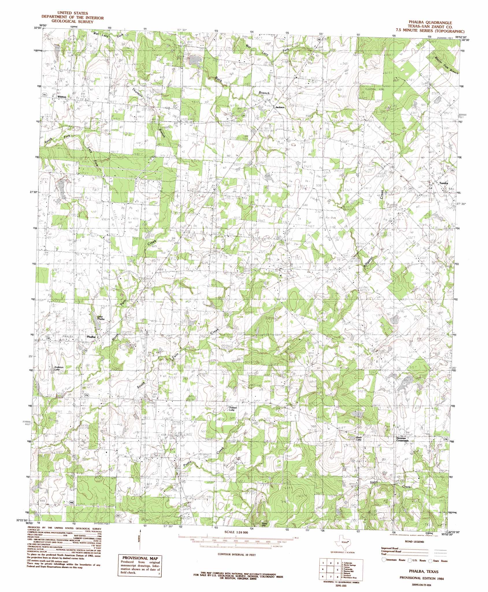
USGS Topo Quad 32095d8 - 1:24,000 scale
| Topo Map Name: | Phalba |
| USGS Topo Quad ID: | 32095d8 |
| Print Size: | ca. 21 1/4" wide x 27" high |
| Southeast Coordinates: | 32.375° N latitude / 95.875° W longitude |
| Map Center Coordinates: | 32.4375° N latitude / 95.9375° W longitude |
| U.S. State: | TX |
| Filename: | o32095d8.jpg |
| Download Map JPG Image: | Phalba topo map 1:24,000 scale |
| Map Type: | Topographic |
| Topo Series: | 7.5´ |
| Map Scale: | 1:24,000 |
| Source of Map Images: | United States Geological Survey (USGS) |
| Alternate Map Versions: |
Phalba TX 1984, updated 1984 Download PDF Buy paper map Phalba TX 2010 Download PDF Buy paper map Phalba TX 2013 Download PDF Buy paper map Phalba TX 2016 Download PDF Buy paper map |
1:24,000 Topo Quads surrounding Phalba
Elmo |
Wills Point |
Edgewood |
Fruitvale |
Grand Saline |
Ola |
Cedarvale |
Myrtle Springs |
Canton |
Van |
Kemp |
Prairieville |
Phalba |
Martins Mill |
Ben Wheeler |
Tool |
Mabank |
Stockard |
Murchinson West |
Murchinson East |
Kerens |
Malakoff |
Mallard Hill |
Athens |
Leagueville |
> Back to 32095a1 at 1:100,000 scale
> Back to 32094a1 at 1:250,000 scale
> Back to U.S. Topo Maps home
Phalba topo map: Gazetteer
Phalba: Dams
Charles Napper Lake Dam elevation 151m 495′Soil Conservation Service Site 134 Dam elevation 135m 442′
Soil Conservation Service Site 135b Dam elevation 134m 439′
Phalba: Lakes
Pollard Lake elevation 152m 498′Phalba: Populated Places
Denman Crossroads elevation 164m 538′Jackson elevation 151m 495′
Phalba elevation 135m 442′
Tundra elevation 172m 564′
Whitton elevation 142m 465′
Phalba: Reservoirs
Andrews Lake elevation 129m 423′Bush Lake elevation 167m 547′
Charles Napper Lake elevation 151m 495′
Lake Phalba elevation 137m 449′
Soil Conservation Service Site 134 Reservoir elevation 135m 442′
Soil Conservation Service Site 135b Reservoir elevation 134m 439′
Phalba: Summits
Sand Hill elevation 207m 679′Phalba digital topo map on disk
Buy this Phalba topo map showing relief, roads, GPS coordinates and other geographical features, as a high-resolution digital map file on DVD: