Pritchett Topo Map Texas
To zoom in, hover over the map of Pritchett
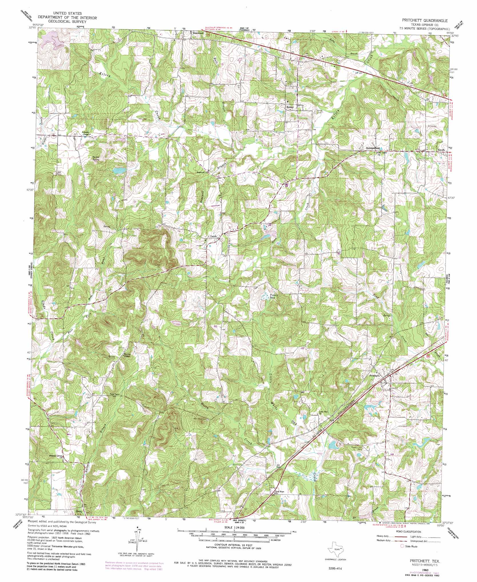
USGS Topo Quad 32095f1 - 1:24,000 scale
| Topo Map Name: | Pritchett |
| USGS Topo Quad ID: | 32095f1 |
| Print Size: | ca. 21 1/4" wide x 27" high |
| Southeast Coordinates: | 32.625° N latitude / 95° W longitude |
| Map Center Coordinates: | 32.6875° N latitude / 95.0625° W longitude |
| U.S. State: | TX |
| Filename: | o32095f1.jpg |
| Download Map JPG Image: | Pritchett topo map 1:24,000 scale |
| Map Type: | Topographic |
| Topo Series: | 7.5´ |
| Map Scale: | 1:24,000 |
| Source of Map Images: | United States Geological Survey (USGS) |
| Alternate Map Versions: |
Pritchett TX 1960, updated 1961 Download PDF Buy paper map Pritchett TX 1960, updated 1961 Download PDF Buy paper map Pritchett TX 1960, updated 1982 Download PDF Buy paper map Pritchett TX 2010 Download PDF Buy paper map Pritchett TX 2012 Download PDF Buy paper map Pritchett TX 2016 Download PDF Buy paper map |
1:24,000 Topo Quads surrounding Pritchett
Winnsboro |
Newsome |
Leesburg |
Pittsburg |
Lafayette |
Cartwright |
Rhonesboro |
Thomas |
Bettie |
Coffeeville |
Hainesville |
Shady Grove |
Pritchett |
Gilmer |
Glenwood |
Crow |
Hawkins |
Big Sandy |
Gladewater |
White Oak |
Tyler North |
Winona |
Starrville |
Kilgore Nw |
Kilgore Ne |
> Back to 32095e1 at 1:100,000 scale
> Back to 32094a1 at 1:250,000 scale
> Back to U.S. Topo Maps home
Pritchett topo map: Gazetteer
Pritchett: Dams
Bane Lake Dam elevation 124m 406′Medley Lake Dam elevation 122m 400′
Pritchett: Lakes
Turkey Pond elevation 119m 390′Pritchett: Populated Places
Kelsey elevation 129m 423′Latch elevation 135m 442′
Pritchett elevation 125m 410′
Summerfield elevation 126m 413′
Pritchett: Reservoirs
Bane Lake elevation 124m 406′Medley Lake elevation 122m 400′
Pritchett: Springs
Barton Spring elevation 141m 462′Pritchett: Streams
Beech Creek elevation 97m 318′Coon Creek elevation 100m 328′
East Fork Glade Creek elevation 108m 354′
Hall Branch elevation 104m 341′
Hopewell Branch elevation 102m 334′
Moore Branch elevation 116m 380′
Rocky Branch elevation 94m 308′
Pritchett: Summits
Peter Hayes Hill elevation 137m 449′Pritchett digital topo map on disk
Buy this Pritchett topo map showing relief, roads, GPS coordinates and other geographical features, as a high-resolution digital map file on DVD: