Grand Saline Topo Map Texas
To zoom in, hover over the map of Grand Saline
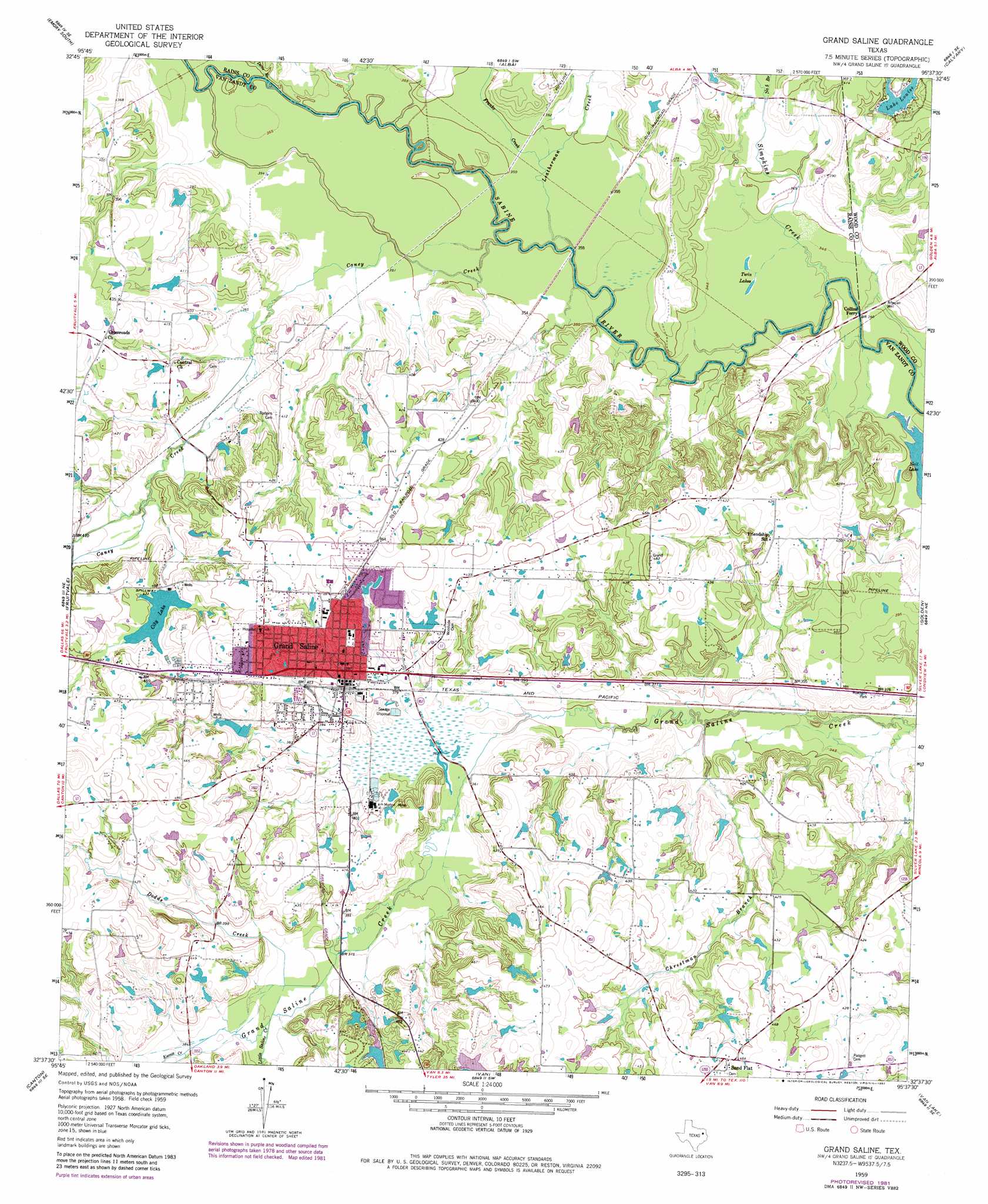
USGS Topo Quad 32095f6 - 1:24,000 scale
| Topo Map Name: | Grand Saline |
| USGS Topo Quad ID: | 32095f6 |
| Print Size: | ca. 21 1/4" wide x 27" high |
| Southeast Coordinates: | 32.625° N latitude / 95.625° W longitude |
| Map Center Coordinates: | 32.6875° N latitude / 95.6875° W longitude |
| U.S. State: | TX |
| Filename: | o32095f6.jpg |
| Download Map JPG Image: | Grand Saline topo map 1:24,000 scale |
| Map Type: | Topographic |
| Topo Series: | 7.5´ |
| Map Scale: | 1:24,000 |
| Source of Map Images: | United States Geological Survey (USGS) |
| Alternate Map Versions: |
Grand Saline TX 1959, updated 1960 Download PDF Buy paper map Grand Saline TX 1959, updated 1973 Download PDF Buy paper map Grand Saline TX 1959, updated 1982 Download PDF Buy paper map Grand Saline TX 2010 Download PDF Buy paper map Grand Saline TX 2012 Download PDF Buy paper map Grand Saline TX 2016 Download PDF Buy paper map |
1:24,000 Topo Quads surrounding Grand Saline
Lone Oak South |
Emory North |
Arbala |
Yantis |
Pleasant Grove |
Iron Bridge Dam |
Emory South |
Alba |
Calvary |
Quitman |
Edgewood |
Fruitvale |
Grand Saline |
Golden |
Mineola |
Myrtle Springs |
Canton |
Van |
Van Lake |
Lindale |
Phalba |
Martins Mill |
Ben Wheeler |
Carroll |
Mount Sylvan |
> Back to 32095e1 at 1:100,000 scale
> Back to 32094a1 at 1:250,000 scale
> Back to U.S. Topo Maps home
Grand Saline topo map: Gazetteer
Grand Saline: Dams
Big Lake Dam elevation 129m 423′City of Grand Saline Dam elevation 128m 419′
Darnell Dam Number 3 elevation 123m 403′
Darnell Dam Number 4 elevation 122m 400′
Jones Lake Dam elevation 130m 426′
Lake Louise Dam elevation 116m 380′
Morton Salt Company Dam elevation 129m 423′
Grand Saline: Lakes
Neil Lake elevation 102m 334′Twin Lakes elevation 104m 341′
Grand Saline: Mines
Morton Mine elevation 119m 390′Grand Saline: Populated Places
Grand Saline elevation 122m 400′Sand Flat elevation 141m 462′
Grand Saline: Reservoirs
Big Lake elevation 129m 423′City Lake elevation 128m 419′
Darnell Lake Number 3 elevation 123m 403′
Darnell Lake Number 4 elevation 122m 400′
Jones Lake elevation 130m 426′
Lake Louise elevation 120m 393′
Morton Salt Company Lake elevation 129m 423′
Grand Saline: Streams
Caney Creek elevation 102m 334′Chrestman Branch elevation 103m 337′
Davis Branch elevation 107m 351′
Dodds Creek elevation 112m 367′
Franks Creek elevation 106m 347′
Koonce Creek elevation 115m 377′
Leatherman Creek elevation 102m 334′
Little Saline Creek elevation 114m 374′
Number Five Branch elevation 110m 360′
Simpkins Creek elevation 100m 328′
Grand Saline digital topo map on disk
Buy this Grand Saline topo map showing relief, roads, GPS coordinates and other geographical features, as a high-resolution digital map file on DVD: