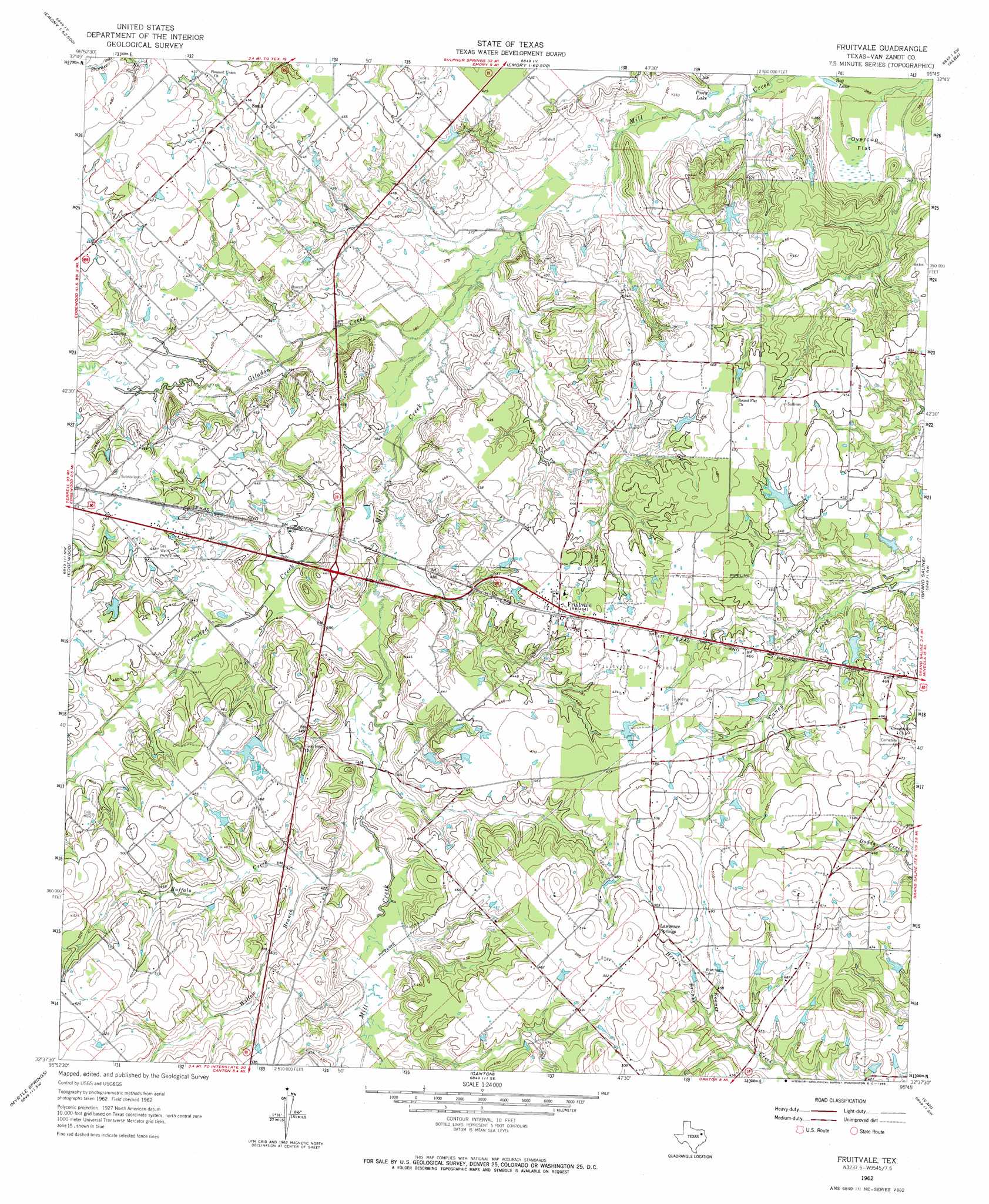
Fruitvale Topo Map Texas
To zoom in, hover over the map of Fruitvale
USGS Topo Quad 32095f7 - 1:24,000 scale
| Topo Map Name: | Fruitvale |
| USGS Topo Quad ID: | 32095f7 |
| Print Size: | ca. 21 1/4" wide x 27" high |
| Southeast Coordinates: | 32.625° N latitude / 95.75° W longitude |
| Map Center Coordinates: | 32.6875° N latitude / 95.8125° W longitude |
| U.S. State: | TX |
| Filename: | o32095f7.jpg |
| Download Map JPG Image: | Fruitvale topo map 1:24,000 scale |
| Map Type: | Topographic |
| Topo Series: | 7.5´ |
| Map Scale: | 1:24,000 |
| Source of Map Images: | United States Geological Survey (USGS) |
| Alternate Map Versions: |
Fruitvale TX 1962, updated 1966 Download PDF Buy paper map Fruitvale TX 2010 Download PDF Buy paper map Fruitvale TX 2012 Download PDF Buy paper map Fruitvale TX 2016 Download PDF Buy paper map |
1:24,000 Topo Quads surrounding Fruitvale
West Tawakoni |
Lone Oak South |
Emory North |
Arbala |
Yantis |
Ables Springs |
Iron Bridge Dam |
Emory South |
Alba |
Calvary |
Wills Point |
Edgewood |
Fruitvale |
Grand Saline |
Golden |
Cedarvale |
Myrtle Springs |
Canton |
Van |
Van Lake |
Prairieville |
Phalba |
Martins Mill |
Ben Wheeler |
Carroll |
> Back to 32095e1 at 1:100,000 scale
> Back to 32094a1 at 1:250,000 scale
> Back to U.S. Topo Maps home
Fruitvale topo map: Gazetteer
Fruitvale: Dams
Musslewhite Lake Dam elevation 133m 436′Fruitvale: Flats
Overcup Flat elevation 110m 360′Fruitvale: Lakes
Bog Lake elevation 110m 360′Posey Lake elevation 112m 367′
Fruitvale: Oilfields
Fruitvale Oil Field elevation 147m 482′Fruitvale: Populated Places
Fruitvale elevation 142m 465′Lawrence Springs elevation 153m 501′
Small elevation 139m 456′
Fruitvale: Reservoirs
Musslewhite Lake elevation 133m 436′Fruitvale: Streams
Buffalo Creek elevation 122m 400′Crooked Creek elevation 116m 380′
Giladon Creek elevation 113m 370′
Herrin Branch elevation 131m 429′
Willow Branch elevation 125m 410′
Fruitvale digital topo map on disk
Buy this Fruitvale topo map showing relief, roads, GPS coordinates and other geographical features, as a high-resolution digital map file on DVD: