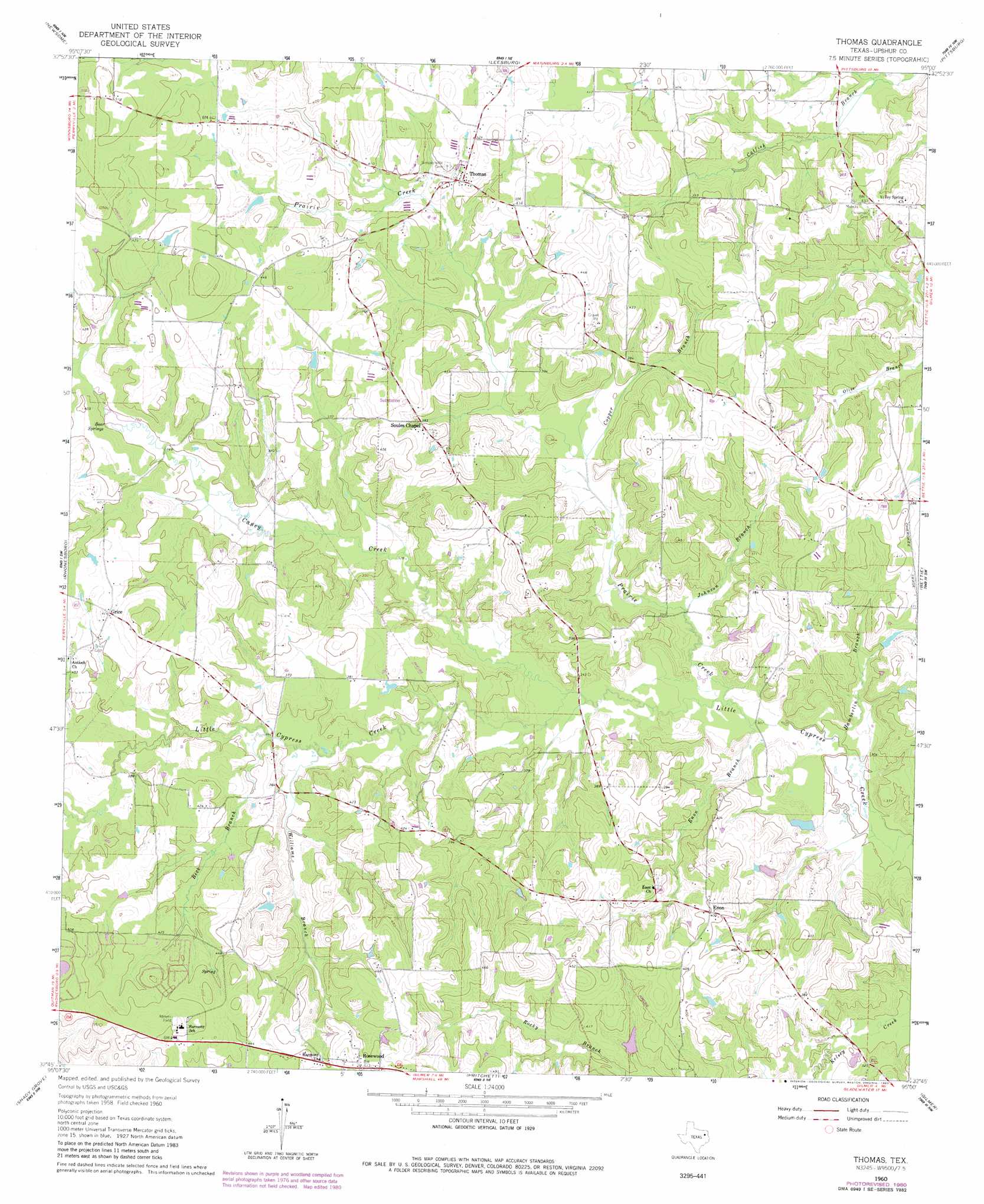
Thomas Topo Map Texas
To zoom in, hover over the map of Thomas
USGS Topo Quad 32095g1 - 1:24,000 scale
| Topo Map Name: | Thomas |
| USGS Topo Quad ID: | 32095g1 |
| Print Size: | ca. 21 1/4" wide x 27" high |
| Southeast Coordinates: | 32.75° N latitude / 95° W longitude |
| Map Center Coordinates: | 32.8125° N latitude / 95.0625° W longitude |
| U.S. State: | TX |
| Filename: | o32095g1.jpg |
| Download Map JPG Image: | Thomas topo map 1:24,000 scale |
| Map Type: | Topographic |
| Topo Series: | 7.5´ |
| Map Scale: | 1:24,000 |
| Source of Map Images: | United States Geological Survey (USGS) |
| Alternate Map Versions: |
Thomas TX 1960, updated 1962 Download PDF Buy paper map Thomas TX 1960, updated 1962 Download PDF Buy paper map Thomas TX 1960, updated 1980 Download PDF Buy paper map Thomas TX 2010 Download PDF Buy paper map Thomas TX 2012 Download PDF Buy paper map Thomas TX 2016 Download PDF Buy paper map |
1:24,000 Topo Quads surrounding Thomas
Purley |
New Hope |
Monticello |
Harvard |
Cason |
Winnsboro |
Newsome |
Leesburg |
Pittsburg |
Lafayette |
Cartwright |
Rhonesboro |
Thomas |
Bettie |
Coffeeville |
Hainesville |
Shady Grove |
Pritchett |
Gilmer |
Glenwood |
Crow |
Hawkins |
Big Sandy |
Gladewater |
White Oak |
> Back to 32095e1 at 1:100,000 scale
> Back to 32094a1 at 1:250,000 scale
> Back to U.S. Topo Maps home
Thomas topo map: Gazetteer
Thomas: Dams
Allen Lake Dam elevation 122m 400′Henderson Lake Dam elevation 109m 357′
Thomas: Populated Places
Enon elevation 122m 400′Grice elevation 128m 419′
Rosewood elevation 145m 475′
Simpsonville elevation 122m 400′
Soules Chapel elevation 123m 403′
Thomas elevation 130m 426′
Thomas: Reservoirs
Allen Lake elevation 122m 400′Henderson Lake elevation 109m 357′
Thomas: Springs
Bear Springs elevation 108m 354′Thomas: Streams
Beck Branch elevation 101m 331′Caney Creek elevation 94m 308′
Copper Branch elevation 102m 334′
Enon Branch elevation 93m 305′
Hamberlin Branch elevation 91m 298′
Johnson Branch elevation 95m 311′
Prairie Creek elevation 93m 305′
Williams Branch elevation 101m 331′
Thomas digital topo map on disk
Buy this Thomas topo map showing relief, roads, GPS coordinates and other geographical features, as a high-resolution digital map file on DVD: